
| Memorials | : | 2 |
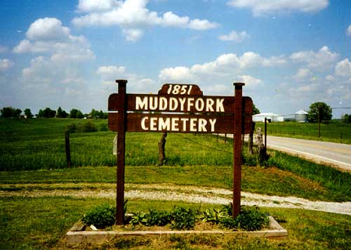
| Location | : | Kearney, Clay County, USA |
| Coordinate | : | 39.4193993, -94.3703003 |
frequently asked questions (FAQ):
-
Where is Muddy Fork Cemetery?
Muddy Fork Cemetery is located at Kearney, Clay County ,Missouri ,USA.
-
Muddy Fork Cemetery cemetery's updated grave count on graveviews.com?
2 memorials
-
Where are the coordinates of the Muddy Fork Cemetery?
Latitude: 39.4193993
Longitude: -94.3703003
Nearby Cemetories:
1. Arnold-Holt Cemetery
Clay County, USA
Coordinate: 39.4410000, -94.3682000
2. Estes Family Graveyard
Kearney, Clay County, USA
Coordinate: 39.3973450, -94.3710150
3. Arnold-Spellman Graveyard
Holt, Clay County, USA
Coordinate: 39.4364000, -94.3320000
4. New Hope Cemetery
Holt, Clay County, USA
Coordinate: 39.4332809, -94.3245773
5. Wilerton - McClelland Cemetery
Clay County, USA
Coordinate: 39.4481823, -94.3315423
6. Fairview Cemetery
Kearney, Clay County, USA
Coordinate: 39.3774986, -94.3597031
7. Jesse James Farm
Kearney, Clay County, USA
Coordinate: 39.3908360, -94.3224120
8. Estes Cemetery
Clay County, USA
Coordinate: 39.3722038, -94.3583755
9. Mount Gilead Cemetery
Kearney, Clay County, USA
Coordinate: 39.3826942, -94.4129410
10. Antioch Cemetery
Holt, Clay County, USA
Coordinate: 39.4552994, -94.3214035
11. Mount Olivet Cemetery
Kearney, Clay County, USA
Coordinate: 39.3671989, -94.3632965
12. Newlee-Soper Cemetery
Kearney, Clay County, USA
Coordinate: 39.3713989, -94.4011002
13. Arley Cemetery
Kearney, Clay County, USA
Coordinate: 39.4041061, -94.4458237
14. Oakland Cemetery
Haynesville, Clinton County, USA
Coordinate: 39.4631004, -94.3114014
15. Mount Zion Cemetery
Plattsburg, Clinton County, USA
Coordinate: 39.4672012, -94.4242020
16. Wilson Cemetery
Clay County, USA
Coordinate: 39.4192009, -94.2855988
17. Gill Family Cemetery
Holt, Clay County, USA
Coordinate: 39.4496384, -94.2937927
18. Crowley Cemetery
Kearney, Clay County, USA
Coordinate: 39.3685989, -94.3086014
19. Eberts Cemetery
Clinton County, USA
Coordinate: 39.4692001, -94.4356003
20. Bethel Cemetery
Kearney, Clay County, USA
Coordinate: 39.3744011, -94.2902985
21. Shady Grove Cemetery
Kearney, Clay County, USA
Coordinate: 39.3605995, -94.3003006
22. Fairview Cemetery
Guyton, Clinton County, USA
Coordinate: 39.4756012, -94.4443970
23. Cook Cemetery
Clinton County, USA
Coordinate: 39.4805984, -94.4452972
24. Tapp Cemetery
Kearney, Clay County, USA
Coordinate: 39.3342000, -94.3669000