
| Memorials | : | 0 |
| Location | : | Holt, Clay County, USA |
| Coordinate | : | 39.4496384, -94.2937927 |
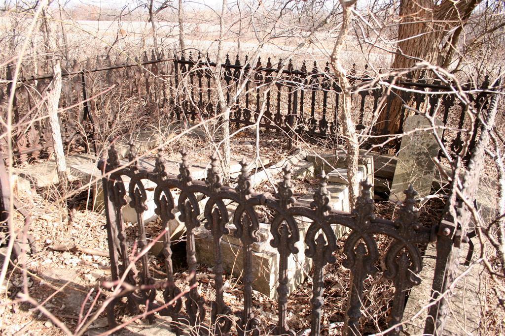
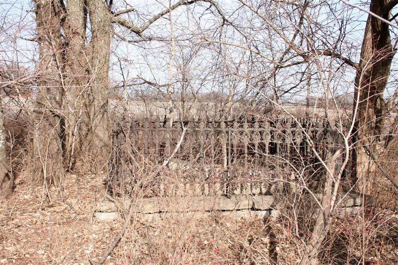
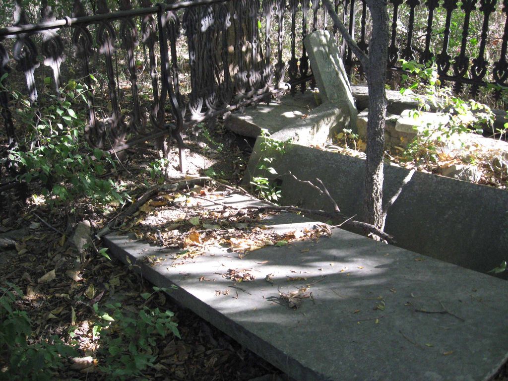
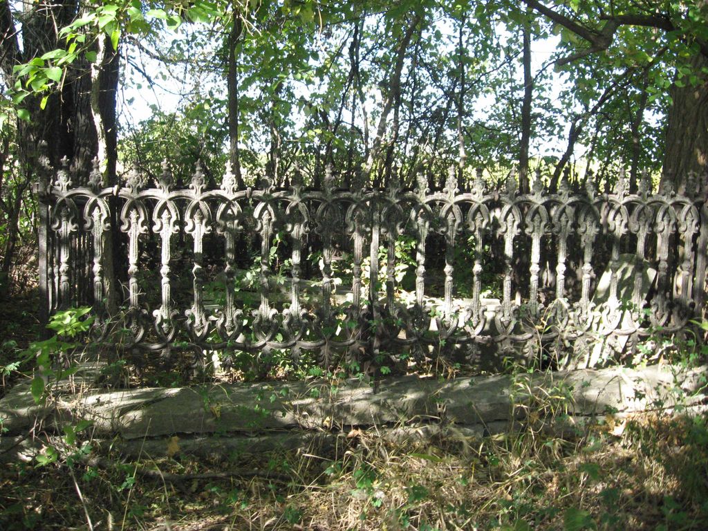
| Description | : | This cemetery is about three miles east of Holt, Missouri, in the SW¼ of the NE¼ of Section 32, Township 54, Range 30, Clay County, Missouri. This was originally Gill land, and later Shanks. Part of the cemetery is enclosed with an iron fence with other graves surrounding it on the outside. The cemetery is on the edge of the road and on the north side. |
frequently asked questions (FAQ):
-
Where is Gill Family Cemetery?
Gill Family Cemetery is located at Holt, Clay County ,Missouri ,USA.
-
Gill Family Cemetery cemetery's updated grave count on graveviews.com?
0 memorials
-
Where are the coordinates of the Gill Family Cemetery?
Latitude: 39.4496384
Longitude: -94.2937927
Nearby Cemetories:
1. Oakland Cemetery
Haynesville, Clinton County, USA
Coordinate: 39.4631004, -94.3114014
2. Antioch Cemetery
Holt, Clay County, USA
Coordinate: 39.4552994, -94.3214035
3. New Hope Cemetery
Holt, Clay County, USA
Coordinate: 39.4332809, -94.3245773
4. Wilerton - McClelland Cemetery
Clay County, USA
Coordinate: 39.4481823, -94.3315423
5. Wilson Cemetery
Clay County, USA
Coordinate: 39.4192009, -94.2855988
6. Arnold-Spellman Graveyard
Holt, Clay County, USA
Coordinate: 39.4364000, -94.3320000
7. Watkins Mill Cemetery
Clay County, USA
Coordinate: 39.4106800, -94.2603200
8. Converse Cemetery
Lathrop, Clinton County, USA
Coordinate: 39.4994011, -94.2794037
9. Majors Family Cemetery
Excelsior Springs, Clay County, USA
Coordinate: 39.4042358, -94.2513657
10. Arnold-Holt Cemetery
Clay County, USA
Coordinate: 39.4410000, -94.3682000
11. Hollingsworth Family Cemetery
Excelsior Springs, Clay County, USA
Coordinate: 39.4293940, -94.2230050
12. Jesse James Farm
Kearney, Clay County, USA
Coordinate: 39.3908360, -94.3224120
13. Muddy Fork Cemetery
Kearney, Clay County, USA
Coordinate: 39.4193993, -94.3703003
14. Barnesville Cemetery
Barnesville, Clinton County, USA
Coordinate: 39.5046310, -94.2302322
15. Bethel Cemetery
Kearney, Clay County, USA
Coordinate: 39.3744011, -94.2902985
16. Lawson Cemetery
Lawson, Ray County, USA
Coordinate: 39.4368248, -94.1954880
17. Estes Family Graveyard
Kearney, Clay County, USA
Coordinate: 39.3973450, -94.3710150
18. Crowley Cemetery
Kearney, Clay County, USA
Coordinate: 39.3685989, -94.3086014
19. Fairview Cemetery
Kearney, Clay County, USA
Coordinate: 39.3774986, -94.3597031
20. John Jack Crowley Graveyard
Clay County, USA
Coordinate: 39.3659167, -94.2566111
21. Shady Grove Cemetery
Kearney, Clay County, USA
Coordinate: 39.3605995, -94.3003006
22. Estes Cemetery
Clay County, USA
Coordinate: 39.3722038, -94.3583755
23. Mackintyre's Church and Cemetery
Lathrop, Clinton County, USA
Coordinate: 39.5073700, -94.3891100
24. Salem Christian Union Church Cemetery
Excelsior Springs, Clay County, USA
Coordinate: 39.3766708, -94.2157745