
| Memorials | : | 9 |
| Location | : | Centertown, Cole County, USA |
| Coordinate | : | 38.5936012, -92.4152985 |
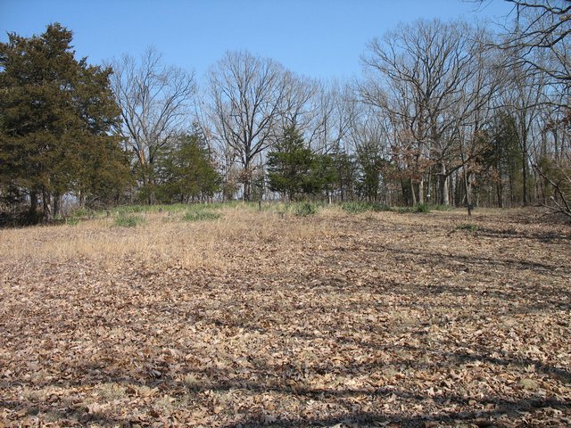
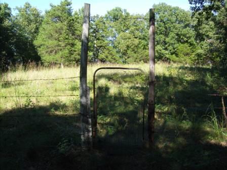
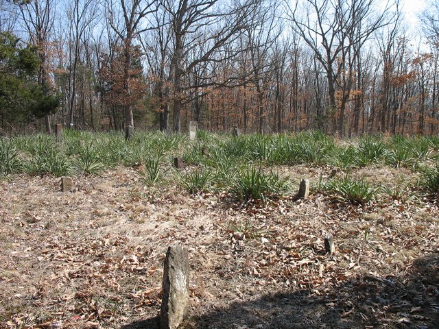
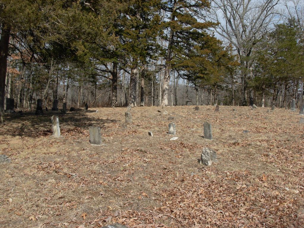
| Description | : | At Centertown, MO (Cole County) from the junction of Hwy 50 and Route U, go South on Route U approximately 1.8 miles to the Richard Strobel residence at 721 Route U. There is a big sign on the East side of U that says Murray Cemetery. A lane takes off from the driveway on the left side of the house. The cemetery is a short distance down the lane. Mr. Strobel has an agreement with the county to allow access to the cemetery as it is on private property. This cemetery is so overgrown, it is impossible to gain access. ... Read More |
frequently asked questions (FAQ):
-
Where is Murray Cemetery?
Murray Cemetery is located at 721 Route U Centertown, Cole County ,Missouri , 65023-3411USA.
-
Murray Cemetery cemetery's updated grave count on graveviews.com?
4 memorials
-
Where are the coordinates of the Murray Cemetery?
Latitude: 38.5936012
Longitude: -92.4152985
Nearby Cemetories:
1. Evangelical Lutheran Emanuel Cemetery
Centertown, Cole County, USA
Coordinate: 38.6173820, -92.4191208
2. Centertown Cemetery
Centertown, Cole County, USA
Coordinate: 38.6188660, -92.4031677
3. Chambers Cemetery
Elston, Cole County, USA
Coordinate: 38.6166153, -92.3853836
4. Barnhardt Cemetery
Lohman, Cole County, USA
Coordinate: 38.5537900, -92.4267100
5. McGirk-George Cemetery
McGirk, Moniteau County, USA
Coordinate: 38.6115500, -92.4679500
6. McGirk Cemetery
McGirk, Moniteau County, USA
Coordinate: 38.6143300, -92.4721500
7. New Saint Martin Catholic Cemetery
Saint Martins, Cole County, USA
Coordinate: 38.6032900, -92.3415420
8. Old Saint Martins Catholic Cemetery
Saint Martins, Cole County, USA
Coordinate: 38.5952620, -92.3356720
9. Stone Cemetery
Cole County, USA
Coordinate: 38.5718994, -92.3358002
10. Sweetwater Cemetery
Moniteau County, USA
Coordinate: 38.6567001, -92.4411011
11. Van Pool Cemetery
Moniteau County, USA
Coordinate: 38.5372009, -92.4627991
12. Old Lebanon Cemetery
McGirk, Moniteau County, USA
Coordinate: 38.6321983, -92.4888992
13. Wilkerson Cemetery
Cole County, USA
Coordinate: 38.5722008, -92.3308029
14. Saint Pauls Lutheran Cemetery
Lohman, Cole County, USA
Coordinate: 38.5388985, -92.3597031
15. Salem United Church of Christ Cemetery
Moniteau County, USA
Coordinate: 38.5864300, -92.5045400
16. Cole County Poor Farm Cemetery
Elston, Cole County, USA
Coordinate: 38.6141810, -92.3287310
17. Elias Chambers Burial Ground
Elston, Cole County, USA
Coordinate: 38.6320600, -92.3362300
18. Blank Cemetery
Russellville, Cole County, USA
Coordinate: 38.5203018, -92.4180984
19. County Farm Cemetery
California, Moniteau County, USA
Coordinate: 38.6103548, -92.5077443
20. Elston Cemetery
Elston, Cole County, USA
Coordinate: 38.6134491, -92.3227310
21. Russellville Cemetery
Russellville, Cole County, USA
Coordinate: 38.5196991, -92.4366989
22. Plummer Burying Ground
Jefferson City, Cole County, USA
Coordinate: 38.5633800, -92.3247900
23. Schmutz Cemetery
Moniteau County, USA
Coordinate: 38.6321983, -92.5018997
24. Swiss Cemetery
California, Moniteau County, USA
Coordinate: 38.6324600, -92.5021100