| Memorials | : | 1 |
| Location | : | Jefferson City, Cole County, USA |
| Coordinate | : | 38.5633800, -92.3247900 |
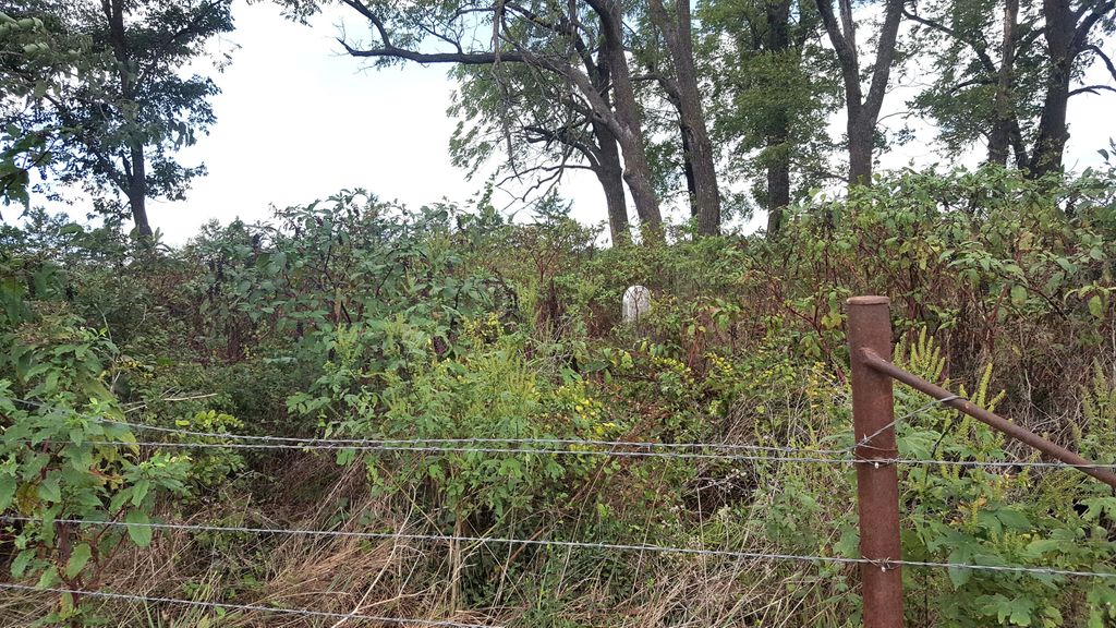
| Description | : | Cemetery census taken in the 1930's indicate it was "located on Garman Farm, now owned by Seidle." Township 44 North - Range 12 West - Section 14 - SE 1/4 o f NW 1/4 From Highway 50 West, turn left/south on Route D; go about 1/2 mile. Turn right on Meadows Ford Road. The cemetery sits up in the field on the right, about 1/2 mile down the road. Cemetery is in very bad condition with only a few stones standing. |
frequently asked questions (FAQ):
-
Where is Plummer Burying Ground?
Plummer Burying Ground is located at Jefferson City, Cole County ,Missouri ,USA.
-
Plummer Burying Ground cemetery's updated grave count on graveviews.com?
1 memorials
-
Where are the coordinates of the Plummer Burying Ground?
Latitude: 38.5633800
Longitude: -92.3247900
Nearby Cemetories:
1. Wilkerson Cemetery
Cole County, USA
Coordinate: 38.5722008, -92.3308029
2. Stone Cemetery
Cole County, USA
Coordinate: 38.5718994, -92.3358002
3. Gordon Cemetery
Lohman, Cole County, USA
Coordinate: 38.5370900, -92.3158100
4. Saint Joseph Cemetery
Stringtown, Cole County, USA
Coordinate: 38.5361110, -92.3320720
5. Old Catholic Cemetery
Jefferson City, Cole County, USA
Coordinate: 38.5358009, -92.3321991
6. Emil Seidel Farm Cemetery
Scruggs, Cole County, USA
Coordinate: 38.5601845, -92.2841797
7. Old Saint Martins Catholic Cemetery
Saint Martins, Cole County, USA
Coordinate: 38.5952620, -92.3356720
8. Dixon Family Cemetery
Apache Flats, Cole County, USA
Coordinate: 38.5879300, -92.2904400
9. Saint Pauls Lutheran Cemetery
Lohman, Cole County, USA
Coordinate: 38.5388985, -92.3597031
10. New Saint Martin Catholic Cemetery
Saint Martins, Cole County, USA
Coordinate: 38.6032900, -92.3415420
11. Squire Walser Gravesite
Elston, Cole County, USA
Coordinate: 38.6050700, -92.3081600
12. Hawthorn Memorial Gardens
Jefferson City, Cole County, USA
Coordinate: 38.5842018, -92.2677994
13. Saint Johns Lutheran Church Cemetery
Stringtown, Cole County, USA
Coordinate: 38.5192986, -92.3526993
14. Elston Cemetery
Elston, Cole County, USA
Coordinate: 38.6134491, -92.3227310
15. Cole County Poor Farm Cemetery
Elston, Cole County, USA
Coordinate: 38.6141810, -92.3287310
16. Eberhardt Cemetery
Cole County, USA
Coordinate: 38.5257988, -92.2668991
17. Zion Lutheran Cemetery
Cole County, USA
Coordinate: 38.5360985, -92.2521973
18. Longview Cemetery
Jefferson City, Cole County, USA
Coordinate: 38.5946999, -92.2536011
19. Kleindits Cemetery
Jefferson Township, Cole County, USA
Coordinate: 38.6240390, -92.2917600
20. Elias Chambers Burial Ground
Elston, Cole County, USA
Coordinate: 38.6320600, -92.3362300
21. Colvin Strong Cemetery
Millbrook, Cole County, USA
Coordinate: 38.5025600, -92.3690400
22. Chambers Cemetery
Elston, Cole County, USA
Coordinate: 38.6166153, -92.3853836
23. Eilenstein Burial Ground
Cole County, USA
Coordinate: 38.5477600, -92.2352200
24. Wyatt-Dix Farm Cemetery
Jefferson City, Cole County, USA
Coordinate: 38.5912400, -92.2364600


