
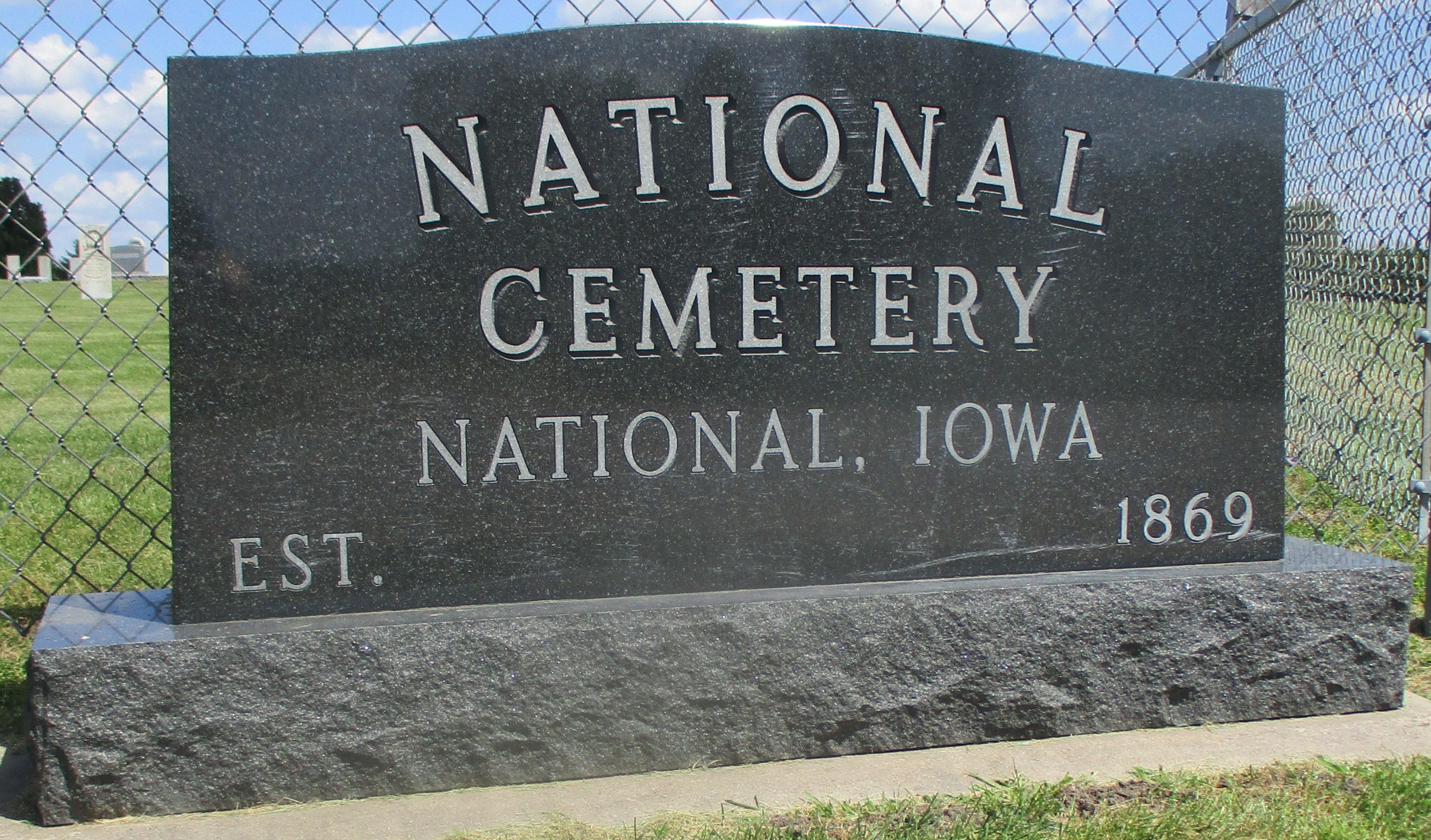
| Memorials | : | 336 |
| Location | : | National, Clayton County, USA |
| Coordinate | : | 42.9536018, -91.2902985 |
frequently asked questions (FAQ):
-
Where is National Cemetery?
National Cemetery is located at Hiawatha Pioneer Trail (US 52) National, Clayton County ,Iowa , 52049USA.
-
National Cemetery cemetery's updated grave count on graveviews.com?
336 memorials
-
Where are the coordinates of the National Cemetery?
Latitude: 42.9536018
Longitude: -91.2902985
Nearby Cemetories:
1. Giard Cemetery
Farmersburg, Clayton County, USA
Coordinate: 42.9933014, -91.3080978
2. Bismark Cemetery
Farmersburg, Clayton County, USA
Coordinate: 42.9790000, -91.3500000
3. Farmersburg-Wagner Cemetery
Farmersburg, Clayton County, USA
Coordinate: 42.9481010, -91.3700027
4. Eastman Cemetery
McGregor, Clayton County, USA
Coordinate: 43.0010000, -91.2190000
5. Clayton Center Cemetery
Clayton Center, Clayton County, USA
Coordinate: 42.8841705, -91.3225021
6. Zion Lutheran Cemetery
Clayton Center, Clayton County, USA
Coordinate: 42.8841705, -91.3249969
7. County Home Cemetery
Clayton Center, Clayton County, USA
Coordinate: 42.8916702, -91.3499985
8. Railroad Employee Cemetery
Giard, Clayton County, USA
Coordinate: 43.0305395, -91.3140229
9. Norwegian Church Cemetery
McGregor, Clayton County, USA
Coordinate: 42.9644400, -91.1764100
10. First Evangelical Lutheran Church Cemetery
McGregor, Clayton County, USA
Coordinate: 42.9718000, -91.1760000
11. Colony Catholic Cemetery (Defunct)
Read Township, Clayton County, USA
Coordinate: 42.8830000, -91.3580000
12. Moody Cemetery
McGregor, Clayton County, USA
Coordinate: 43.0030594, -91.1886063
13. Buell Park Cemetery
Mendon Township, Clayton County, USA
Coordinate: 43.0168226, -91.1999590
14. Garnavillo Community Cemetery
Garnavillo, Clayton County, USA
Coordinate: 42.8656000, -91.2422100
15. Garnavillo Cemetery
Garnavillo, Clayton County, USA
Coordinate: 42.8660300, -91.2390100
16. Saint Joseph Cemetery
Garnavillo, Clayton County, USA
Coordinate: 42.8628006, -91.2502975
17. Walton Cemetery
McGregor, Clayton County, USA
Coordinate: 43.0216270, -91.1909350
18. Gooding Cemetery
Wagner Township, Clayton County, USA
Coordinate: 42.9869490, -91.4191570
19. Pleasant Grove Cemetery
McGregor, Clayton County, USA
Coordinate: 43.0266991, -91.1949997
20. Saint Marys Catholic Church Cemetery
McGregor, Clayton County, USA
Coordinate: 43.0213735, -91.1834632
21. Norway Lutheran Church Cemetery
Saint Olaf, Clayton County, USA
Coordinate: 42.9352798, -91.4302826
22. Clayton Cemetery
Clayton, Clayton County, USA
Coordinate: 42.9043999, -91.1641998
23. Saint Wenceslaus Cemetery
McGregor, Clayton County, USA
Coordinate: 43.0593987, -91.3142014
24. Harford Cemetery
Wyalusing, Grant County, USA
Coordinate: 42.9401000, -91.1401800