
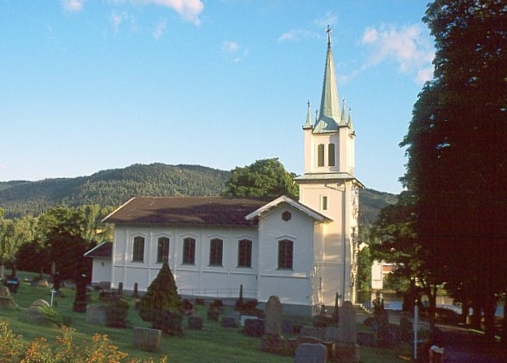
| Memorials | : | 0 |
| Location | : | Krokstadelva, Nedre Eiker kommune, Norway |
| Coordinate | : | 59.7573380, 10.0363650 |
frequently asked questions (FAQ):
-
Where is Nedre Eiker Churchyard?
Nedre Eiker Churchyard is located at Krokstadelva, Nedre Eiker kommune ,Buskerud fylke ,Norway.
-
Nedre Eiker Churchyard cemetery's updated grave count on graveviews.com?
0 memorials
-
Where are the coordinates of the Nedre Eiker Churchyard?
Latitude: 59.7573380
Longitude: 10.0363650
Nearby Cemetories:
1. Åssiden Cemetery
Drammen, Drammen kommune, Norway
Coordinate: 59.7591686, 10.1154243
2. Haug Kirke
Hokksund, Øvre Eiker kommune, Norway
Coordinate: 59.7649980, 9.9046820
3. Bragernes Cemetery
Drammen, Drammen kommune, Norway
Coordinate: 59.7481560, 10.2016710
4. Strømsø Gravplass
Stromso, Drammen kommune, Norway
Coordinate: 59.7355911, 10.2072084
5. Frogner Cemetery
Lierbyen, Lier kommune, Norway
Coordinate: 59.7791730, 10.2240060
6. Tangen Cemetery
Tangen, Drammen kommune, Norway
Coordinate: 59.7257300, 10.2484600
7. Bakke Kirke
Øvre Eiker kommune, Norway
Coordinate: 59.8359000, 9.8726000
8. Fiskum Church Cemetery
Øvre Eiker kommune, Norway
Coordinate: 59.6989035, 9.8100539
9. Sjåstad
Lier kommune, Norway
Coordinate: 59.8499235, 10.2138581
10. Ahrensburg Friedhof
Grosshansdorf, Kreis Stormarn, Germany
Coordinate: 59.6641940, 10.2149440
11. Eidsfoss Church Cemetery
Eidsfoss, Hof kommune, Norway
Coordinate: 59.5919200, 10.0453700
12. Røyken Kirkegaard
Royken, Røyken kommune, Norway
Coordinate: 59.7467160, 10.3850690
13. Heggen Kirkegaard
Modum kommune, Norway
Coordinate: 59.9408250, 10.0006690
14. Sylling Churchyard
Sylling, Lier kommune, Norway
Coordinate: 59.8987580, 10.2806720
15. Sande In Vestfold Cemetery
Sande, Sande kommune, Norway
Coordinate: 59.5888037, 10.2082535
16. Kongsberg Kirke Gravlund
Kongsberg, Kongsberg kommune, Norway
Coordinate: 59.6656756, 9.6469139
17. Asker Church
Asker, Asker kommune, Norway
Coordinate: 59.8434020, 10.4358860
18. Hof kirkegård
Hof, Hof kommune, Norway
Coordinate: 59.5394100, 10.0799600
19. Slemmestad Kirkegaard
Slemmestad, Røyken kommune, Norway
Coordinate: 59.7680240, 10.4724700
20. Kirkegaarden ved Naeringsparken
Kongsberg, Kongsberg kommune, Norway
Coordinate: 59.6520680, 9.6457200
21. Kongsberg Gomsrud Gravlund
Kongsberg, Kongsberg kommune, Norway
Coordinate: 59.6410080, 9.6566630
22. Efteløt Parish Churchyard
Kongsberg, Kongsberg kommune, Norway
Coordinate: 59.5504874, 9.8097957
23. Hurum Cemetery
Hurum kommune, Norway
Coordinate: 59.6144100, 10.4590700
24. Tanum Churchyard
Bærum kommune, Norway
Coordinate: 59.8950330, 10.4790930