
| Memorials | : | 0 |
| Location | : | Georgetown County, USA |
| Coordinate | : | 33.5259700, -79.1346000 |
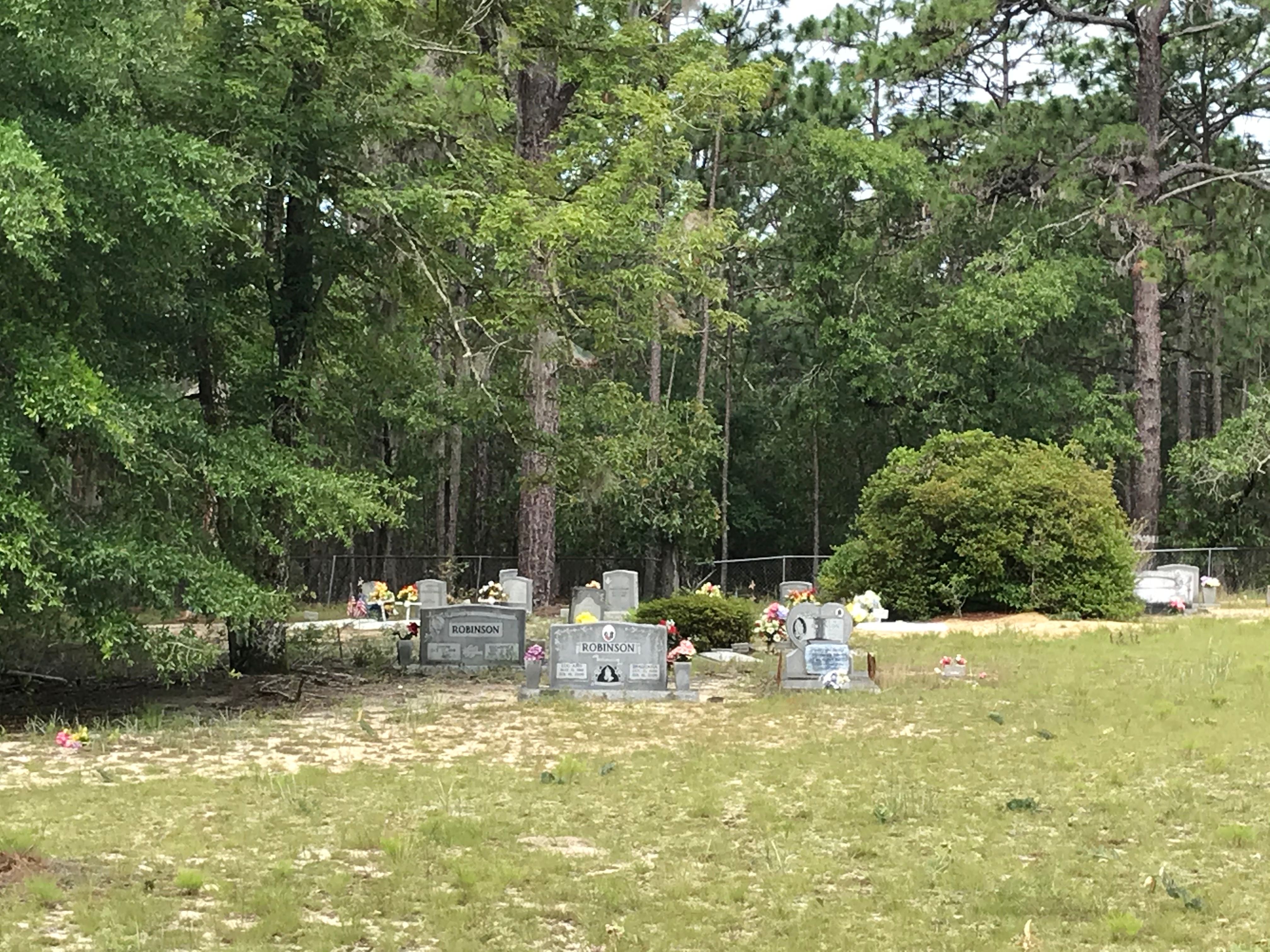
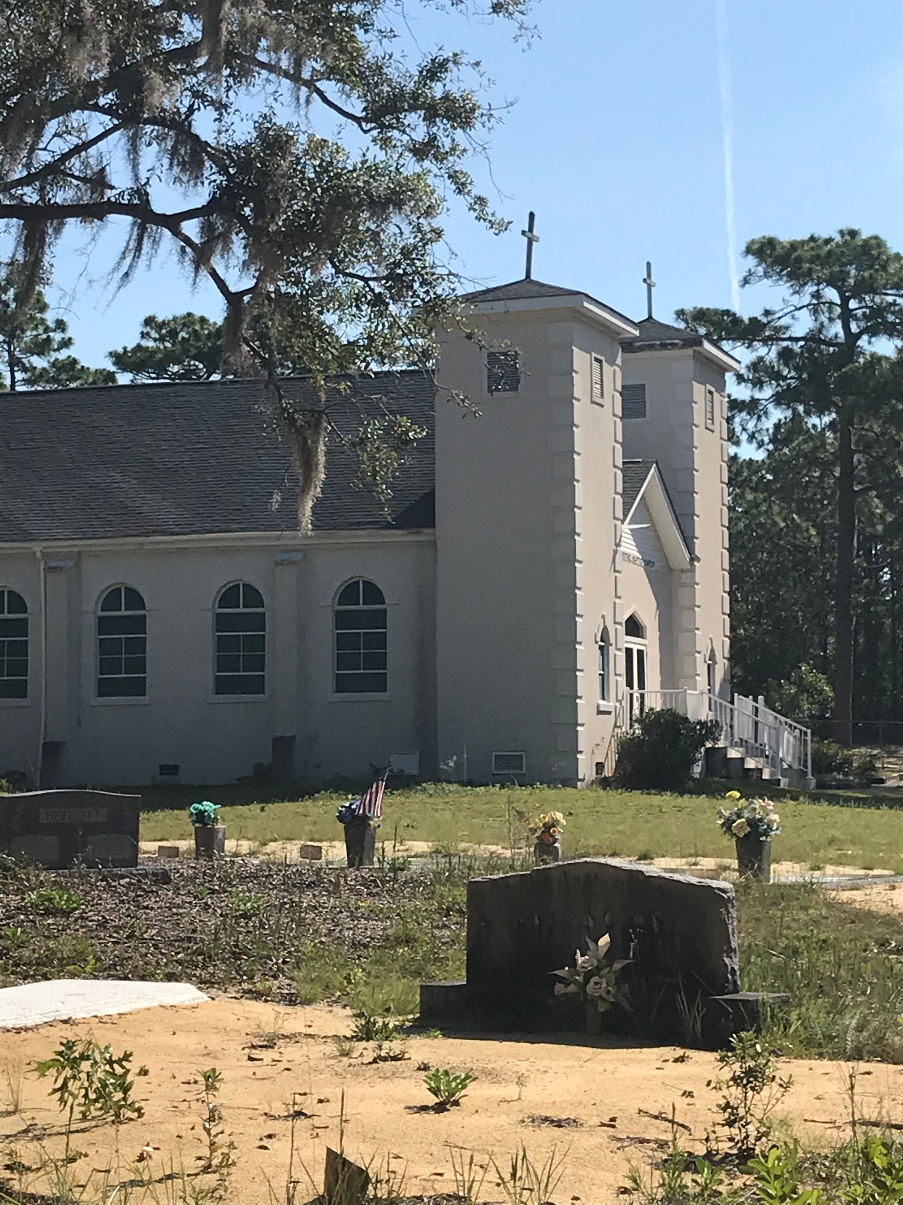
| Description | : | Church and cemetery are on Sandy Island in upper Georgetown County. Access to the island is by ferry, or at least by boat. The community is largely isolated from the mainland. Pawleys Island is a postal address, but the church and the cemetery are NOT IN Pawleys Island, NOR in Murrells Inlet. Both towns are along the coast. Sandy Island is inland, west of Waccamaw River. Numerous death certificates say Sandy Island, Murrells Inlet, which suggests that in prior years the Island might have been served by a post office in Murrells Inlet. An excellent description of the island... Read More |
frequently asked questions (FAQ):
-
Where is New Bethel Baptist Cemetery Sandy Island?
New Bethel Baptist Cemetery Sandy Island is located at 19 Sandy Island Rd., Pawleys Island, SC Georgetown County ,South Carolina , 29585USA.
-
New Bethel Baptist Cemetery Sandy Island cemetery's updated grave count on graveviews.com?
0 memorials
-
Where are the coordinates of the New Bethel Baptist Cemetery Sandy Island?
Latitude: 33.5259700
Longitude: -79.1346000

Nearby Cemetories:
1. Belin Cemetery
Belin, Georgetown County, USA
Coordinate: 33.5179460, -79.1436540
2. Oaks Cemetery
Murrells Inlet, Georgetown County, USA
Coordinate: 33.5108300, -79.1127300
3. Springfield Plantation Slave Cemetery
Murrells Inlet, Georgetown County, USA
Coordinate: 33.5260380, -79.0857380
4. Prince Frederick Cemetery
Plantersville, Georgetown County, USA
Coordinate: 33.5060000, -79.1800000
5. Laurel Hill Plantation Slave Cemetery
Murrells Inlet, Georgetown County, USA
Coordinate: 33.5423390, -79.0868480
6. Saint Pauls Waccamaw United Methodist Church Colu
Pawleys Island, Georgetown County, USA
Coordinate: 33.4857020, -79.0955760
7. Eaddy Tabernacle
Murrells Inlet, Georgetown County, USA
Coordinate: 33.5469500, -79.0777200
8. Gordon Chapel AME Church
Murrells Inlet, Georgetown County, USA
Coordinate: 33.5464290, -79.0765050
9. Mount Carmel Missionary Baptist Church Cemetery
Plantersville, Georgetown County, USA
Coordinate: 33.5470070, -79.1930650
10. Richmond Hill Slave Cemetery
Murrells Inlet, Georgetown County, USA
Coordinate: 33.5525000, -79.0792400
11. New Bethel AME Cemetery
Jackson, Georgetown County, USA
Coordinate: 33.4928537, -79.1847166
12. Bethel Church Cemetery
Waverly Mills, Georgetown County, USA
Coordinate: 33.4926270, -79.1846680
13. Jerusalem Baptist Murrells Inlet
Murrells Inlet, Georgetown County, USA
Coordinate: 33.5541990, -79.0755430
14. Saint Peters Lutheran Church Cemetery
Pawleys Island, Georgetown County, USA
Coordinate: 33.4753200, -79.1030800
15. All Saints Episcopal Church Cemetery
Pawleys Island, Georgetown County, USA
Coordinate: 33.4672012, -79.1402969
16. Flowers Cemetery
Marion County, USA
Coordinate: 33.5637100, -79.1964200
17. Greater Mount Carmel Baptist Church Cemetery
Gilliard, Georgetown County, USA
Coordinate: 33.5196000, -79.2117330
18. Saint Paul Missionary AME Church Cemetery
Plantersville, Georgetown County, USA
Coordinate: 33.5759900, -79.1858100
19. Precious Blood of Christ Columbarium
Pawleys Island, Georgetown County, USA
Coordinate: 33.4598550, -79.1404960
20. Holy Cross Cemetery
Pawleys Island, Georgetown County, USA
Coordinate: 33.4606410, -79.1117700
21. Woodstock Cemetery
Murrells Inlet, Georgetown County, USA
Coordinate: 33.5775380, -79.0749640
22. Mount Zion Missionary Baptist Church Cemetery
Pawleys Island, Georgetown County, USA
Coordinate: 33.4543050, -79.1222850
23. New Bethel AME Church Cemetery
Georgetown, Georgetown County, USA
Coordinate: 33.5551290, -79.2153530
24. Saint John AME Cemetery
Pawleys Island, Georgetown County, USA
Coordinate: 33.4516411, -79.1252289