
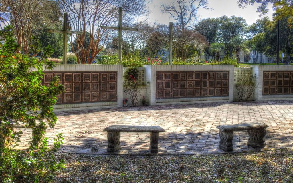
| Memorials | : | 2 |
| Location | : | Pawleys Island, Georgetown County, USA |
| Coordinate | : | 33.4857020, -79.0955760 |
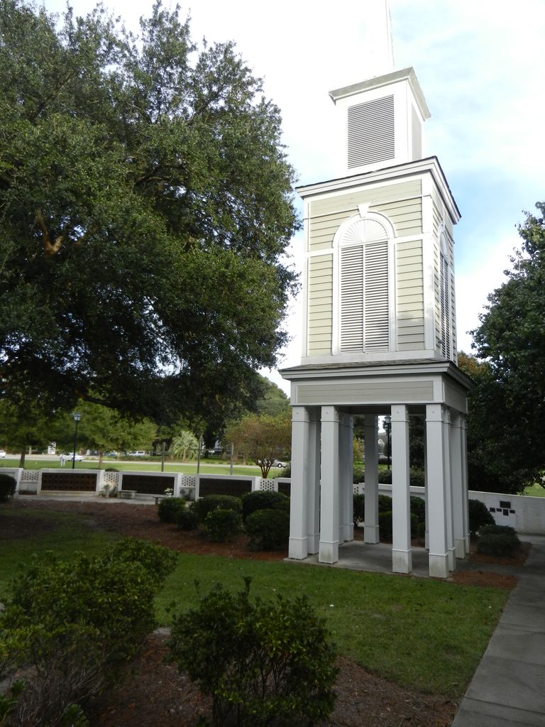
| Description | : | St. Paul's Waccamaw United Methodist Church 180 St. Paul's Place Pawleys Island, SC Created by FAG member #47753934 |
frequently asked questions (FAQ):
-
Where is Saint Pauls Waccamaw United Methodist Church Colu?
Saint Pauls Waccamaw United Methodist Church Colu is located at Pawleys Island, Georgetown County ,South Carolina ,USA.
-
Saint Pauls Waccamaw United Methodist Church Colu cemetery's updated grave count on graveviews.com?
2 memorials
-
Where are the coordinates of the Saint Pauls Waccamaw United Methodist Church Colu?
Latitude: 33.4857020
Longitude: -79.0955760
Nearby Cemetories:
1. Saint Peters Lutheran Church Cemetery
Pawleys Island, Georgetown County, USA
Coordinate: 33.4753200, -79.1030800
2. Holy Cross Cemetery
Pawleys Island, Georgetown County, USA
Coordinate: 33.4606410, -79.1117700
3. Oaks Cemetery
Murrells Inlet, Georgetown County, USA
Coordinate: 33.5108300, -79.1127300
4. Mount Zion Missionary Baptist Church Cemetery
Pawleys Island, Georgetown County, USA
Coordinate: 33.4543050, -79.1222850
5. Springfield Plantation Slave Cemetery
Murrells Inlet, Georgetown County, USA
Coordinate: 33.5260380, -79.0857380
6. All Saints Episcopal Church Cemetery
Pawleys Island, Georgetown County, USA
Coordinate: 33.4672012, -79.1402969
7. Saint John AME Cemetery
Pawleys Island, Georgetown County, USA
Coordinate: 33.4516411, -79.1252289
8. Precious Blood of Christ Columbarium
Pawleys Island, Georgetown County, USA
Coordinate: 33.4598550, -79.1404960
9. Ben Horry Cemetery
Fraserville, Georgetown County, USA
Coordinate: 33.4462070, -79.1260830
10. Belin Cemetery
Belin, Georgetown County, USA
Coordinate: 33.5179460, -79.1436540
11. New Bethel Baptist Cemetery Sandy Island
Georgetown County, USA
Coordinate: 33.5259700, -79.1346000
12. Laurel Hill Plantation Slave Cemetery
Murrells Inlet, Georgetown County, USA
Coordinate: 33.5423390, -79.0868480
13. Pawleys Island Presbyterian Church Churchyard
Pawleys Island, Georgetown County, USA
Coordinate: 33.4362990, -79.1355100
14. Gordon Chapel AME Church
Murrells Inlet, Georgetown County, USA
Coordinate: 33.5464290, -79.0765050
15. Eaddy Tabernacle
Murrells Inlet, Georgetown County, USA
Coordinate: 33.5469500, -79.0777200
16. Pawley Burial Plot at Wahacca
Pawleys Island, Georgetown County, USA
Coordinate: 33.4260300, -79.1324800
17. Shackelford Family Burying Ground
Georgetown, Georgetown County, USA
Coordinate: 33.4260480, -79.1328880
18. Richmond Hill Slave Cemetery
Murrells Inlet, Georgetown County, USA
Coordinate: 33.5525000, -79.0792400
19. Jerusalem Baptist Murrells Inlet
Murrells Inlet, Georgetown County, USA
Coordinate: 33.5541990, -79.0755430
20. Prince Frederick Cemetery
Plantersville, Georgetown County, USA
Coordinate: 33.5060000, -79.1800000
21. Bethel Church Cemetery
Waverly Mills, Georgetown County, USA
Coordinate: 33.4926270, -79.1846680
22. New Bethel AME Cemetery
Jackson, Georgetown County, USA
Coordinate: 33.4928537, -79.1847166
23. Saint Marys AME Church Cemetery
Pawleys Island, Georgetown County, USA
Coordinate: 33.4241000, -79.1492000
24. True Blue Plantation Cemetery
Pawleys Island, Georgetown County, USA
Coordinate: 33.4412994, -79.1746979