
| Memorials | : | 30 |
| Location | : | Mount Airy, Surry County, USA |
| Coordinate | : | 36.5533870, -80.7018270 |
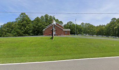
| Description | : | From the intersection of US 52 and NC 89 in Mt. Airy, go west on NC 89 for about 1/2 mile and turn right on N. Franklin Rd. Then go about 200 yards and turn left on Pipers Gap Rd. Then go about 5-6 miles and the cemetery and church will be on the right with a larger cemetery (west) on the left across from the church. |
frequently asked questions (FAQ):
-
Where is New Bethel Baptist South?
New Bethel Baptist South is located at Mount Airy, Surry County ,North Carolina ,USA.
-
New Bethel Baptist South cemetery's updated grave count on graveviews.com?
30 memorials
-
Where are the coordinates of the New Bethel Baptist South?
Latitude: 36.5533870
Longitude: -80.7018270
Nearby Cemetories:
1. New Bethel Baptist Church Cemetery
Mount Airy, Surry County, USA
Coordinate: 36.5535920, -80.7020960
2. James Harding Golding Family Cemetery
Mount Airy, Surry County, USA
Coordinate: 36.5539500, -80.7023900
3. Imogene Baptist Church Cemetery
Pine Ridge, Surry County, USA
Coordinate: 36.5521393, -80.7203598
4. Beamer Cemetery
Mount Airy, Surry County, USA
Coordinate: 36.5343060, -80.7012220
5. Snow Cemetery
Mount Airy, Surry County, USA
Coordinate: 36.5422500, -80.7299170
6. Oak Ridge Baptist Church Cemetery
Cana, Carroll County, USA
Coordinate: 36.5718760, -80.6800790
7. Christopher W Jones Cemetery
Cana, Carroll County, USA
Coordinate: 36.5819178, -80.7000292
8. Furbee Cemetery
Wetzel County, USA
Coordinate: 36.5363984, -80.7316687
9. Zion United Methodist Cemetery
Mount Airy, Surry County, USA
Coordinate: 36.5326958, -80.6725845
10. Maple Grove United Methodist Church Cemetery
Pine Ridge, Surry County, USA
Coordinate: 36.5237770, -80.7171402
11. McCraw Family Cemetery
Lambsburg, Carroll County, USA
Coordinate: 36.5814200, -80.7235270
12. Vernon-Leonard Cemetery
Cana, Carroll County, USA
Coordinate: 36.5841200, -80.7217600
13. Johnson Puckett Cemetery
Mount Airy, Surry County, USA
Coordinate: 36.5306740, -80.7362830
14. Booker-Busick-Smith Cemetery
Mount Airy, Surry County, USA
Coordinate: 36.5302400, -80.6638700
15. Surratt Cemetery
Lambsburg, Carroll County, USA
Coordinate: 36.5790920, -80.7396730
16. Gray Cemetery
Cana, Carroll County, USA
Coordinate: 36.5943420, -80.7034040
17. Flower Gap Primitive Baptist Church Cemetery
Cana, Carroll County, USA
Coordinate: 36.5900510, -80.7286500
18. A.L. Jones Family Cemetery
Cana, Carroll County, USA
Coordinate: 36.5754410, -80.6561640
19. Epworth United Methodist Church Cemetery
Cana, Carroll County, USA
Coordinate: 36.5736110, -80.6536110
20. Primitive Baptist Church Of Jesus Christ Cemetery
Cana, Carroll County, USA
Coordinate: 36.5917320, -80.6737210
21. Wisler Cemetery
Cana, Carroll County, USA
Coordinate: 36.5933240, -80.6756550
22. Cedar Lane-Easter Cemetery
Cana, Carroll County, USA
Coordinate: 36.5898610, -80.7356070
23. Easter Family Cemetery
Carroll County, USA
Coordinate: 36.5900270, -80.7354860
24. Cana Baptist Church Cemetery
Cana, Carroll County, USA
Coordinate: 36.5920764, -80.6717347