
| Memorials | : | 0 |
| Location | : | Huddersfield, Metropolitan Borough of Kirklees, England |
| Coordinate | : | 53.6447670, -1.7843060 |
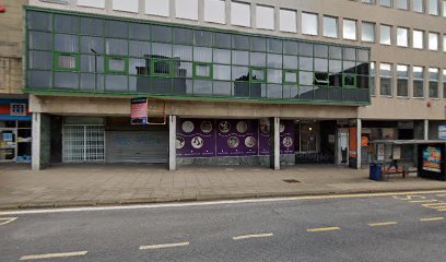
| Description | : | The chapel on High Street was built in the 1860s and closed in 1944. The building was demolished around 1956. |
frequently asked questions (FAQ):
-
Where is New Conexion Chapel?
New Conexion Chapel is located at Huddersfield, Metropolitan Borough of Kirklees ,West Yorkshire ,England.
-
New Conexion Chapel cemetery's updated grave count on graveviews.com?
0 memorials
-
Where are the coordinates of the New Conexion Chapel?
Latitude: 53.6447670
Longitude: -1.7843060
Nearby Cemetories:
1. St Paul Churchyard
Huddersfield, Metropolitan Borough of Kirklees, England
Coordinate: 53.6438800, -1.7795800
2. St. Peter's Churchyard
Huddersfield, Metropolitan Borough of Kirklees, England
Coordinate: 53.6475760, -1.7809710
3. Holy Trinity Churchyard
Huddersfield, Metropolitan Borough of Kirklees, England
Coordinate: 53.6497300, -1.7928400
4. Edgerton Cemetery
Edgerton, Metropolitan Borough of Kirklees, England
Coordinate: 53.6535400, -1.7935100
5. Christ Church Memorial Garden
Moldgreen, Metropolitan Borough of Kirklees, England
Coordinate: 53.6457200, -1.7651400
6. Friends Burial Ground
Huddersfield, Metropolitan Borough of Kirklees, England
Coordinate: 53.6427300, -1.8041100
7. New Congregational Church
Moldgreen, Metropolitan Borough of Kirklees, England
Coordinate: 53.6433201, -1.7629206
8. Lockwood Baptist Chapelyard
Lockwood, Metropolitan Borough of Kirklees, England
Coordinate: 53.6336200, -1.7955400
9. All Saints Churchyard
Huddersfield, Metropolitan Borough of Kirklees, England
Coordinate: 53.6428410, -1.8063770
10. Emmanuel Churchyard
Lockwood, Metropolitan Borough of Kirklees, England
Coordinate: 53.6301400, -1.7957410
11. St John the Evangelist Churchyard
Newsome, Metropolitan Borough of Kirklees, England
Coordinate: 53.6280000, -1.7834300
12. Rose Hill Natural Burial Ground
Huddersfield, Metropolitan Borough of Kirklees, England
Coordinate: 53.6588400, -1.8029600
13. Almondbury Cemetery
Almondbury, Metropolitan Borough of Kirklees, England
Coordinate: 53.6341320, -1.7522980
14. St Luke Churchyard
Milnsbridge, Metropolitan Borough of Kirklees, England
Coordinate: 53.6370540, -1.8214650
15. Christ Church Churchyard
Fartown, Metropolitan Borough of Kirklees, England
Coordinate: 53.6675400, -1.7694500
16. Christ Church Woodhouse
Huddersfield, Metropolitan Borough of Kirklees, England
Coordinate: 53.6677310, -1.7694960
17. Lockwood Cemetery
Huddersfield, Metropolitan Borough of Kirklees, England
Coordinate: 53.6240290, -1.8069020
18. All Hallows Churchyard
Almondbury, Metropolitan Borough of Kirklees, England
Coordinate: 53.6316620, -1.7467620
19. St. Stephen's Churchyard
Lindley, Metropolitan Borough of Kirklees, England
Coordinate: 53.6590210, -1.8222000
20. St Paul Churchyard
Armitage Bridge, Metropolitan Borough of Kirklees, England
Coordinate: 53.6193850, -1.7984590
21. St Mark Churchyard
Huddersfield, Metropolitan Borough of Kirklees, England
Coordinate: 53.6459760, -1.8322580
22. Zion Methodist Chapelyard
Lindley, Metropolitan Borough of Kirklees, England
Coordinate: 53.6617100, -1.8236500
23. Lindley Methodist Chapelyard
Lindley, Metropolitan Borough of Kirklees, England
Coordinate: 53.6634200, -1.8219000
24. Hey Lane Cemetery
Huddersfield, Metropolitan Borough of Kirklees, England
Coordinate: 53.6156100, -1.7786000