
| Memorials | : | 0 |
| Location | : | Moldgreen, Metropolitan Borough of Kirklees, England |
| Coordinate | : | 53.6433201, -1.7629206 |
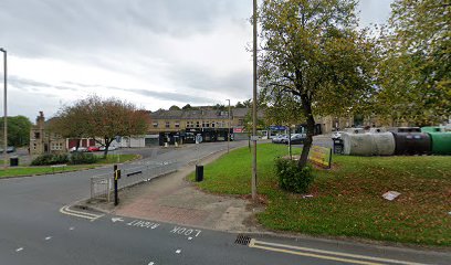
| Description | : | Also known as Moldgreen United Reform Church The foundation stone was laid on 28 July 1866 and the first services were given in April 1868. The total cost of around £3,700 was partly offset by an anonymous "benevolent lady" who gifted £1,300 to the Rev. W. Hodgkiss. The architects were Messrs. Healey of Bradford and the following surnames were recorded as the contractors: (Info extracted from Huddersfield Exposed webpage) This church was demolished in the 1980's as part of the road widening scheme for Wakefield Road, and replaced by the current United Reform Church |
frequently asked questions (FAQ):
-
Where is New Congregational Church?
New Congregational Church is located at Wakefield Road Moldgreen, Metropolitan Borough of Kirklees ,West Yorkshire ,England.
-
New Congregational Church cemetery's updated grave count on graveviews.com?
0 memorials
-
Where are the coordinates of the New Congregational Church?
Latitude: 53.6433201
Longitude: -1.7629206
Nearby Cemetories:
1. Christ Church Memorial Garden
Moldgreen, Metropolitan Borough of Kirklees, England
Coordinate: 53.6457200, -1.7651400
2. St Paul Churchyard
Huddersfield, Metropolitan Borough of Kirklees, England
Coordinate: 53.6438800, -1.7795800
3. Almondbury Cemetery
Almondbury, Metropolitan Borough of Kirklees, England
Coordinate: 53.6341320, -1.7522980
4. St. Peter's Churchyard
Huddersfield, Metropolitan Borough of Kirklees, England
Coordinate: 53.6475760, -1.7809710
5. New Conexion Chapel
Huddersfield, Metropolitan Borough of Kirklees, England
Coordinate: 53.6447670, -1.7843060
6. All Hallows Churchyard
Almondbury, Metropolitan Borough of Kirklees, England
Coordinate: 53.6316620, -1.7467620
7. Holy Trinity Churchyard
Huddersfield, Metropolitan Borough of Kirklees, England
Coordinate: 53.6497300, -1.7928400
8. St John the Evangelist Churchyard
Newsome, Metropolitan Borough of Kirklees, England
Coordinate: 53.6280000, -1.7834300
9. St John the Baptist Churchyard
Kirkheaton, Metropolitan Borough of Kirklees, England
Coordinate: 53.6508510, -1.7309650
10. Edgerton Cemetery
Edgerton, Metropolitan Borough of Kirklees, England
Coordinate: 53.6535400, -1.7935100
11. Lockwood Baptist Chapelyard
Lockwood, Metropolitan Borough of Kirklees, England
Coordinate: 53.6336200, -1.7955400
12. Emmanuel Churchyard
Lockwood, Metropolitan Borough of Kirklees, England
Coordinate: 53.6301400, -1.7957410
13. Friends Burial Ground
Huddersfield, Metropolitan Borough of Kirklees, England
Coordinate: 53.6427300, -1.8041100
14. Christ Church Churchyard
Fartown, Metropolitan Borough of Kirklees, England
Coordinate: 53.6675400, -1.7694500
15. Christ Church Woodhouse
Huddersfield, Metropolitan Borough of Kirklees, England
Coordinate: 53.6677310, -1.7694960
16. Kirkheaton Cemetery
Kirkheaton, Metropolitan Borough of Kirklees, England
Coordinate: 53.6523100, -1.7228500
17. All Saints Churchyard
Huddersfield, Metropolitan Borough of Kirklees, England
Coordinate: 53.6428410, -1.8063770
18. Deighton Methodist Chapelyard Extension Cemetery
Huddersfield, Metropolitan Borough of Kirklees, England
Coordinate: 53.6705000, -1.7519300
19. Rose Hill Natural Burial Ground
Huddersfield, Metropolitan Borough of Kirklees, England
Coordinate: 53.6588400, -1.8029600
20. Deighton Methodist Chapelyard
Huddersfield, Metropolitan Borough of Kirklees, England
Coordinate: 53.6711800, -1.7518600
21. Hey Lane Cemetery
Huddersfield, Metropolitan Borough of Kirklees, England
Coordinate: 53.6156100, -1.7786000
22. St Paul Churchyard
Armitage Bridge, Metropolitan Borough of Kirklees, England
Coordinate: 53.6193850, -1.7984590
23. Lockwood Cemetery
Huddersfield, Metropolitan Borough of Kirklees, England
Coordinate: 53.6240290, -1.8069020
24. St Lucius Churchyard
Farnley Tyas, Metropolitan Borough of Kirklees, England
Coordinate: 53.6107400, -1.7532300