
| Memorials | : | 0 |
| Location | : | Edisto Island, Charleston County, USA |
| Coordinate | : | 32.5730100, -80.2837400 |
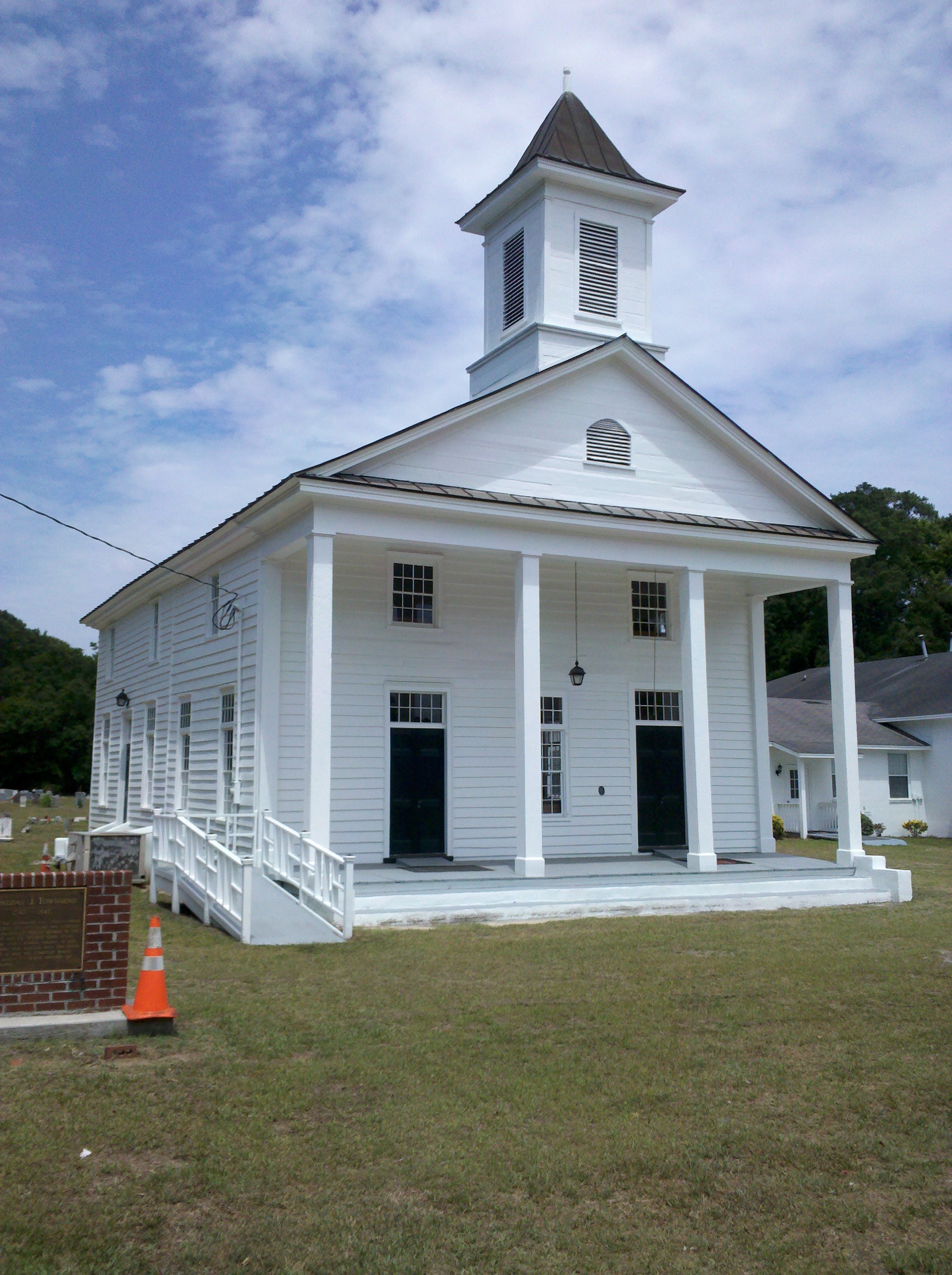
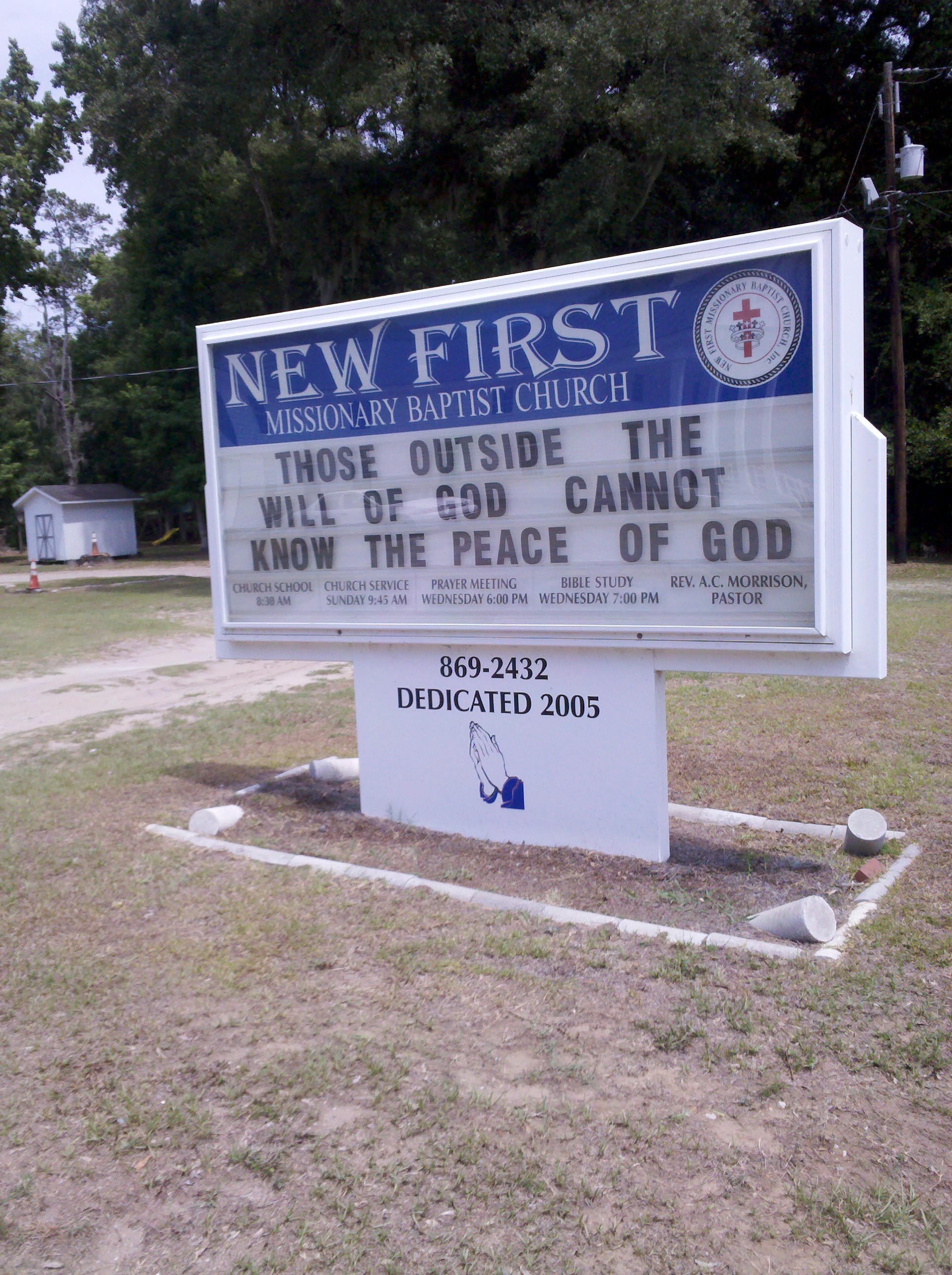
| Description | : | Corner of Hwy 174 and Oak Island Road. The church and cemetery are located on the corner of Oak Island Road and Highway 174 on Edisto Island. The church was originally used by a white congregation but now is used by a black congregation. The burials listed are for white congregation. |
frequently asked questions (FAQ):
-
Where is New First Missionary Baptist Church Cemetery?
New First Missionary Baptist Church Cemetery is located at 1644 Hwy 174 Edisto Island, Charleston County ,South Carolina , 29438USA.
-
New First Missionary Baptist Church Cemetery cemetery's updated grave count on graveviews.com?
0 memorials
-
Where are the coordinates of the New First Missionary Baptist Church Cemetery?
Latitude: 32.5730100
Longitude: -80.2837400

Nearby Cemetories:
1. New First Missionary Baptist Church Cemetery
Edisto Island, Charleston County, USA
Coordinate: 32.5730100, -80.2837400
2. Old First Baptist Church
Edisto Island, Charleston County, USA
Coordinate: 32.5729900, -80.2836400
3. Zion Reformed Episcopal Church
Edisto Island, Charleston County, USA
Coordinate: 32.5729000, -80.2837000
4. New First Baptist Church Cemetery
Edisto Island, Charleston County, USA
Coordinate: 32.5722008, -80.2840118
5. Trinity Cemetery
Edisto Island, Charleston County, USA
Coordinate: 32.5700800, -80.2837000
6. Trinity Episcopal Church Cemetery
Edisto Island, Charleston County, USA
Coordinate: 32.5694000, -80.2838000
7. Edisto Presbyterian Church Cemetery
Edisto Island, Charleston County, USA
Coordinate: 32.5787849, -80.2950134
8. Greater Galilee Church of our Lord
Charleston, Charleston County, USA
Coordinate: 32.5833280, -80.2945170
9. Bethlehem RMUE Church Cemetery
Edisto Island, Charleston County, USA
Coordinate: 32.5590000, -80.2772000
10. Lawton-Seabrook Cemetery
Edisto Island, Charleston County, USA
Coordinate: 32.5892400, -80.2965700
11. Presbyterian Church on Edisto Island Cemetery
Edisto Island, Charleston County, USA
Coordinate: 32.5801964, -80.3081284
12. Allen AME Church Cemetery
Edisto Island, Charleston County, USA
Coordinate: 32.5519000, -80.2769000
13. Whaley-Seabrook Cemetery
Edisto Island, Charleston County, USA
Coordinate: 32.6016670, -80.2813890
14. Greater Bethel AME Church Cemetery
Edisto Island, Charleston County, USA
Coordinate: 32.5420000, -80.2894000
15. Murray's Cemetery
Edisto Island, Charleston County, USA
Coordinate: 32.5515890, -80.2344800
16. Gun Bluff Plantation Cemetery
Edisto Island, Charleston County, USA
Coordinate: 32.5814670, -80.3420730
17. Mount Olive Baptist Church Cemetery
Edisto Island, Charleston County, USA
Coordinate: 32.5842000, -80.3465000
18. Calvary AME Church Cemetery
Edisto Island, Charleston County, USA
Coordinate: 32.5884000, -80.3536000
19. Meggett Point Plantation
Edisto Island, Charleston County, USA
Coordinate: 32.5555000, -80.3768333
20. Saint Christopher Camp Burial Ground
Johns Island, Charleston County, USA
Coordinate: 32.5662690, -80.1813110
21. Bailey Cemetery
Wadmalaw Island, Charleston County, USA
Coordinate: 32.6322117, -80.2031038
22. Ebenezer Baptist Church Cemetery
Hollywood, Charleston County, USA
Coordinate: 32.6673546, -80.3434219
23. Ferri Family Cemetery
Wadmalaw Island, Charleston County, USA
Coordinate: 32.6467200, -80.1850940
24. Mount Horr AME Church Cemetery
Yonges Island, Charleston County, USA
Coordinate: 32.6739400, -80.3461600