
| Memorials | : | 0 |
| Location | : | Edisto Island, Charleston County, USA |
| Coordinate | : | 32.5729000, -80.2837000 |
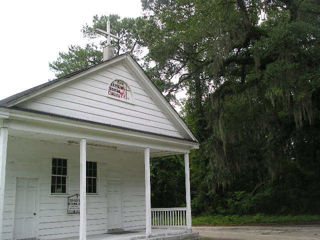
| Description | : | This is a small, old cemetery that is still in use on the road to Edisto Island State Park. There are several graves that have stones without name plaques. Surrounded by trees draped with Spanish moss, the little white church sits quietly in the South Carolina sun. |
frequently asked questions (FAQ):
-
Where is Zion Reformed Episcopal Church?
Zion Reformed Episcopal Church is located at 1650 Hwy 174 Edisto Island, Charleston County ,South Carolina , 29438USA.
-
Zion Reformed Episcopal Church cemetery's updated grave count on graveviews.com?
0 memorials
-
Where are the coordinates of the Zion Reformed Episcopal Church?
Latitude: 32.5729000
Longitude: -80.2837000
Nearby Cemetories:
1. Old First Baptist Church
Edisto Island, Charleston County, USA
Coordinate: 32.5729900, -80.2836400
2. New First Missionary Baptist Church Cemetery
Edisto Island, Charleston County, USA
Coordinate: 32.5730100, -80.2837400
3. New First Missionary Baptist Church Cemetery
Edisto Island, Charleston County, USA
Coordinate: 32.5730100, -80.2837400
4. New First Baptist Church Cemetery
Edisto Island, Charleston County, USA
Coordinate: 32.5722008, -80.2840118
5. Trinity Cemetery
Edisto Island, Charleston County, USA
Coordinate: 32.5700800, -80.2837000
6. Trinity Episcopal Church Cemetery
Edisto Island, Charleston County, USA
Coordinate: 32.5694000, -80.2838000
7. Edisto Presbyterian Church Cemetery
Edisto Island, Charleston County, USA
Coordinate: 32.5787849, -80.2950134
8. Greater Galilee Church of our Lord
Charleston, Charleston County, USA
Coordinate: 32.5833280, -80.2945170
9. Bethlehem RMUE Church Cemetery
Edisto Island, Charleston County, USA
Coordinate: 32.5590000, -80.2772000
10. Lawton-Seabrook Cemetery
Edisto Island, Charleston County, USA
Coordinate: 32.5892400, -80.2965700
11. Allen AME Church Cemetery
Edisto Island, Charleston County, USA
Coordinate: 32.5519000, -80.2769000
12. Presbyterian Church on Edisto Island Cemetery
Edisto Island, Charleston County, USA
Coordinate: 32.5801964, -80.3081284
13. Whaley-Seabrook Cemetery
Edisto Island, Charleston County, USA
Coordinate: 32.6016670, -80.2813890
14. Greater Bethel AME Church Cemetery
Edisto Island, Charleston County, USA
Coordinate: 32.5420000, -80.2894000
15. Murray's Cemetery
Edisto Island, Charleston County, USA
Coordinate: 32.5515890, -80.2344800
16. Gun Bluff Plantation Cemetery
Edisto Island, Charleston County, USA
Coordinate: 32.5814670, -80.3420730
17. Mount Olive Baptist Church Cemetery
Edisto Island, Charleston County, USA
Coordinate: 32.5842000, -80.3465000
18. Calvary AME Church Cemetery
Edisto Island, Charleston County, USA
Coordinate: 32.5884000, -80.3536000
19. Meggett Point Plantation
Edisto Island, Charleston County, USA
Coordinate: 32.5555000, -80.3768333
20. Saint Christopher Camp Burial Ground
Johns Island, Charleston County, USA
Coordinate: 32.5662690, -80.1813110
21. Bailey Cemetery
Wadmalaw Island, Charleston County, USA
Coordinate: 32.6322117, -80.2031038
22. Ebenezer Baptist Church Cemetery
Hollywood, Charleston County, USA
Coordinate: 32.6673546, -80.3434219
23. Ferri Family Cemetery
Wadmalaw Island, Charleston County, USA
Coordinate: 32.6467200, -80.1850940
24. Mount Horr AME Church Cemetery
Yonges Island, Charleston County, USA
Coordinate: 32.6739400, -80.3461600