
| Memorials | : | 0 |
| Location | : | Edisto Island, Charleston County, USA |
| Coordinate | : | 32.5729900, -80.2836400 |
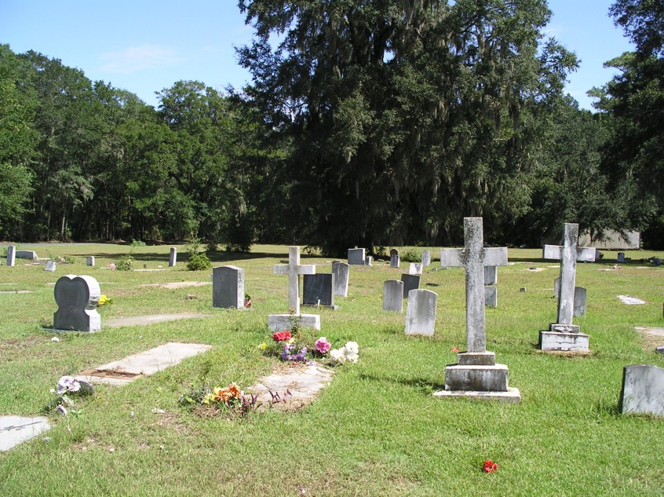
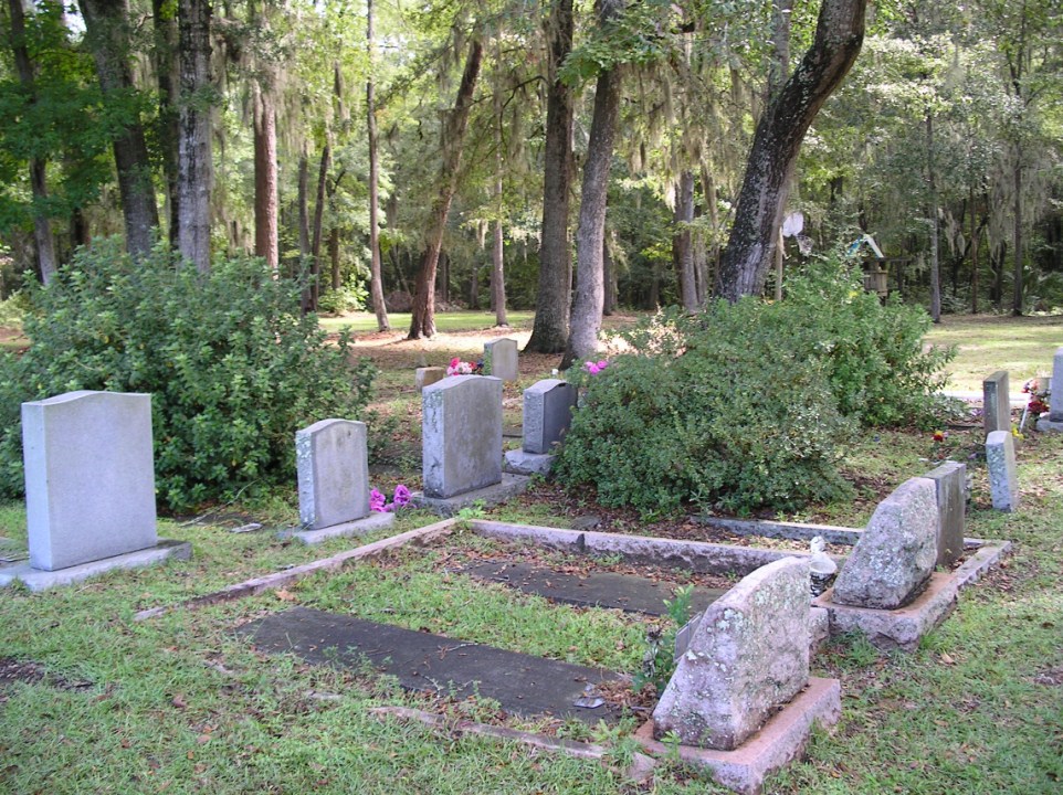
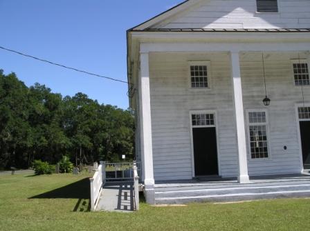
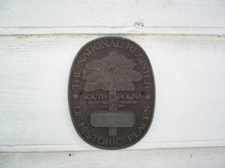
| Description | : | See also: New First Missionary Baptist Church - name was changed from Old First Baptist Church A short distance down Highway 174 (just past Oak Island Road) is the pride of Edisto's African American community: Old First Baptist Church (circa 1818). The oldest church building on Edisto, it is listed on the National Register of Historic Places. This church was founded by a woman, Hephzibah Jenkins Townsend. Baptists had worshipped on Edisto since 1686, but there was no church. In 1811, Mrs. Townsend obtained the original church site and through her efforts the building was erected. In the late 1860s the trustees... Read More |
frequently asked questions (FAQ):
-
Where is Old First Baptist Church?
Old First Baptist Church is located at Edisto Island, Charleston County ,South Carolina ,USA.
-
Old First Baptist Church cemetery's updated grave count on graveviews.com?
0 memorials
-
Where are the coordinates of the Old First Baptist Church?
Latitude: 32.5729900
Longitude: -80.2836400


Nearby Cemetories:
1. New First Missionary Baptist Church Cemetery
Edisto Island, Charleston County, USA
Coordinate: 32.5730100, -80.2837400
2. New First Missionary Baptist Church Cemetery
Edisto Island, Charleston County, USA
Coordinate: 32.5730100, -80.2837400
3. Zion Reformed Episcopal Church
Edisto Island, Charleston County, USA
Coordinate: 32.5729000, -80.2837000
4. New First Baptist Church Cemetery
Edisto Island, Charleston County, USA
Coordinate: 32.5722008, -80.2840118
5. Trinity Cemetery
Edisto Island, Charleston County, USA
Coordinate: 32.5700800, -80.2837000
6. Trinity Episcopal Church Cemetery
Edisto Island, Charleston County, USA
Coordinate: 32.5694000, -80.2838000
7. Edisto Presbyterian Church Cemetery
Edisto Island, Charleston County, USA
Coordinate: 32.5787849, -80.2950134
8. Greater Galilee Church of our Lord
Charleston, Charleston County, USA
Coordinate: 32.5833280, -80.2945170
9. Bethlehem RMUE Church Cemetery
Edisto Island, Charleston County, USA
Coordinate: 32.5590000, -80.2772000
10. Lawton-Seabrook Cemetery
Edisto Island, Charleston County, USA
Coordinate: 32.5892400, -80.2965700
11. Allen AME Church Cemetery
Edisto Island, Charleston County, USA
Coordinate: 32.5519000, -80.2769000
12. Presbyterian Church on Edisto Island Cemetery
Edisto Island, Charleston County, USA
Coordinate: 32.5801964, -80.3081284
13. Whaley-Seabrook Cemetery
Edisto Island, Charleston County, USA
Coordinate: 32.6016670, -80.2813890
14. Greater Bethel AME Church Cemetery
Edisto Island, Charleston County, USA
Coordinate: 32.5420000, -80.2894000
15. Murray's Cemetery
Edisto Island, Charleston County, USA
Coordinate: 32.5515890, -80.2344800
16. Gun Bluff Plantation Cemetery
Edisto Island, Charleston County, USA
Coordinate: 32.5814670, -80.3420730
17. Mount Olive Baptist Church Cemetery
Edisto Island, Charleston County, USA
Coordinate: 32.5842000, -80.3465000
18. Calvary AME Church Cemetery
Edisto Island, Charleston County, USA
Coordinate: 32.5884000, -80.3536000
19. Meggett Point Plantation
Edisto Island, Charleston County, USA
Coordinate: 32.5555000, -80.3768333
20. Saint Christopher Camp Burial Ground
Johns Island, Charleston County, USA
Coordinate: 32.5662690, -80.1813110
21. Bailey Cemetery
Wadmalaw Island, Charleston County, USA
Coordinate: 32.6322117, -80.2031038
22. Ebenezer Baptist Church Cemetery
Hollywood, Charleston County, USA
Coordinate: 32.6673546, -80.3434219
23. Ferri Family Cemetery
Wadmalaw Island, Charleston County, USA
Coordinate: 32.6467200, -80.1850940
24. Mount Horr AME Church Cemetery
Yonges Island, Charleston County, USA
Coordinate: 32.6739400, -80.3461600