
| Memorials | : | 0 |
| Location | : | Burnt House, Ritchie County, USA |
| Coordinate | : | 39.0525520, -81.0169120 |
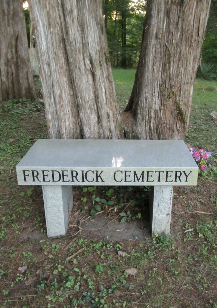
| Description | : | This graveyard is located on a hill across Route 47 from the Burnt House Community Building. It is named for Nicholas H. Frederick, buried here. In addition to the graves marked with commercially manufactured headstones, this cemetery contains a fair number designated by fieldstones with no legible inscription. This cemetery is not in the same place as the Joe Frederick Cemetery (near Barker Farm Cemetery) at Fonzo. There are also two additional, smaller Frederick cemeteries-- the Phillip Frederick and S.B. (Samuel) Frederick cemeteries. These are both just off Rt. 47 as well, according to WPA readings and Ritchie Co. Historical Society records,... Read More |
frequently asked questions (FAQ):
-
Where is N.H. Frederick Cemetery?
N.H. Frederick Cemetery is located at Burnt House, Ritchie County ,West Virginia ,USA.
-
N.H. Frederick Cemetery cemetery's updated grave count on graveviews.com?
0 memorials
-
Where are the coordinates of the N.H. Frederick Cemetery?
Latitude: 39.0525520
Longitude: -81.0169120
Nearby Cemetories:
1. Burnt House United Methodist Church Cemetery
Burnt House, Ritchie County, USA
Coordinate: 39.0487301, -80.9904470
2. Hardman Chapel Cemetery
Harrisville, Ritchie County, USA
Coordinate: 39.0582000, -81.0517400
3. Hatfield Cemetery
Ritchie County, USA
Coordinate: 39.0853004, -81.0302963
4. Hazelgreen Cemetery
Ritchie County, USA
Coordinate: 39.0853004, -81.0021973
5. Goff Cemetery
Burnt House, Ritchie County, USA
Coordinate: 39.0361530, -80.9774200
6. Reeves Cemetery
Goffs, Ritchie County, USA
Coordinate: 39.0882988, -81.0246964
7. Britton Cemetery
Hazelgreen, Ritchie County, USA
Coordinate: 39.0841500, -80.9894000
8. Frederick Cemetery
Fonzo, Ritchie County, USA
Coordinate: 39.0766983, -81.0560989
9. Bethany Cemetery
Harrisville, Ritchie County, USA
Coordinate: 39.0956700, -81.0219500
10. Cunningham Cemetery
Ritchie County, USA
Coordinate: 39.0856018, -81.0761032
11. Roseville Church Cemetery
Gilmer County, USA
Coordinate: 39.0207880, -80.9547600
12. Smith Chapel Cemetery
Prunty, Ritchie County, USA
Coordinate: 39.1121700, -80.9995900
13. Mount Liberty Cemetery
Tanner, Gilmer County, USA
Coordinate: 39.0086390, -80.9616440
14. Fox Cemetery
Ritchie County, USA
Coordinate: 39.0271988, -81.0931015
15. New Mount Olive Cemetery
Burnt House, Ritchie County, USA
Coordinate: 39.0446100, -80.9340200
16. Pine Low Gap Cemetery
Burnt House, Ritchie County, USA
Coordinate: 39.1006400, -80.9562200
17. Mount Olive Cemetery
Burnt House, Ritchie County, USA
Coordinate: 39.0531006, -80.9257965
18. Nobe Cemetery
Nobe, Calhoun County, USA
Coordinate: 38.9813000, -81.0380300
19. Fluharty Cemetery
Calhoun County, USA
Coordinate: 39.0147018, -81.0982971
20. Pleasant Hill Cemetery
Berea, Ritchie County, USA
Coordinate: 39.1162100, -80.9682300
21. Smith Cemetery
Mahone, Ritchie County, USA
Coordinate: 39.0956700, -81.1012600
22. Trace Fork United Methodist Church Cemetery
Gilmer County, USA
Coordinate: 38.9743580, -81.0005560
23. Big Springs Cemetery
Big Springs, Calhoun County, USA
Coordinate: 38.9850006, -81.0708008
24. Knight Cemetery
Big Springs, Calhoun County, USA
Coordinate: 38.9894000, -81.0800000