| Memorials | : | 22 |
| Location | : | Monticello, Drew County, USA |
| Coordinate | : | 33.6342010, -91.7981033 |
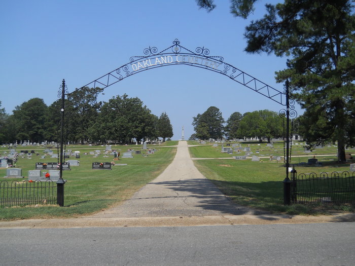
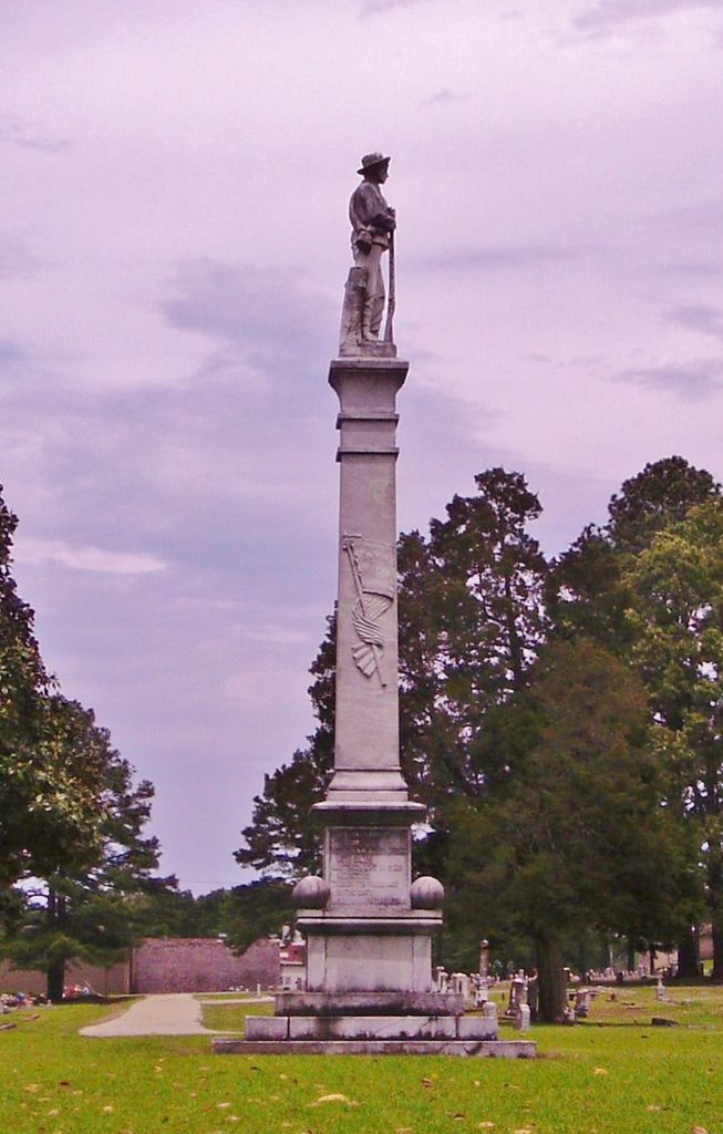
| Description | : | Oakland Cemetery is he largest cemetery in Drew County. Many early settlers are buried in the Old Cemetery section with dates going back to the mid 1800’s. A monument commemorating the Confederate Soldiers of Drew County 1861-1865 was erected by the William F. Slemons Chapter, UDC in 1914 and appears to be standing guard over the Old Cemetery section. It is said that William Pinkney Burks was first to be buried there in 1866. The story is told that a road had to be cut into the cemetery because the timber was so dense. A deed, dated November 1, 1866... Read More |
frequently asked questions (FAQ):
-
Where is Oakland Cemetery?
Oakland Cemetery is located at Monticello, Drew County ,Arkansas ,USA.
-
Oakland Cemetery cemetery's updated grave count on graveviews.com?
20 memorials
-
Where are the coordinates of the Oakland Cemetery?
Latitude: 33.6342010
Longitude: -91.7981033
Nearby Cemetories:
1. Kennedy Boulevard Cemetery
Monticello, Drew County, USA
Coordinate: 33.6395700, -91.7756200
2. Manees Cemetery
Drew County, USA
Coordinate: 33.6333100, -91.8243100
3. Rough and Ready Cemetery
Monticello, Drew County, USA
Coordinate: 33.6082993, -91.7891998
4. Gaster Hill Cemetery
Drew County, USA
Coordinate: 33.6591988, -91.8110962
5. Rose Hill Cemetery
Monticello, Drew County, USA
Coordinate: 33.6749992, -91.7827988
6. Rose Hill Cemetery
Meroney, Lincoln County, USA
Coordinate: 33.6753740, -91.7828590
7. Wells Cemetery
Monticello, Drew County, USA
Coordinate: 33.6567980, -91.8438550
8. Priest Cemetery
Monticello, Drew County, USA
Coordinate: 33.6088080, -91.7485850
9. Veasey Cemetery
Drew County, USA
Coordinate: 33.6088220, -91.7485680
10. Brooks Chapel Cemetery
Monticello, Drew County, USA
Coordinate: 33.5959080, -91.8479410
11. Shady Grove AME Cemetery
Cominto, Drew County, USA
Coordinate: 33.6460991, -91.7316971
12. Union Ridge Cemetery #2
Monticello, Drew County, USA
Coordinate: 33.5786500, -91.7823300
13. Union Ridge Cemetery #1
Monticello, Drew County, USA
Coordinate: 33.5766100, -91.7817100
14. Mount Zion African Methodist Episcopal Church Ceme
Monticello, Drew County, USA
Coordinate: 33.6892960, -91.7367250
15. Zion Hill
Monticello, Drew County, USA
Coordinate: 33.6383080, -91.7027281
16. Torian Cemetery
Drew County, USA
Coordinate: 33.6758003, -91.8927994
17. Old Saline Church Cemetery
Wilmar, Drew County, USA
Coordinate: 33.6197014, -91.9083023
18. Andrews Chapel Cemetery
Barkada, Drew County, USA
Coordinate: 33.6716995, -91.9021988
19. Campground Cemetery
Monticello, Drew County, USA
Coordinate: 33.7292890, -91.8218650
20. Bethel Cemetery
Drew County, USA
Coordinate: 33.6755981, -91.9119034
21. Baker Cemetery
Drew County, USA
Coordinate: 33.5318985, -91.7686005
22. Green Hill Cemetery
Green Hill, Drew County, USA
Coordinate: 33.5647011, -91.8972015
23. Enon Cemetery
Enon, Drew County, USA
Coordinate: 33.5882988, -91.6789017
24. Wilmar Cemetery #1
Wilmar, Drew County, USA
Coordinate: 33.6225014, -91.9385986


