
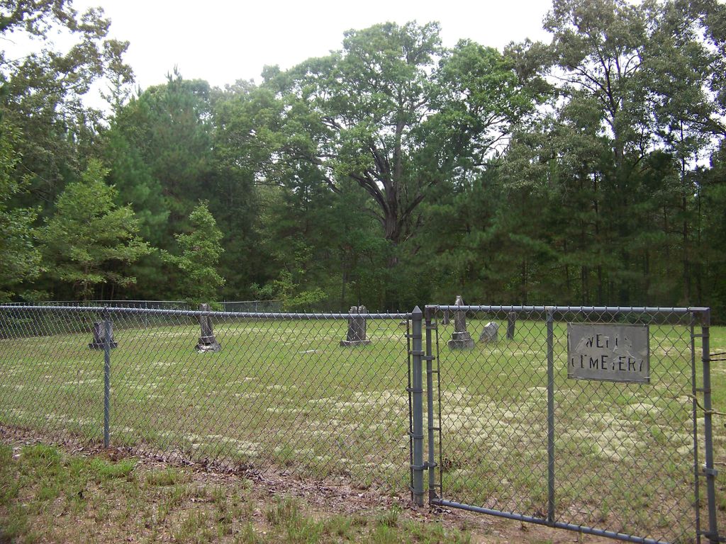
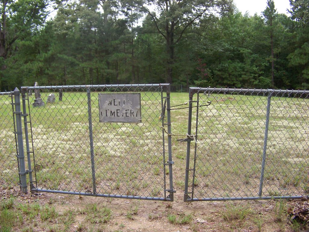
| Memorials | : | 0 |
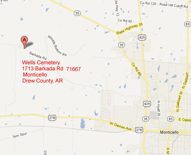
| Location | : | Monticello, Drew County, USA |
| Coordinate | : | 33.6567980, -91.8438550 |
| Description | : | From Highway 425, go 2.8 miles west on Barkada Road. Turn right at the mailbox with this assigned address. The cemetery is past a house, down a paved lane, about a quarter of a mile. The fenced area is about an acre, and there are monuments outside the cemetery in woods |
frequently asked questions (FAQ):
-
Where is Wells Cemetery?
Wells Cemetery is located at 1713 Barkada Road Monticello, Drew County ,Arkansas , 71655USA.
-
Wells Cemetery cemetery's updated grave count on graveviews.com?
0 memorials
-
Where are the coordinates of the Wells Cemetery?
Latitude: 33.6567980
Longitude: -91.8438550
Nearby Cemetories:
1. Gaster Hill Cemetery
Drew County, USA
Coordinate: 33.6591988, -91.8110962
2. Manees Cemetery
Drew County, USA
Coordinate: 33.6333100, -91.8243100
3. Oakland Cemetery
Monticello, Drew County, USA
Coordinate: 33.6342010, -91.7981033
4. Torian Cemetery
Drew County, USA
Coordinate: 33.6758003, -91.8927994
5. Andrews Chapel Cemetery
Barkada, Drew County, USA
Coordinate: 33.6716995, -91.9021988
6. Rose Hill Cemetery
Monticello, Drew County, USA
Coordinate: 33.6749992, -91.7827988
7. Rose Hill Cemetery
Meroney, Lincoln County, USA
Coordinate: 33.6753740, -91.7828590
8. Kennedy Boulevard Cemetery
Monticello, Drew County, USA
Coordinate: 33.6395700, -91.7756200
9. Bethel Cemetery
Drew County, USA
Coordinate: 33.6755981, -91.9119034
10. Brooks Chapel Cemetery
Monticello, Drew County, USA
Coordinate: 33.5959080, -91.8479410
11. Old Saline Church Cemetery
Wilmar, Drew County, USA
Coordinate: 33.6197014, -91.9083023
12. Rough and Ready Cemetery
Monticello, Drew County, USA
Coordinate: 33.6082993, -91.7891998
13. Campground Cemetery
Monticello, Drew County, USA
Coordinate: 33.7292890, -91.8218650
14. Wilmar Cemetery #1
Wilmar, Drew County, USA
Coordinate: 33.6225014, -91.9385986
15. Turner Hills Cemetery
Wilmar, Drew County, USA
Coordinate: 33.6213989, -91.9389038
16. Wells Chapel Cemetery
Monticello, Drew County, USA
Coordinate: 33.7191450, -91.9193510
17. Priest Cemetery
Monticello, Drew County, USA
Coordinate: 33.6088080, -91.7485850
18. Veasey Cemetery
Drew County, USA
Coordinate: 33.6088220, -91.7485680
19. Union Ridge Cemetery #2
Monticello, Drew County, USA
Coordinate: 33.5786500, -91.7823300
20. Shady Grove AME Cemetery
Cominto, Drew County, USA
Coordinate: 33.6460991, -91.7316971
21. Mount Zion African Methodist Episcopal Church Ceme
Monticello, Drew County, USA
Coordinate: 33.6892960, -91.7367250
22. Union Ridge Cemetery #1
Monticello, Drew County, USA
Coordinate: 33.5766100, -91.7817100
23. Spring Hill Cemetery
Drew County, USA
Coordinate: 33.7510986, -91.8675003
24. Green Hill Cemetery
Green Hill, Drew County, USA
Coordinate: 33.5647011, -91.8972015