
| Memorials | : | 0 |
| Location | : | Whispering Pines, Moore County, USA |
| Coordinate | : | 35.2658750, -79.3686680 |
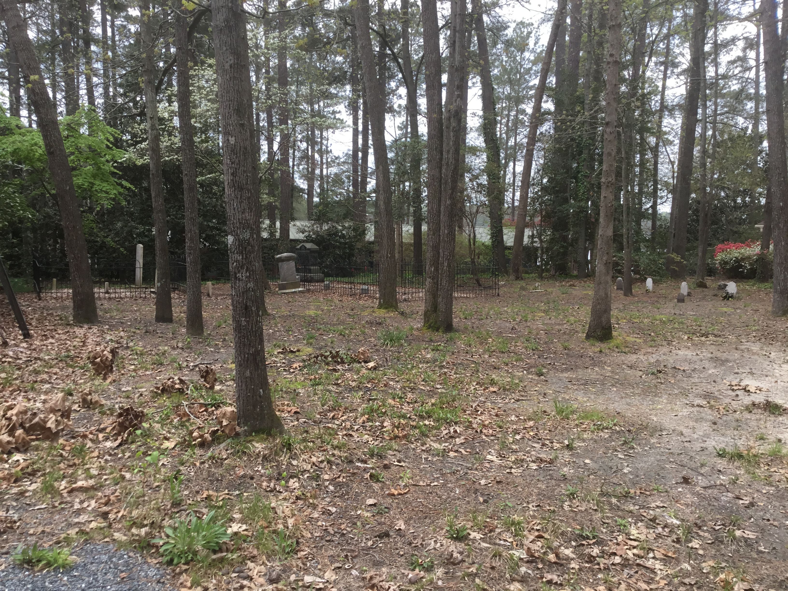
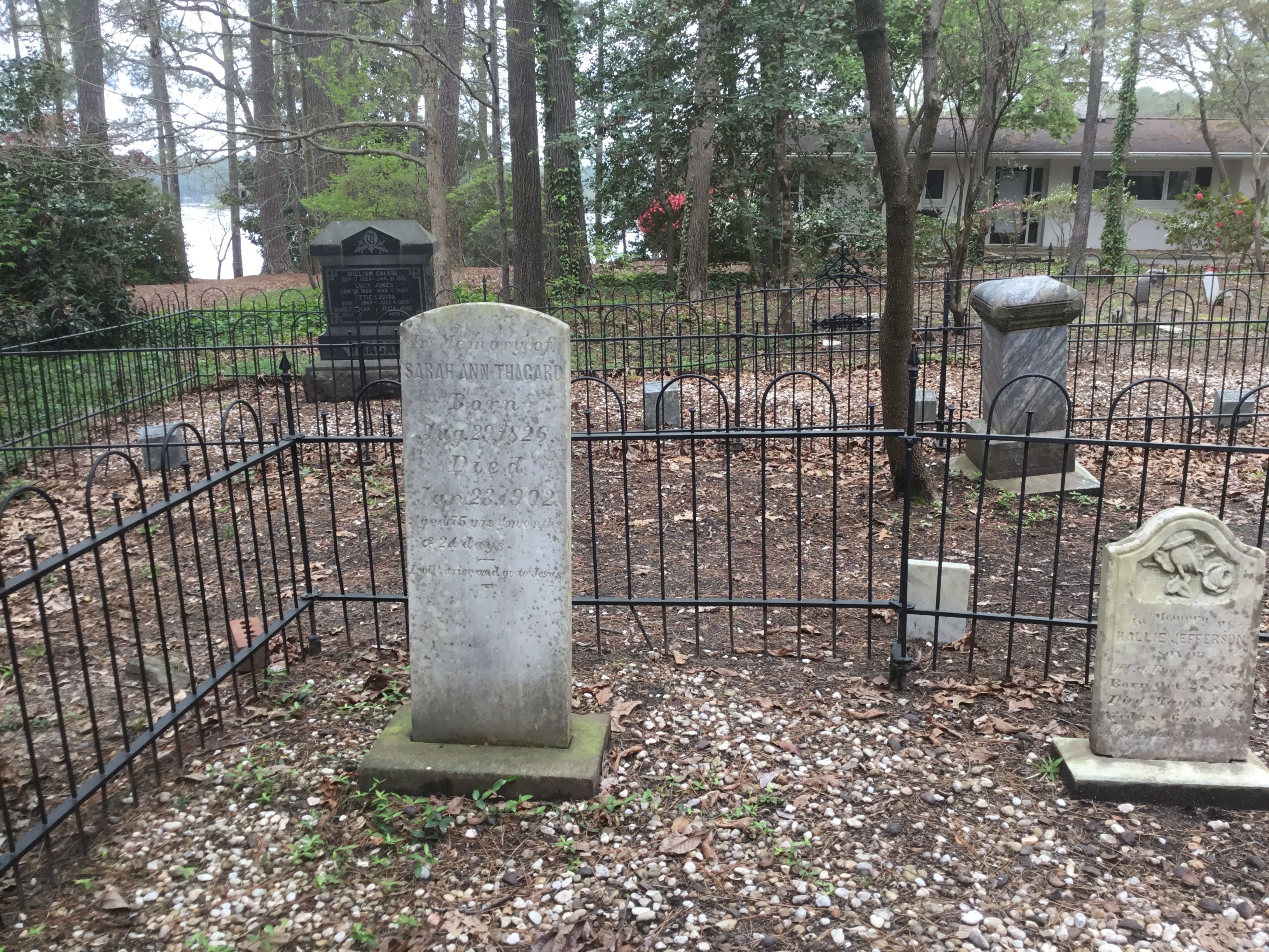
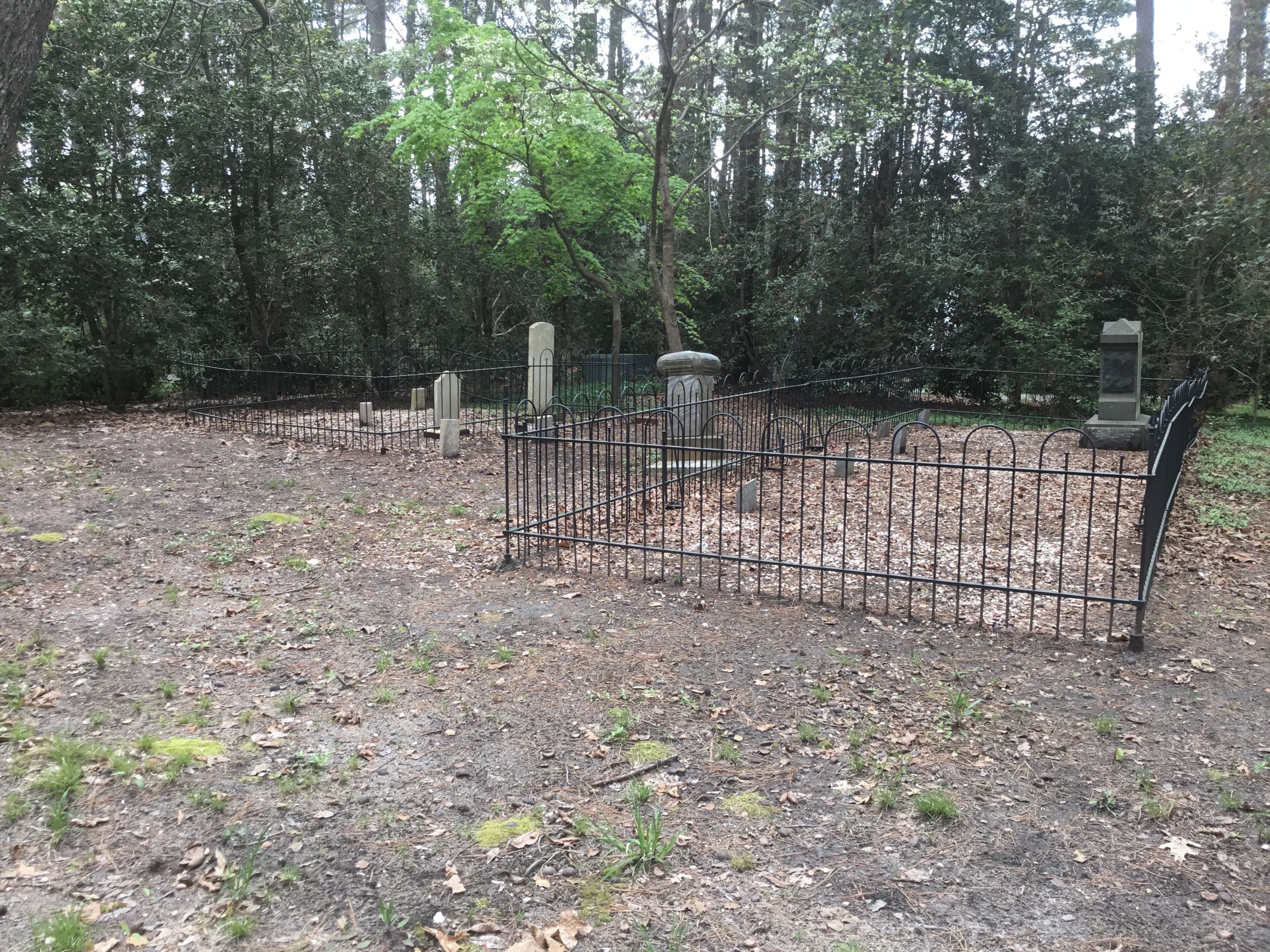
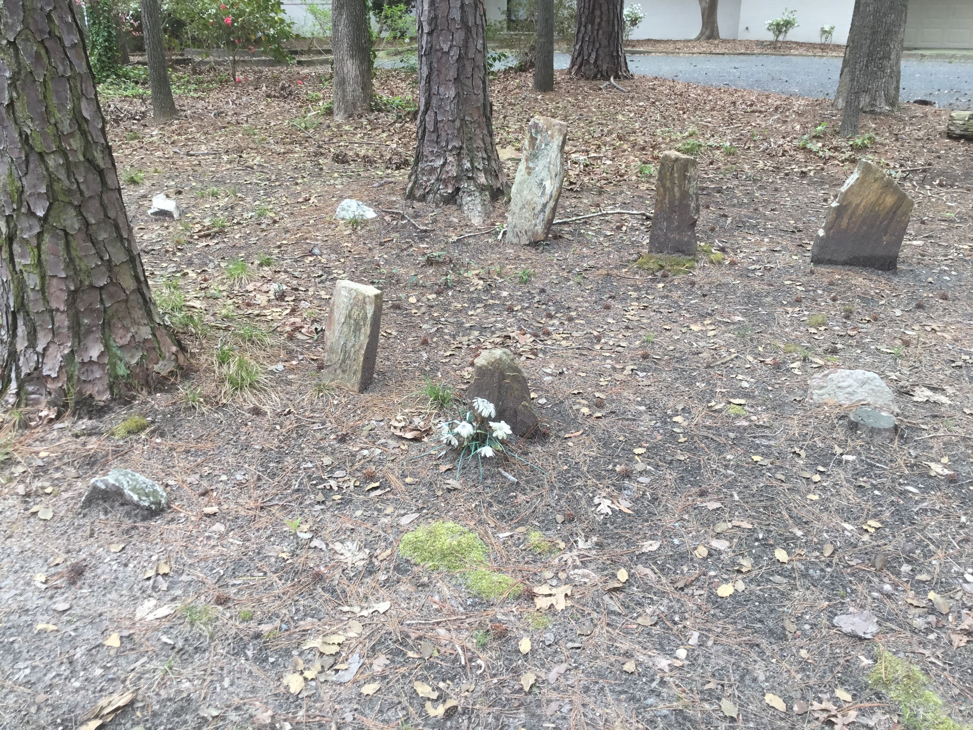
| Description | : | Oaklawn Cemetery was originally a cemetery established in the late 1700's or early 1800's by several families who farmed the land adjacent to Thaggard Lake, which was named after the Thaggard family. Some of the families in the area later started Yates-Thaggard Baptist Church and a church cemetery was started for church families. The new church and cemetery was located at the intersection of Niagra-Carthage Road and Hardee Road in Whispering Pines, North Carolina, which is about 2 miles from Oaklawn Cemetery. An interesting feature of the cemetery is the existence of unmarked headstones placed near the family... Read More |
frequently asked questions (FAQ):
-
Where is Oaklawn Cemetery?
Oaklawn Cemetery is located at Lakeview Drive Whispering Pines, Moore County ,North Carolina , 28327USA.
-
Oaklawn Cemetery cemetery's updated grave count on graveviews.com?
0 memorials
-
Where are the coordinates of the Oaklawn Cemetery?
Latitude: 35.2658750
Longitude: -79.3686680
Nearby Cemetories:
1. Yates-Thagard Baptist Cemetery
Whispering Pines, Moore County, USA
Coordinate: 35.2586890, -79.3655190
2. Holly Grove Primitive Baptist Church Cemetery
Whispering Pines, Moore County, USA
Coordinate: 35.2800820, -79.3639360
3. Crossroads Community Church Cemetery
Whispering Pines, Moore County, USA
Coordinate: 35.2798370, -79.3615280
4. Eureka Presbyterian Church Cemetery
Carthage, Moore County, USA
Coordinate: 35.2746690, -79.3874700
5. Bible Tabernacle Church Cemetery
Southern Pines, Moore County, USA
Coordinate: 35.2514610, -79.3984920
6. Sadler Family Cemetery
Carthage, Moore County, USA
Coordinate: 35.2797580, -79.3350430
7. Pleasant Hill Baptist Church Cemetery
Southern Pines, Moore County, USA
Coordinate: 35.2218560, -79.3636470
8. Halls Memorial Church Cemetery
Vass, Moore County, USA
Coordinate: 35.2849510, -79.3153240
9. Henderson Cemetery
Vass, Moore County, USA
Coordinate: 35.2902985, -79.3158035
10. Saint Anthony of Padua Cemetery
Southern Pines, Moore County, USA
Coordinate: 35.2152660, -79.3788550
11. Union Presbyterian Church Cemetery
Carthage, Moore County, USA
Coordinate: 35.3164650, -79.3483260
12. Trinity Bible Church Cemetery
Carthage, Moore County, USA
Coordinate: 35.3215750, -79.3938350
13. Lakeview Cemetery
Lakeview, Moore County, USA
Coordinate: 35.2382900, -79.3033500
14. Sassafras Springs Cemetery
Carthage, Moore County, USA
Coordinate: 35.3202400, -79.4099100
15. Highland Baptist Church Cemetery
Vass, Moore County, USA
Coordinate: 35.2423620, -79.2923530
16. Saint Matthews Chapel Church Cemetery
Eastwood, Moore County, USA
Coordinate: 35.2451440, -79.4477820
17. Manly Cemetery
Manly, Moore County, USA
Coordinate: 35.1969500, -79.3617800
18. Summer Hill Baptist Church Cemetery
Carthage, Moore County, USA
Coordinate: 35.3093470, -79.4372090
19. Victory Community Baptist Church Cemetery
Carthage, Moore County, USA
Coordinate: 35.2877820, -79.4522750
20. Eastwood Community Cemetery
West End, Moore County, USA
Coordinate: 35.2412120, -79.4527430
21. Stony Hill Free Will Baptist Church Cemetery
Carthage, Moore County, USA
Coordinate: 35.3353860, -79.4073180
22. Crains Creek Cemetery
Cameron, Moore County, USA
Coordinate: 35.3017006, -79.2827988
23. Community Friends Church Cemetery
Carthage, Moore County, USA
Coordinate: 35.3417360, -79.3957510
24. Manly Presbyterian Church Cemetery
Southern Pines, Moore County, USA
Coordinate: 35.1844840, -79.3708580