
| Memorials | : | 1 |
| Location | : | Carthage, Moore County, USA |
| Coordinate | : | 35.2746690, -79.3874700 |
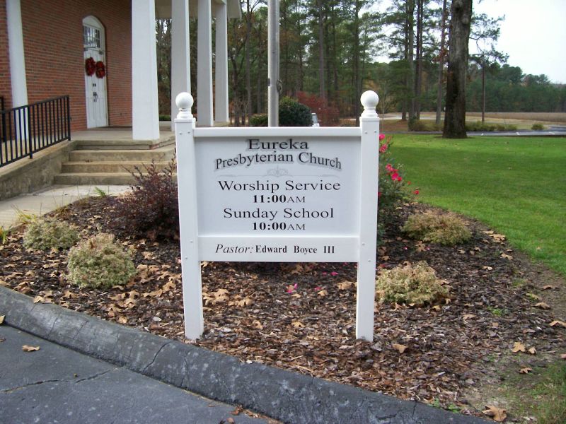
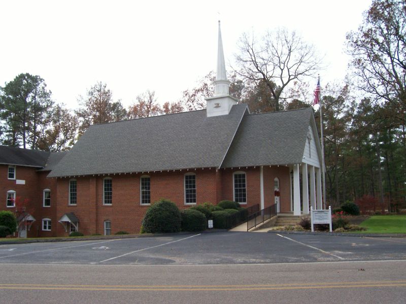
| Description | : | Cemetery is located across the street from the church on Eureka Church Road. Church is located at corner of Farm Life School Road and Eureka Church Road. |
frequently asked questions (FAQ):
-
Where is Eureka Presbyterian Church Cemetery?
Eureka Presbyterian Church Cemetery is located at 2155 Farm Life School Road Carthage, Moore County ,North Carolina , 28327USA.
-
Eureka Presbyterian Church Cemetery cemetery's updated grave count on graveviews.com?
1 memorials
-
Where are the coordinates of the Eureka Presbyterian Church Cemetery?
Latitude: 35.2746690
Longitude: -79.3874700

Nearby Cemetories:
1. Oaklawn Cemetery
Whispering Pines, Moore County, USA
Coordinate: 35.2658750, -79.3686680
2. Holly Grove Primitive Baptist Church Cemetery
Whispering Pines, Moore County, USA
Coordinate: 35.2800820, -79.3639360
3. Crossroads Community Church Cemetery
Whispering Pines, Moore County, USA
Coordinate: 35.2798370, -79.3615280
4. Yates-Thagard Baptist Cemetery
Whispering Pines, Moore County, USA
Coordinate: 35.2586890, -79.3655190
5. Bible Tabernacle Church Cemetery
Southern Pines, Moore County, USA
Coordinate: 35.2514610, -79.3984920
6. Sadler Family Cemetery
Carthage, Moore County, USA
Coordinate: 35.2797580, -79.3350430
7. Trinity Bible Church Cemetery
Carthage, Moore County, USA
Coordinate: 35.3215750, -79.3938350
8. Sassafras Springs Cemetery
Carthage, Moore County, USA
Coordinate: 35.3202400, -79.4099100
9. Union Presbyterian Church Cemetery
Carthage, Moore County, USA
Coordinate: 35.3164650, -79.3483260
10. Summer Hill Baptist Church Cemetery
Carthage, Moore County, USA
Coordinate: 35.3093470, -79.4372090
11. Victory Community Baptist Church Cemetery
Carthage, Moore County, USA
Coordinate: 35.2877820, -79.4522750
12. Pleasant Hill Baptist Church Cemetery
Southern Pines, Moore County, USA
Coordinate: 35.2218560, -79.3636470
13. Saint Matthews Chapel Church Cemetery
Eastwood, Moore County, USA
Coordinate: 35.2451440, -79.4477820
14. Halls Memorial Church Cemetery
Vass, Moore County, USA
Coordinate: 35.2849510, -79.3153240
15. Saint Anthony of Padua Cemetery
Southern Pines, Moore County, USA
Coordinate: 35.2152660, -79.3788550
16. Henderson Cemetery
Vass, Moore County, USA
Coordinate: 35.2902985, -79.3158035
17. Stony Hill Free Will Baptist Church Cemetery
Carthage, Moore County, USA
Coordinate: 35.3353860, -79.4073180
18. Eastwood Community Cemetery
West End, Moore County, USA
Coordinate: 35.2412120, -79.4527430
19. Community Friends Church Cemetery
Carthage, Moore County, USA
Coordinate: 35.3417360, -79.3957510
20. Culdee Presbyterian Church Cemetery
West End, Moore County, USA
Coordinate: 35.2506660, -79.4689180
21. Ingram Branch Presbyterian Church Cemetery
West End, Moore County, USA
Coordinate: 35.2900570, -79.4727800
22. Doubs Chapel United Methodist Church Cemetery
West End, Moore County, USA
Coordinate: 35.2835840, -79.4743410
23. Saint Augustine AME Zion Church Cemetery
Carthage, Moore County, USA
Coordinate: 35.3409460, -79.4253210
24. John Hall Presbyterian Church Cemetery
Carthage, Moore County, USA
Coordinate: 35.3419230, -79.4296210