
| Memorials | : | 1 |
| Location | : | Sherman, Grayson County, USA |
| Coordinate | : | 33.6760406, -96.6941223 |
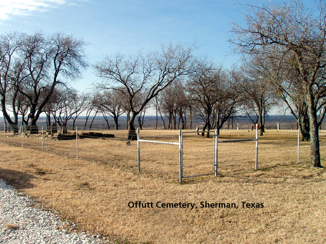
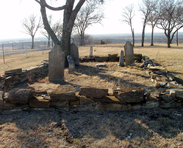
| Description | : | This cemetery is located in Sherman, about 3 miles west of highway 1417 on State Highway 82. Turn north on Bar Seven Drive, a gravel road, and go across two cattle guards. The chain link fenced cemetery is on the left. Few markers are legible and about 30 markers are simply square stones sticking out of the soil with no markings. All stones with markings have been photograph and added to this site. |
frequently asked questions (FAQ):
-
Where is Offutt Cemetery?
Offutt Cemetery is located at Sherman, Grayson County ,Texas ,USA.
-
Offutt Cemetery cemetery's updated grave count on graveviews.com?
1 memorials
-
Where are the coordinates of the Offutt Cemetery?
Latitude: 33.6760406
Longitude: -96.6941223
Nearby Cemetories:
1. Wimberly Family Cemetery
Sherman, Grayson County, USA
Coordinate: 33.6621100, -96.6927280
2. Keirsey Cemetery
Sherman, Grayson County, USA
Coordinate: 33.6949997, -96.6575012
3. County Farm Cemetery
Grayson County, USA
Coordinate: 33.6615050, -96.6487230
4. Grayson County Farm Cemetery
Sherman, Grayson County, USA
Coordinate: 33.6614609, -96.6480865
5. Enterprise Cemetery
Pottsboro, Grayson County, USA
Coordinate: 33.7230988, -96.6988983
6. Friendship Cemetery
Sherman, Grayson County, USA
Coordinate: 33.6344910, -96.6636734
7. Forest Woodmen Circle Cemetery
Sherman, Grayson County, USA
Coordinate: 33.6355700, -96.6438100
8. Kendall Chapel Cemetery
Southmayd, Grayson County, USA
Coordinate: 33.6645330, -96.7774700
9. West Hill Cemetery
Sherman, Grayson County, USA
Coordinate: 33.6319008, -96.6194000
10. Austin Street Cemetery
Grayson County, USA
Coordinate: 33.6323000, -96.6132400
11. Campbell Family Cemetery
Grayson County, USA
Coordinate: 33.7499540, -96.6368960
12. Hagerman Cemetery
Pottsboro, Grayson County, USA
Coordinate: 33.7543983, -96.7435989
13. Hendrix Cemetery
Sherman, Grayson County, USA
Coordinate: 33.6833330, -96.5775170
14. Saint Marys Cemetery
Sherman, Grayson County, USA
Coordinate: 33.6145706, -96.6026535
15. Ellsworth Community Cemetery
Ellsworth, Grayson County, USA
Coordinate: 33.7045990, -96.5801240
16. Loftin-McLain Cemetery
Denison, Grayson County, USA
Coordinate: 33.7143600, -96.5835100
17. Iron Ore Cemetery
Denison, Grayson County, USA
Coordinate: 33.7102750, -96.5810680
18. Witten Cemetery
Sherman, Grayson County, USA
Coordinate: 33.6048180, -96.6087440
19. Cedarlawn Memorial Park
Sherman, Grayson County, USA
Coordinate: 33.6947289, -96.5741501
20. Christian Chapel Cemetery
Sadler, Grayson County, USA
Coordinate: 33.6805992, -96.8167038
21. Holder Cemetery
Denison, Grayson County, USA
Coordinate: 33.7646820, -96.6271480
22. Georgetown Cemetery
Pottsboro, Grayson County, USA
Coordinate: 33.7872009, -96.6877975
23. Cottonwood Cemetery
Sherman, Grayson County, USA
Coordinate: 33.6152800, -96.5723560
24. Clark Cemetery
Denison, Grayson County, USA
Coordinate: 33.7477510, -96.5807460