| Memorials | : | 0 |
| Location | : | Hematite, Jefferson County, USA |
| Coordinate | : | 38.2011111, -90.5036111 |
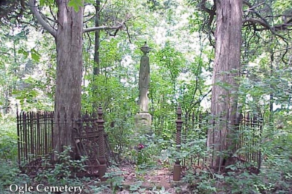
| Description | : | This cemetery is very overgrown and about 3/4 mile up in to the woods. Access not available. This is per the Jefferson County Historical Society |
frequently asked questions (FAQ):
-
Where is Ogle Cemetery?
Ogle Cemetery is located at Hematite, Jefferson County ,Missouri ,USA.
-
Ogle Cemetery cemetery's updated grave count on graveviews.com?
0 memorials
-
Where are the coordinates of the Ogle Cemetery?
Latitude: 38.2011111
Longitude: -90.5036111
Nearby Cemetories:
1. Null Cemetery
Hematite, Jefferson County, USA
Coordinate: 38.1947212, -90.4852753
2. Hematite Christian Church Cemetery
Hematite, Jefferson County, USA
Coordinate: 38.1995500, -90.4799300
3. Lone Pilgrim Cemetery
Hillsboro, Jefferson County, USA
Coordinate: 38.2159100, -90.5362100
4. Hillsboro Cemetery
Hillsboro, Jefferson County, USA
Coordinate: 38.2273900, -90.5582800
5. Zion United Methodist Cemetery
Mapaville, Jefferson County, USA
Coordinate: 38.2492600, -90.4813300
6. Peaceful Ridge Cemetery
De Soto, Jefferson County, USA
Coordinate: 38.1699300, -90.5565500
7. Sunnyside Cemetery
Festus, Jefferson County, USA
Coordinate: 38.1533012, -90.4653015
8. Good Shepherd Cemetery
Hillsboro, Jefferson County, USA
Coordinate: 38.2352982, -90.5697021
9. McNulty Gravesite
Jefferson County, USA
Coordinate: 38.1391300, -90.4729700
10. Zion Lutheran Church Cemetery
Hillsboro, Jefferson County, USA
Coordinate: 38.2681670, -90.4959220
11. Jarvis Cemetery
Jefferson County, USA
Coordinate: 38.2700320, -90.5022620
12. Baker Cemetery
Jefferson County, USA
Coordinate: 38.2465400, -90.4283100
13. Isaac Stroud Baker Cemetery
Jefferson County, USA
Coordinate: 38.2463989, -90.4272003
14. Mount Zion Cemetery
Festus, Jefferson County, USA
Coordinate: 38.2014008, -90.4077988
15. Vinyard Cemetery
Festus, Jefferson County, USA
Coordinate: 38.2106530, -90.4072880
16. City Cemetery
De Soto, Jefferson County, USA
Coordinate: 38.1405260, -90.5642440
17. Calvary Cemetery
De Soto, Jefferson County, USA
Coordinate: 38.1413994, -90.5718994
18. Sandy Baptist Church Cemetery
Hillsboro, Jefferson County, USA
Coordinate: 38.2819970, -90.4852000
19. Gamel Cemetery
Festus, Jefferson County, USA
Coordinate: 38.2155400, -90.4005700
20. Evangelical Lutheran Cross Cemetery
Hillsboro, Jefferson County, USA
Coordinate: 38.2825030, -90.4858610
21. Mahler Cemetery
Jefferson County, USA
Coordinate: 38.2807999, -90.4713974
22. Luckey Baptist Church Cemetery
De Soto, Jefferson County, USA
Coordinate: 38.1709100, -90.6040100
23. Jefferson County Poor Farm Cemetery
Hillsboro, Jefferson County, USA
Coordinate: 38.2202240, -90.6115980
24. Madison Cemetery
Festus, Jefferson County, USA
Coordinate: 38.1836014, -90.3930969

