
| Memorials | : | 0 |
| Location | : | Mealsgate, Allerdale Borough, England |
| Coordinate | : | 54.7651800, -3.2390300 |
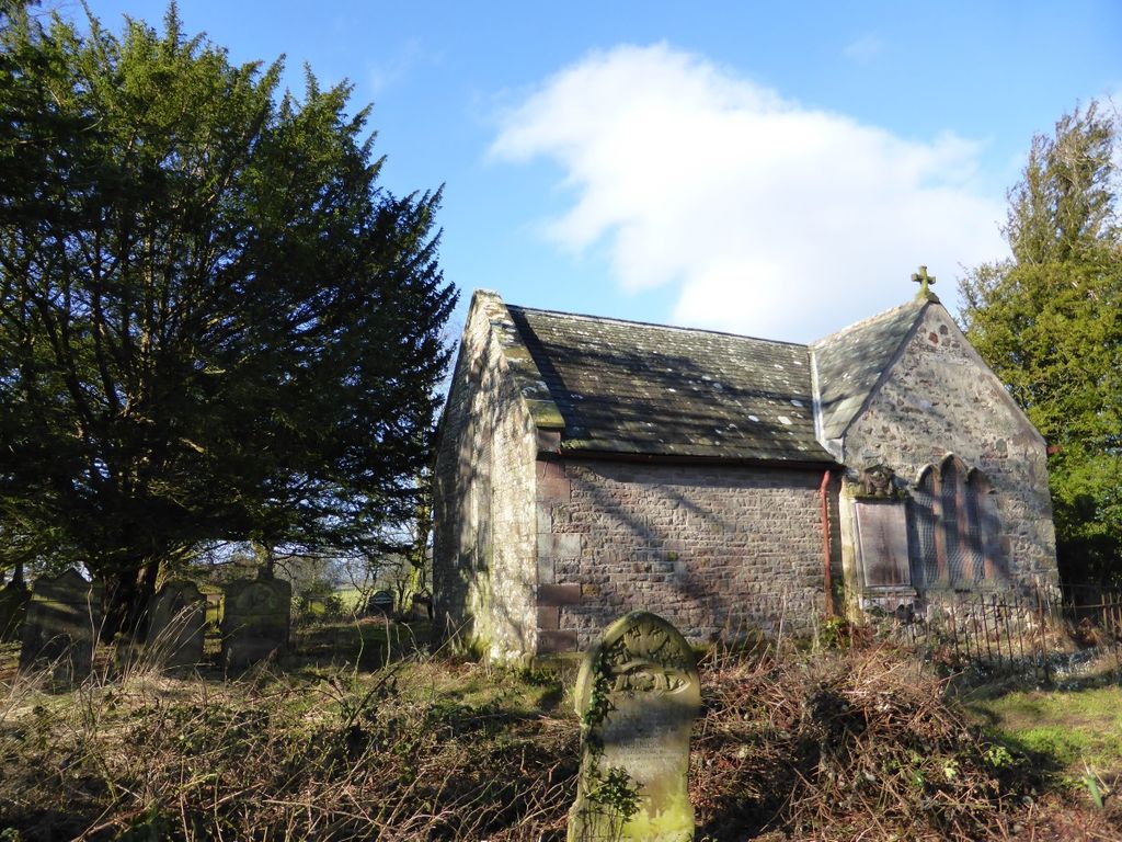
| Description | : | Old Allhallows church was built in the 12th century and renovated in 1861, and served as the parish church until 1899 when the new All Saints church was built nearby. Most of the old church was destroyed in 1935, leaving only a small chapel. The churchyard is down a footpath off a side road of the A595 south of the village of Mealsgate. |
frequently asked questions (FAQ):
-
Where is Old All Hallows Churchyard?
Old All Hallows Churchyard is located at Mealsgate, Allerdale Borough ,Cumbria ,England.
-
Old All Hallows Churchyard cemetery's updated grave count on graveviews.com?
0 memorials
-
Where are the coordinates of the Old All Hallows Churchyard?
Latitude: 54.7651800
Longitude: -3.2390300
Nearby Cemetories:
1. All Saints Churchyard
Mealsgate, Allerdale Borough, England
Coordinate: 54.7709800, -3.2493310
2. St Michael and All Angels Churchyard
Torpenhow, Allerdale Borough, England
Coordinate: 54.7468720, -3.2354350
3. All Saints Churchyard
Boltongate, Allerdale Borough, England
Coordinate: 54.7560600, -3.1989180
4. St. James Churchyard
Uldale, Allerdale Borough, England
Coordinate: 54.7305460, -3.1813050
5. St. Kentigern Churchyard
Aspatria, Allerdale Borough, England
Coordinate: 54.7648630, -3.3270680
6. St. Mungo Churchyard
Bromfield, Allerdale Borough, England
Coordinate: 54.8109800, -3.2838200
7. St Cuthbert Churchyard
Plumbland, Allerdale Borough, England
Coordinate: 54.7405890, -3.3350880
8. St Matthew’s Churchyard
Westnewton, Allerdale Borough, England
Coordinate: 54.7848970, -3.3455930
9. St Hilda Churchyard
Westward, Allerdale Borough, England
Coordinate: 54.7934590, -3.1316380
10. Wigton Cemetery
Wigton, Allerdale Borough, England
Coordinate: 54.8299030, -3.1769080
11. Saint Mary Churchyard
Wigton, Allerdale Borough, England
Coordinate: 54.8236150, -3.1596630
12. Holme Cultram Abbey Churchyard
Abbeytown, Allerdale Borough, England
Coordinate: 54.8453090, -3.2832650
13. St. Mary's Churchyard
Gilcrux, Allerdale Borough, England
Coordinate: 54.7307810, -3.3722050
14. St Michael & All Angels Churchyard
Bewaldeth, Allerdale Borough, England
Coordinate: 54.6879000, -3.3009000
15. St James Churchyard
Hayton, Allerdale Borough, England
Coordinate: 54.7625930, -3.3880000
16. St. Barnabas Churchyard
Setmurthy, Allerdale Borough, England
Coordinate: 54.6783590, -3.2661670
17. St John Churchyard
Bassenthwaite, Allerdale Borough, England
Coordinate: 54.6732270, -3.1972350
18. Holme St Cuthbert Churchyard
Holme St Cuthbert, Allerdale Borough, England
Coordinate: 54.8108780, -3.3951990
19. St. Margaret's Churchyard
Allerdale Borough, England
Coordinate: 54.6594846, -3.2573294
20. St. Bridget's Church Cemetery
Bridekirk, Allerdale Borough, England
Coordinate: 54.6905620, -3.3715490
21. St. Kentigern Churchyard
Caldbeck, Allerdale Borough, England
Coordinate: 54.7489630, -3.0496700
22. Christ Churchyard
Allonby, Allerdale Borough, England
Coordinate: 54.7671880, -3.4309950
23. Quaker Burial Ground
Allonby, Allerdale Borough, England
Coordinate: 54.7790680, -3.4296924
24. Holy Trinity Churchyard Rosley
Westward, Allerdale Borough, England
Coordinate: 54.8189050, -3.0666484