
| Memorials | : | 0 |
| Location | : | Caldbeck, Allerdale Borough, England |
| Coordinate | : | 54.7489630, -3.0496700 |
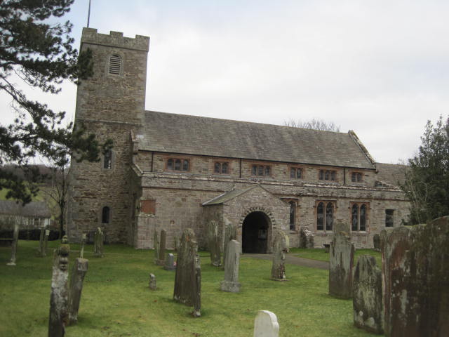
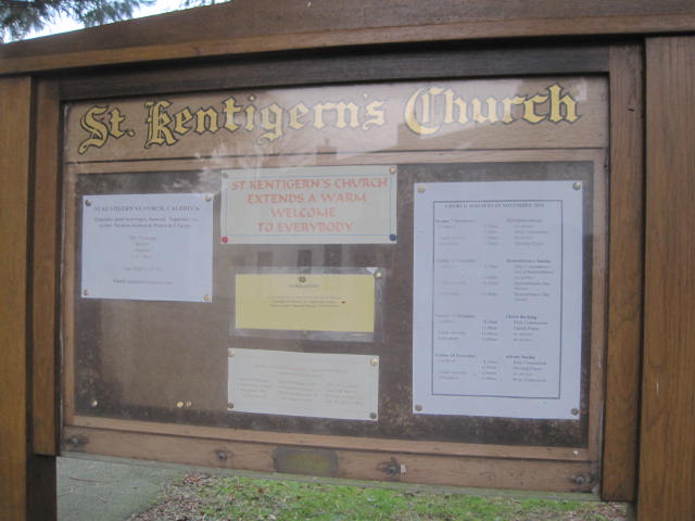
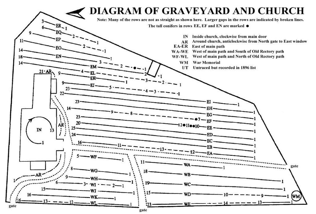
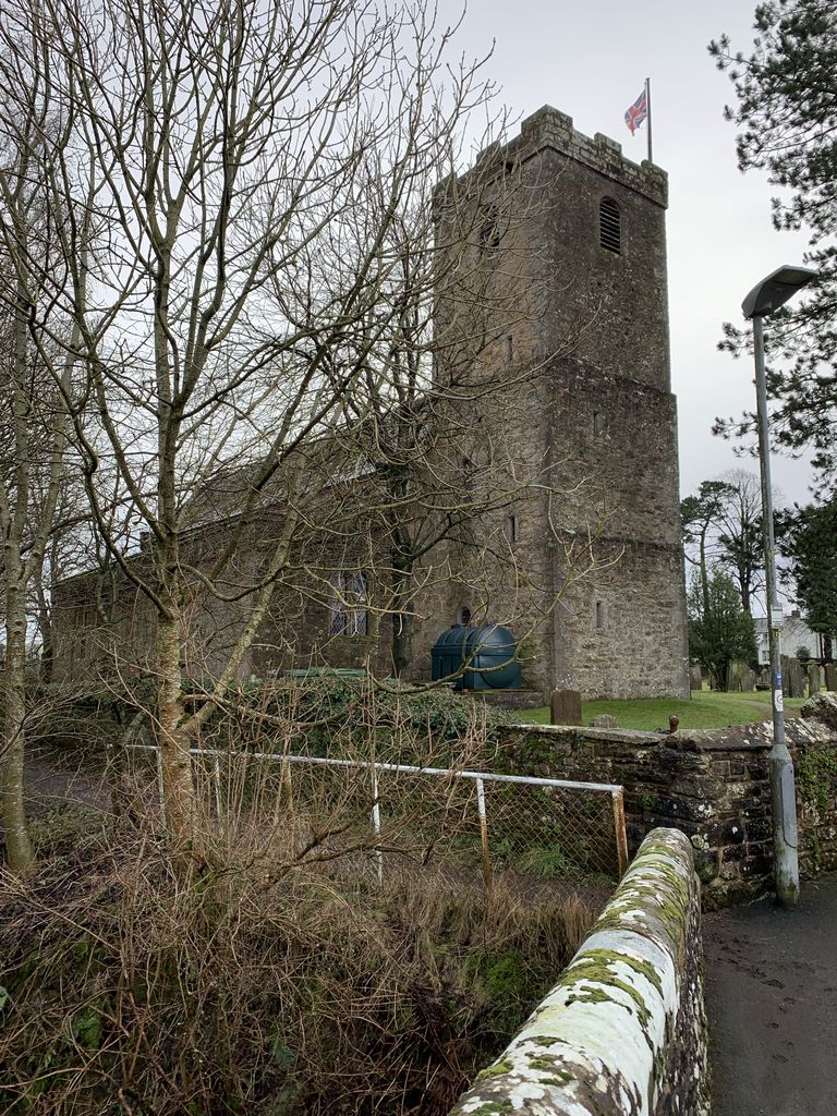
| Description | : | There has been a church on this site since at least the 13th century. In 1896 the Rev. James Wilson MA surveyed the inscriptions in the churchyard and published his records in a small book. Caldbeck & District Local History Society did a survey in the early 1990s, and updated their records over the years, publishing a revised edition of "Monumental Inscriptions in the Church and Churchyard of Saint Kentigern's, Caldbeck, Cumbria" in 2000 (available as a PDF from the society website). The churchyard diagram and many of the recorded inscriptions here are from that book, with permission of the... Read More |
frequently asked questions (FAQ):
-
Where is St. Kentigern Churchyard?
St. Kentigern Churchyard is located at Caldbeck, Allerdale Borough ,Cumbria ,England.
-
St. Kentigern Churchyard cemetery's updated grave count on graveviews.com?
0 memorials
-
Where are the coordinates of the St. Kentigern Churchyard?
Latitude: 54.7489630
Longitude: -3.0496700
Nearby Cemetories:
1. St. Mary's Churchyard
Sebergham, Allerdale Borough, England
Coordinate: 54.7676720, -2.9898510
2. St. Kentigern Churchyard
Castle Sowerby, Eden District, England
Coordinate: 54.7164180, -2.9635500
3. St Hilda Churchyard
Westward, Allerdale Borough, England
Coordinate: 54.7934590, -3.1316380
4. All Saints Churchyard
Dalston, City of Carlisle, England
Coordinate: 54.8011550, -2.9673270
5. Holy Trinity Churchyard Rosley
Westward, Allerdale Borough, England
Coordinate: 54.8189050, -3.0666484
6. St. James Churchyard
Uldale, Allerdale Borough, England
Coordinate: 54.7305460, -3.1813050
7. All Saints Churchyard
Boltongate, Allerdale Borough, England
Coordinate: 54.7560600, -3.1989180
8. Christ Church Cemetery
Ivegill, Eden District, England
Coordinate: 54.7810300, -2.9045330
9. St Kentigern Churchyard
Mungrisdale, Eden District, England
Coordinate: 54.6648230, -2.9880510
10. St. Andrew's Churchyard
Thursby, Allerdale Borough, England
Coordinate: 54.8425950, -3.0543387
11. Saint Mary Churchyard
Wigton, Allerdale Borough, England
Coordinate: 54.8236150, -3.1596630
12. St. Michael's Churchyard
Dalston, City of Carlisle, England
Coordinate: 54.8422650, -2.9836400
13. St Michael and All Angels Churchyard
Torpenhow, Allerdale Borough, England
Coordinate: 54.7468720, -3.2354350
14. Wigton Cemetery
Wigton, Allerdale Borough, England
Coordinate: 54.8299030, -3.1769080
15. St. Michael's Churchyard
Skelton, Eden District, England
Coordinate: 54.7106900, -2.8713760
16. Old All Hallows Churchyard
Mealsgate, Allerdale Borough, England
Coordinate: 54.7651800, -3.2390300
17. St John Churchyard
Bassenthwaite, Allerdale Borough, England
Coordinate: 54.6732270, -3.1972350
18. All Saints Churchyard
Mealsgate, Allerdale Borough, England
Coordinate: 54.7709800, -3.2493310
19. St Andrew's Churchyard
Aikton, Allerdale Borough, England
Coordinate: 54.8653000, -3.1194000
20. St. James Churchyard
Hutton, Eden District, England
Coordinate: 54.7200100, -2.8410400
21. St Mary's Churchyard
Wreay, Eden District, England
Coordinate: 54.8319630, -2.8807780
22. Saint Mary's Church Cemetery
Wreay, Eden District, England
Coordinate: 54.8344500, -2.8824300
23. St Giles at Great Orton Churchyard
Great Orton, City of Carlisle, England
Coordinate: 54.8789300, -3.0475580
24. St. Mary Churchyard
Threlkeld, Eden District, England
Coordinate: 54.6188430, -3.0518450