
| Memorials | : | 52 |
| Location | : | Amanda, Fairfield County, USA |
| Coordinate | : | 39.6153720, -82.7594120 |
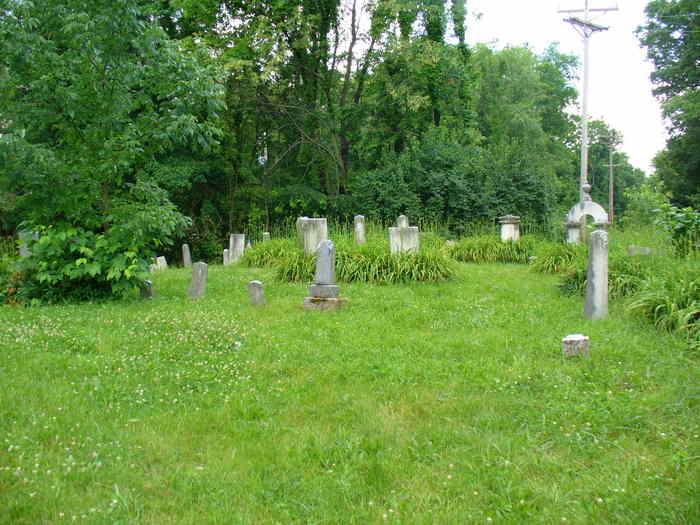
| Description | : | The cemetery is located on the south side of Bowers Road SW (Township Road 144) about 0.3 miles west of its intersection with Amada-Southern Road SW (County Road 14). The cemetery is located in Clear Creek Township, Fairfield County, Ohio, and is # 14263 (Old Conrad Cemetery) in “Ohio Cemeteries 1803-2003”, compiled by the Ohio Genealogical Society. The U.S. Geological Survey (USGS) Geographic Names Information System (GNIS) feature ID for the cemetery is 1039319 (Conrad Cemetery / Conrad Cemeteries). |
frequently asked questions (FAQ):
-
Where is Old Conrad Cemetery?
Old Conrad Cemetery is located at 7775 Bowers Road SW (Township Road 144) Amanda, Fairfield County ,Ohio , 43102USA.
-
Old Conrad Cemetery cemetery's updated grave count on graveviews.com?
52 memorials
-
Where are the coordinates of the Old Conrad Cemetery?
Latitude: 39.6153720
Longitude: -82.7594120
Nearby Cemetories:
1. Conrad Cemetery
Amanda, Fairfield County, USA
Coordinate: 39.6156006, -82.7568970
2. Emanuel Mennonite Church Cemetery
Amanda, Fairfield County, USA
Coordinate: 39.6171580, -82.7471100
3. Nigh Family Cemetery
Fairfield County, USA
Coordinate: 39.6409683, -82.7604141
4. Drinkle Cemetery
Fairfield County, USA
Coordinate: 39.5911100, -82.7283800
5. Amanda Presbyterian Cemetery
Amanda, Fairfield County, USA
Coordinate: 39.6481300, -82.7421200
6. Old Dutch Hollow Cemetery
Amanda, Fairfield County, USA
Coordinate: 39.6466410, -82.7908450
7. Dutch Hollow Cemetery
Amanda, Fairfield County, USA
Coordinate: 39.6478004, -82.7897034
8. Mace Cemetery
Amanda, Fairfield County, USA
Coordinate: 39.6474710, -82.7978680
9. Wolf Cemetery
Stoutsville, Fairfield County, USA
Coordinate: 39.5901600, -82.8070200
10. Zion Mount Nebo Cemetery
Drinkle, Fairfield County, USA
Coordinate: 39.5901718, -82.7097549
11. Augustus Cemetery
Fairfield County, USA
Coordinate: 39.5677986, -82.7493973
12. Maple Hill Cemetery
Stoutsville, Fairfield County, USA
Coordinate: 39.6006012, -82.8227997
13. Neff Cemetery
Stoutsville, Fairfield County, USA
Coordinate: 39.5821991, -82.8106003
14. Heidelberg Reformed Church Cemetery
Stoutsville, Fairfield County, USA
Coordinate: 39.6047783, -82.8269348
15. Julian Cemetery (Defunct)
Clearcreek Township, Fairfield County, USA
Coordinate: 39.5635986, -82.7403030
16. Salem-Shaeffer Cemetery
Fairfield County, USA
Coordinate: 39.5985985, -82.6908035
17. Kohler-Shaeffer Cemetery
Fairfield County, USA
Coordinate: 39.5881930, -82.6956660
18. Stuckey Cemetery
Amanda, Fairfield County, USA
Coordinate: 39.6420490, -82.6935770
19. Tarlton United Brethren Cemetery
Stoutsville, Fairfield County, USA
Coordinate: 39.5576530, -82.7792140
20. Kern Cemetery
Fairfield County, USA
Coordinate: 39.5792007, -82.6968994
21. Tarlton Cemetery
Tarlton, Pickaway County, USA
Coordinate: 39.5550630, -82.7737820
22. Clearport Cemetery
Clearport, Fairfield County, USA
Coordinate: 39.6247785, -82.6801626
23. Bunker Hill Cemetery
Stoutsville, Fairfield County, USA
Coordinate: 39.5855100, -82.8308600
24. Chambers-Grubb Cemetery
Laurelville, Hocking County, USA
Coordinate: 39.5587600, -82.7206900