
| Memorials | : | 0 |
| Location | : | Spies, Moore County, USA |
| Coordinate | : | 35.3864611, -79.6414389 |
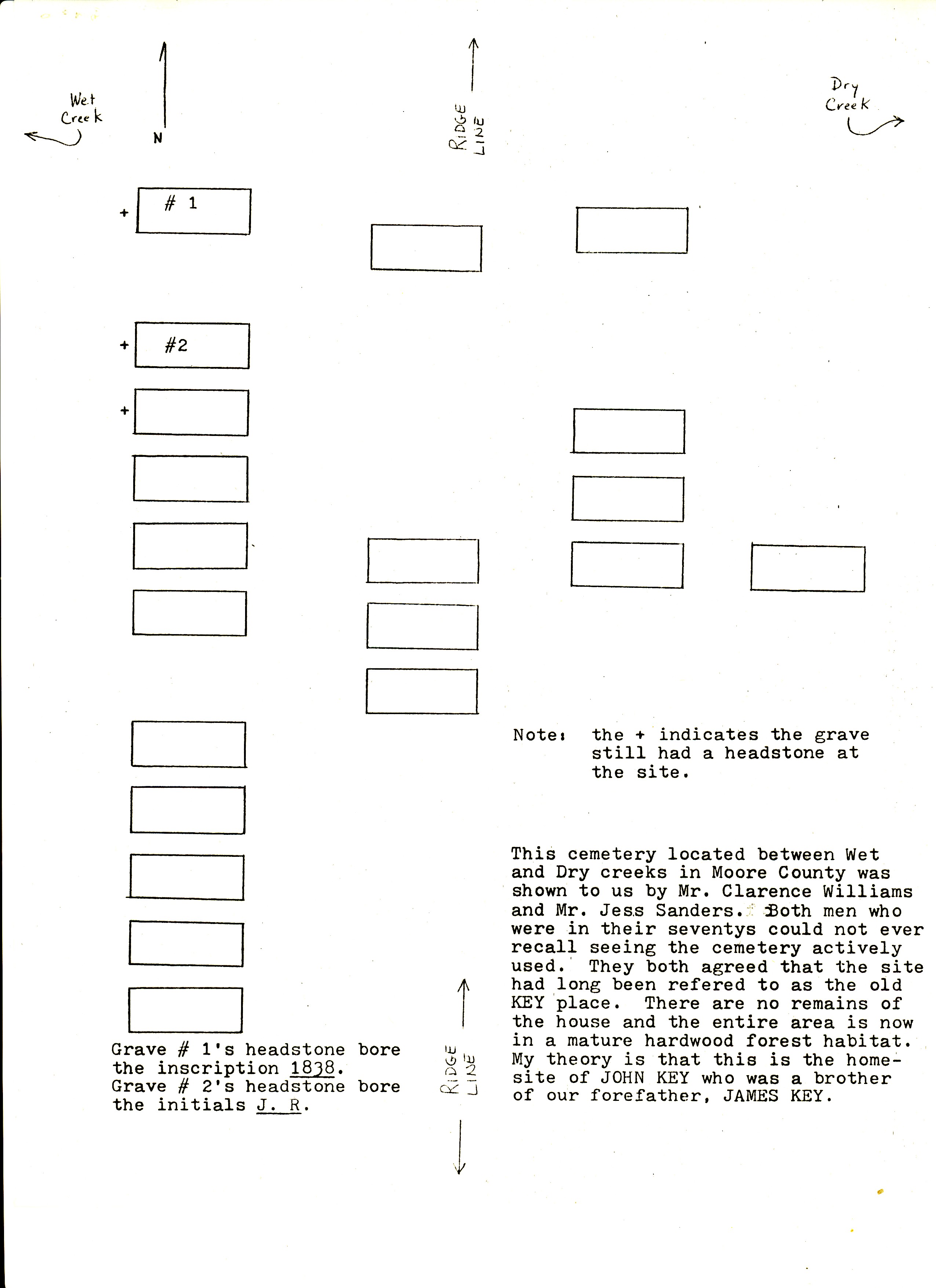
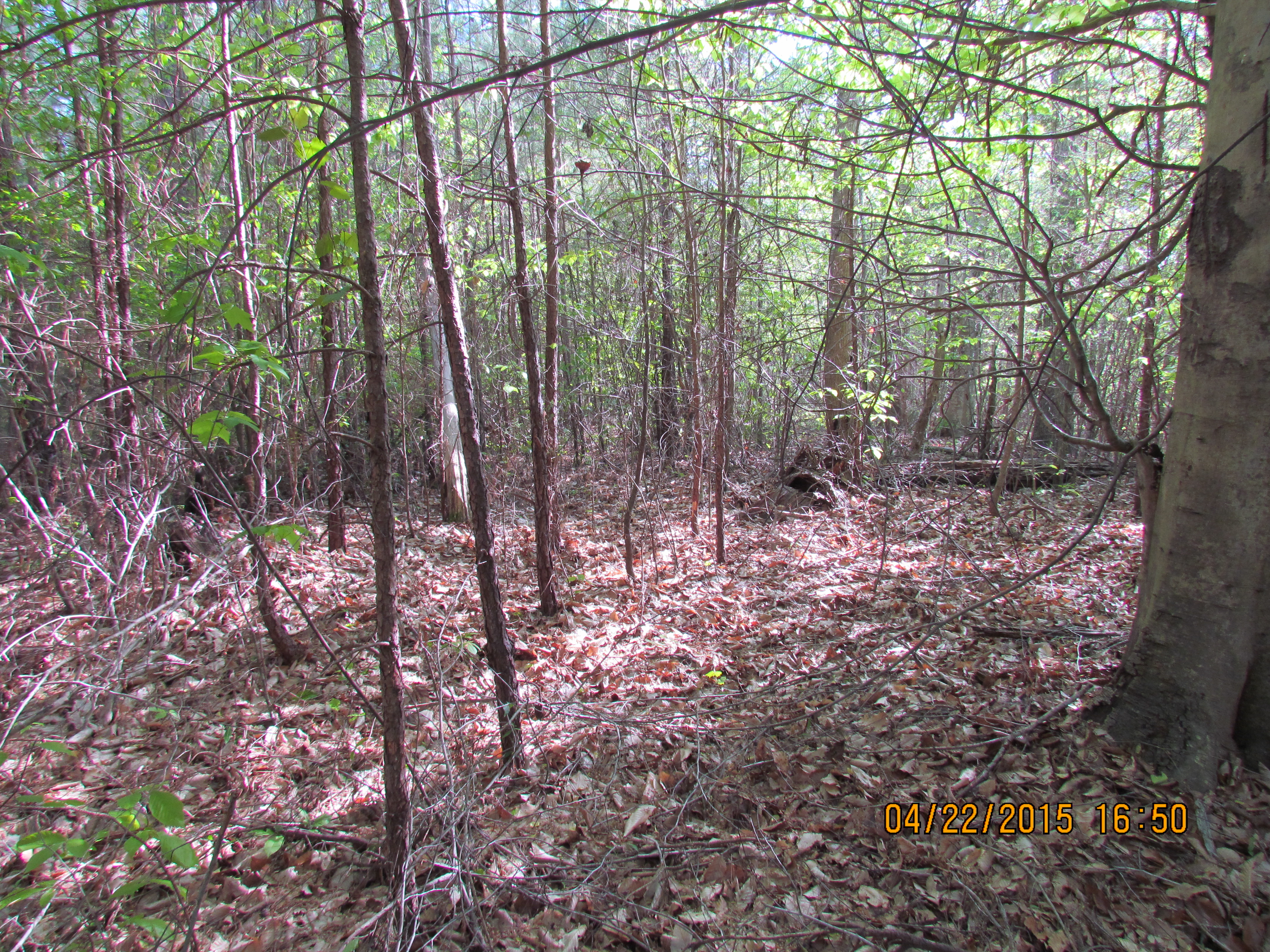
| Description | : | This cemetery is located on private property SE of Spies, Moore County, North Carolina. The cemetery is located about 550 yards south of where Wet Creek crosses State Hwy 24/27 and about 580 yards west of Alton Road (about 800 yards south of its intersection with Hwy 24/27). Coordinates are 35 degrees 23'11.26" North and 79 degrees 38'29.18" West. At least 20 sunken graves were counted in this cemetery. It is located on land granted to John Key in 1774. It is believed the cemetery holds members of the John Key Sr family, William Key family... Read More |
frequently asked questions (FAQ):
-
Where is Old John Key Cemetery?
Old John Key Cemetery is located at Spies, Moore County ,North Carolina ,USA.
-
Old John Key Cemetery cemetery's updated grave count on graveviews.com?
0 memorials
-
Where are the coordinates of the Old John Key Cemetery?
Latitude: 35.3864611
Longitude: -79.6414389
Nearby Cemetories:
1. Deaton Cemetery
Robbins, Moore County, USA
Coordinate: 35.3775466, -79.6436082
2. Pine Grove Baptist Church Cemetery
Eagle Springs, Moore County, USA
Coordinate: 35.3904890, -79.6594410
3. Hardy Sanders Gravesite
Robbins, Moore County, USA
Coordinate: 35.4015758, -79.6445489
4. Morgan Family Cemetery
Robbins, Moore County, USA
Coordinate: 35.4054490, -79.6552348
5. Williamson-Key Cemetery
Spies, Moore County, USA
Coordinate: 35.3898083, -79.6724583
6. Cole Cemetery
Robbins, Moore County, USA
Coordinate: 35.3580025, -79.6321839
7. Williams-Morgan Cemetery
Eagle Springs, Moore County, USA
Coordinate: 35.3872530, -79.6047342
8. Melton Family Cemetery
Robbins, Moore County, USA
Coordinate: 35.3570583, -79.6338952
9. Pleasant View Friends Church Cemetery
Eagle Springs, Moore County, USA
Coordinate: 35.4003400, -79.6049900
10. Rock Hill Friends Meeting Cemetery
Eagle Springs, Moore County, USA
Coordinate: 35.3815650, -79.5936600
11. Big Oak Christian Church Cemetery
Zion Grove, Moore County, USA
Coordinate: 35.3468020, -79.6560390
12. Browns Chapel Christian Church Cemetery
Robbins, Moore County, USA
Coordinate: 35.4284520, -79.6502140
13. Sowell Family Cemetery
Robbins, Moore County, USA
Coordinate: 35.4062360, -79.5947134
14. Bensalem Presbyterian Church Cemetery
Eagle Springs, Moore County, USA
Coordinate: 35.3420780, -79.6315230
15. George Davis Cemetery
Robbins, Moore County, USA
Coordinate: 35.4159672, -79.5941860
16. Allen Family Cemetery
Eagle Springs, Moore County, USA
Coordinate: 35.3922500, -79.7005300
17. Guiding Light Baptist Church Cemetery
Robbins, Moore County, USA
Coordinate: 35.4202520, -79.6899960
18. New Zion AME Church Cemetery
Robbins, Moore County, USA
Coordinate: 35.3479660, -79.5931580
19. Zion Grove Community Cemetery
Eagle Springs, Moore County, USA
Coordinate: 35.3428290, -79.5973850
20. Matthew Williams Cemetery
Robbins, Moore County, USA
Coordinate: 35.4098309, -79.5773649
21. Crossroads Baptist Church Cemetery
Robbins, Moore County, USA
Coordinate: 35.4094700, -79.5763900
22. Bascom Chapel United Methodist Church Cemetery
Robbins, Moore County, USA
Coordinate: 35.4393080, -79.6755880
23. Melton family cemetery
Robbins, Moore County, USA
Coordinate: 35.4404412, -79.6787718
24. Emsley Wallace Home Cemetery
Robbins, Moore County, USA
Coordinate: 35.4109047, -79.5710886