
| Memorials | : | 16 |
| Location | : | Lamine, Cooper County, USA |
| Coordinate | : | 38.9683330, -92.9275000 |
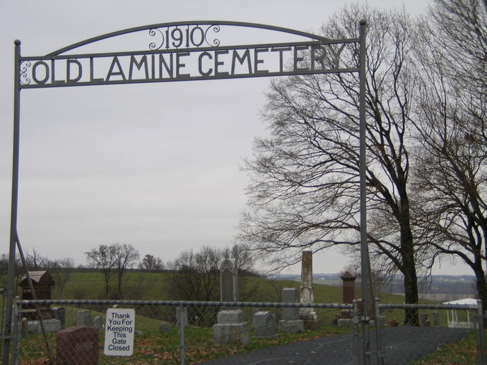
| Description | : | There is no record of the origin of Old Lamine Cemetery; all that we know is: There is about an acre in the southeast corner that is filled with unmarked graves. The only marked graves in that corner are those of the Cramer Family and they have a family tradition that in the beginning it was Cramer Land that was donated for cemetery purposes. The remainder of the cemetery was donated in small plots of 1/2 to 1 acre. The first plots were donated by Mr. Thomas Mellar of Lamine Township in the 1870 decade. Later a plot was donated... Read More |
frequently asked questions (FAQ):
-
Where is Old Lamine Cemetery?
Old Lamine Cemetery is located at Lamine, Cooper County ,Missouri ,USA.
-
Old Lamine Cemetery cemetery's updated grave count on graveviews.com?
15 memorials
-
Where are the coordinates of the Old Lamine Cemetery?
Latitude: 38.9683330
Longitude: -92.9275000
Nearby Cemetories:
1. Schuster Family Cemetery
Lamine, Cooper County, USA
Coordinate: 38.9526600, -92.8862720
2. Herndon Cemetery
Cooper County, USA
Coordinate: 38.9592018, -92.8767014
3. Samuel McMahan Family Cemetery
Lamine, Cooper County, USA
Coordinate: 39.0060000, -92.9072000
4. Allison Family Cemetery
Blackwater, Cooper County, USA
Coordinate: 38.9447910, -92.9801270
5. Peninsula Cemetery
Lamine, Cooper County, USA
Coordinate: 38.9482840, -92.9915830
6. William Reid Family Cemetery
Lamine Township, Cooper County, USA
Coordinate: 39.0240000, -92.9240000
7. Hoke Cemetery
Cooper County, USA
Coordinate: 39.0233002, -92.9480972
8. Thomas McMahan Jr. Cemetery
Lamine, Cooper County, USA
Coordinate: 39.0229560, -92.9506480
9. Saint Martins Cemetery
Pilot Grove, Cooper County, USA
Coordinate: 38.9169006, -92.8778000
10. Jones Chapel Cemetery
Cooper County, USA
Coordinate: 38.9433060, -92.8348710
11. West Boonville Evangelical Church Cemetery
Boonville, Cooper County, USA
Coordinate: 38.9593981, -92.8282225
12. Williams Burials Grounds
Cooper County, USA
Coordinate: 38.9696750, -92.8270000
13. Nelson Cemetery
Nelson, Saline County, USA
Coordinate: 39.0008011, -93.0214005
14. Townsend Cemetery
Nelson, Saline County, USA
Coordinate: 39.0275002, -92.9982986
15. Salt Fork Cemetery
Blackwater, Cooper County, USA
Coordinate: 38.9670800, -93.0367700
16. Marshall Cemetery
Nelson, Saline County, USA
Coordinate: 39.0043890, -93.0295910
17. Nelson Cemetery
Nelson, Saline County, USA
Coordinate: 39.0040400, -93.0317700
18. Sappington Cemetery
Arrow Rock Township, Saline County, USA
Coordinate: 39.0327988, -93.0072021
19. Pilot Grove City Cemetery
Pilot Grove, Cooper County, USA
Coordinate: 38.8788930, -92.9131360
20. Sappington Negro Cemetery
Saline County, USA
Coordinate: 39.0332600, -93.0143700
21. Prairie Lick Cemetery
Billingsville, Cooper County, USA
Coordinate: 38.9170410, -92.8257630
22. Garibaldi Mausoleum
Carano, Provincia di Latina, Italy
Coordinate: 38.8747215, -92.9113922
23. Pleasant Hill Cemetery
Cooper County, USA
Coordinate: 38.8955994, -92.8383026
24. Arrow Rock Cemetery
Arrow Rock, Saline County, USA
Coordinate: 39.0659000, -92.9599700