| Memorials | : | 0 |
| Location | : | Sabula, Iron County, USA |
| Coordinate | : | 37.4099630, -90.6999860 |
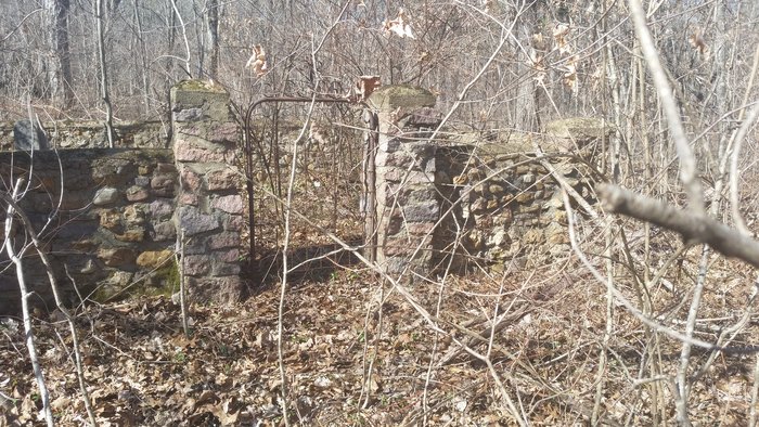
| Description | : | Located in Sabula, Missouri. It is a small cemetery with a barbed wire fence around it and no gate. It is on private property and is overgrown with weeds and vines. Marked stones that I found were for Hodges, Counts, Hughes, Melton, Francis, Collins and Lewis, a total of nine stones that I was able to find on Feb. 27, 2016. A lot of unmarked and marked with fieldstone graves exist here also. Please get permission to enter the private property before trying to locate this cemetery. |
frequently asked questions (FAQ):
-
Where is Old Lewis Cemetery?
Old Lewis Cemetery is located at Sabula, Iron County ,Missouri ,USA.
-
Old Lewis Cemetery cemetery's updated grave count on graveviews.com?
0 memorials
-
Where are the coordinates of the Old Lewis Cemetery?
Latitude: 37.4099630
Longitude: -90.6999860
Nearby Cemetories:
1. Open Door House of Prayer Cemetery
Sabula, Iron County, USA
Coordinate: 37.4276800, -90.6970900
2. Bowles Cemetery
Sabula, Iron County, USA
Coordinate: 37.3921390, -90.6883000
3. Emilys Chapel Cemetery
Sabula, Iron County, USA
Coordinate: 37.4324989, -90.7285995
4. Annapolis Cemetery
Annapolis, Iron County, USA
Coordinate: 37.3620224, -90.6975250
5. Huff Cemetery
Chloride, Iron County, USA
Coordinate: 37.4608002, -90.6896973
6. Lewis Cemetery
Annapolis, Iron County, USA
Coordinate: 37.3596992, -90.6797028
7. Hurst Cemetery
Iron County, USA
Coordinate: 37.4303017, -90.6288986
8. Big Creek Cemetery
Chloride, Iron County, USA
Coordinate: 37.4704704, -90.6914978
9. Hyatts Creek Cemetery
Lesterville, Reynolds County, USA
Coordinate: 37.4007988, -90.7861023
10. Glover Baptist Church Cemetery
Glover, Iron County, USA
Coordinate: 37.4899900, -90.6918200
11. White Cemetery
Iron County, USA
Coordinate: 37.4071999, -90.5931015
12. Rutter Cemetery
Reynolds County, USA
Coordinate: 37.3492012, -90.7769012
13. Sutton Cemetery
Vulcan, Iron County, USA
Coordinate: 37.3255997, -90.6735992
14. Collins Cemetery
Minimum, Iron County, USA
Coordinate: 37.3778000, -90.5942001
15. Allen Cemetery
Iron County, USA
Coordinate: 37.5003540, -90.6948960
16. Funk Cemetery
Annapolis, Iron County, USA
Coordinate: 37.3130989, -90.7391968
17. Dobbins Cemetery
Reynolds County, USA
Coordinate: 37.4397011, -90.8244019
18. Polk Cemetery
Arcadia, Iron County, USA
Coordinate: 37.4464302, -90.5765381
19. Guilliams Cemetery
Reynolds County, USA
Coordinate: 37.3182983, -90.7733002
20. John Ruble Cemetery
Vulcan, Iron County, USA
Coordinate: 37.3016700, -90.6851500
21. Ruble Cemetery
Iron County, USA
Coordinate: 37.3017006, -90.6847000
22. Lesterville Cemetery
Lesterville, Reynolds County, USA
Coordinate: 37.4441986, -90.8330994
23. Meadows Cemetery
Iron County, USA
Coordinate: 37.3358002, -90.5877991
24. James Wesley Lewis Family Cemetery
Reynolds County, USA
Coordinate: 37.3119011, -90.7818985


