
| Memorials | : | 0 |
| Location | : | Stowmarket, Mid Suffolk District, England |
| Website | : | stowmarket.org/visitor-infomation/things-to-see-do/cemeteries/ |
| Coordinate | : | 52.1948000, 0.9923500 |
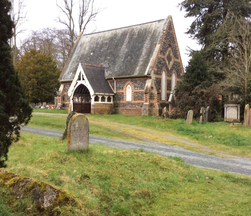
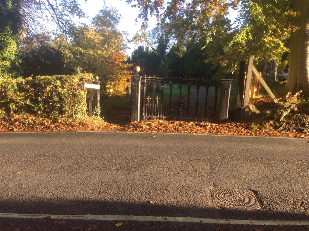
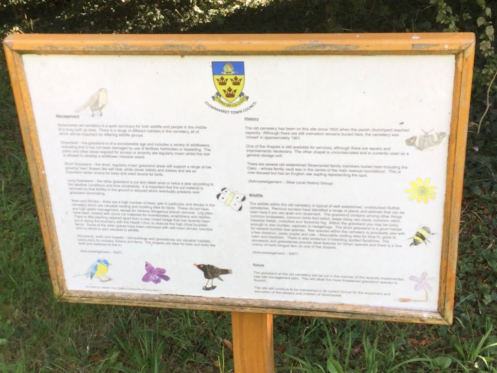
| Description | : | The first burial took place in Aug 1855. The Stowmarket Old Cemetery was closed to new burials in 1901 however burials still happened in previous bought plots and existing graves. There is two small Chapels on the site which were used to hold funerals of those buried in the Cemetery. The Cemetery is the final resting place of a number of the victims of the Gun Cotton Explosion, in 2013 a plaque was installed as a memorial to the victims. The Cemetery also contains an ashes plot which is still in use today |
frequently asked questions (FAQ):
-
Where is Old Stowmarket Cemetery?
Old Stowmarket Cemetery is located at Bury Road Stowmarket, Mid Suffolk District ,Suffolk ,England.
-
Old Stowmarket Cemetery cemetery's updated grave count on graveviews.com?
0 memorials
-
Where are the coordinates of the Old Stowmarket Cemetery?
Latitude: 52.1948000
Longitude: 0.9923500


Nearby Cemetories:
1. New Stowmarket Cemetery
Stowmarket, Mid Suffolk District, England
Coordinate: 52.1948100, 0.9890740
2. Saint Peter and Saint Mary Churchyard
Stowmarket, Mid Suffolk District, England
Coordinate: 52.1881820, 0.9967600
3. United Reformed Church
Stowmarket, Mid Suffolk District, England
Coordinate: 52.1869020, 0.9966670
4. St Mary Churchyard
Combs, Mid Suffolk District, England
Coordinate: 52.1729800, 0.9979300
5. Stowupland Cemetery
Stowupland, Mid Suffolk District, England
Coordinate: 52.1987389, 1.0293667
6. Combs Parish Cemetery
Combs, Mid Suffolk District, England
Coordinate: 52.1714740, 0.9960700
7. Holy Trinity Churchyard
Stowupland, Mid Suffolk District, England
Coordinate: 52.1999210, 1.0306050
8. St. Augustine's Church Burial Ground
Harleston, Mid Suffolk District, England
Coordinate: 52.2045920, 0.9526440
9. St John the Baptist Churchyard
Onehouse, Mid Suffolk District, England
Coordinate: 52.1956290, 0.9495420
10. Old Newton Cemetery
Old Newton, Mid Suffolk District, England
Coordinate: 52.2213520, 1.0127410
11. St. Mary's Churchyard
Old Newton, Mid Suffolk District, England
Coordinate: 52.2216380, 1.0143500
12. St. Mary the Virgin's Church
Haughley, Mid Suffolk District, England
Coordinate: 52.2215800, 0.9647260
13. St. Andrew's Churchyard
Great Finborough, Mid Suffolk District, England
Coordinate: 52.1829290, 0.9439440
14. St. Mary's Churchyard
Badley, Mid Suffolk District, England
Coordinate: 52.1629868, 1.0140250
15. St Peter's Churchyard
Creeting St Peter, Mid Suffolk District, England
Coordinate: 52.1782700, 1.0418800
16. King Charles the Martyr Churchyard
Shelland, Mid Suffolk District, England
Coordinate: 52.2039070, 0.9307170
17. Saint Mary's Churchyard
Buxhall, Mid Suffolk District, England
Coordinate: 52.1803740, 0.9283610
18. St. Mary's Churchyard
Battisford, Mid Suffolk District, England
Coordinate: 52.1493660, 1.0021970
19. Battisford Cemetery
Battisford, Mid Suffolk District, England
Coordinate: 52.1491260, 1.0013920
20. St. Mary's Churchyard
Little Finborough, Mid Suffolk District, England
Coordinate: 52.1561070, 0.9495790
21. Saint Mary's Churchyard
Creeting St Mary, Mid Suffolk District, England
Coordinate: 52.1686000, 1.0591500
22. Saint John The Baptist Burial Ground
Needham Market, Mid Suffolk District, England
Coordinate: 52.1533800, 1.0438900
23. St Mary Churchyard
Earl Stonham, Mid Suffolk District, England
Coordinate: 52.1874050, 1.0820890
24. Mendlesham Green Baptist Churchyard
Mendlesham, Mid Suffolk District, England
Coordinate: 52.2281230, 1.0648860