
| Memorials | : | 0 |
| Location | : | Gash Settlement, Marion County, USA |
| Coordinate | : | 39.7569600, -91.5095800 |
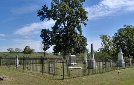
| Description | : | Bates-Gash Cemetery is located in Marion County Missouri approximately one half mile east of US 61 on County Road 406. This is in the general area of the Gash Settlement, a small group of connected families who departed from the area of Buncombe County, North Carolina and arrived in 1818, and considered by historians to be the first Permanent settlement in what is now Marion County after the Louisiana Purchase. With the founding of Palmyra a short time later, the settlement never developed into an organized community. The burials in this cemetery include some of these early settlers, and the... Read More |
frequently asked questions (FAQ):
-
Where is Bates-Gash Cemetery?
Bates-Gash Cemetery is located at Gash Settlement, Marion County ,Missouri ,USA.
-
Bates-Gash Cemetery cemetery's updated grave count on graveviews.com?
0 memorials
-
Where are the coordinates of the Bates-Gash Cemetery?
Latitude: 39.7569600
Longitude: -91.5095800
Nearby Cemetories:
1. Shropshire Cemetery
Marion County, USA
Coordinate: 39.7742500, -91.5201740
2. Mission Hill Baptist Church Cemetery
Palmyra, Marion County, USA
Coordinate: 39.7778600, -91.5196400
3. Barkley Cemetery
Hannibal, Marion County, USA
Coordinate: 39.7355995, -91.4981003
4. Marion County Infirmary Cemetery
Palmyra, Marion County, USA
Coordinate: 39.7870710, -91.5351030
5. Armstrong Cemetery
Hannibal, Marion County, USA
Coordinate: 39.7881012, -91.4768982
6. McWilliams Cemetery
Marion County, USA
Coordinate: 39.7524986, -91.4542007
7. Thrasher Chapel Cemetery
Marion County, USA
Coordinate: 39.7728004, -91.4531021
8. Kaiser Cemetery
Marion County, USA
Coordinate: 39.7769012, -91.4546967
9. Baker Cemetery
Withers Mill, Marion County, USA
Coordinate: 39.7124200, -91.4912600
10. Bush Cemetery
Marion County, USA
Coordinate: 39.7486000, -91.4486008
11. Baskett Cemetery
Marion County, USA
Coordinate: 39.7724991, -91.4452972
12. Whaley Cemetery
Marion County, USA
Coordinate: 39.7569008, -91.4405975
13. Hendren Family Cemetery
Marion County, USA
Coordinate: 39.7498000, -91.4408800
14. Greenwood Cemetery
Palmyra, Marion County, USA
Coordinate: 39.8100014, -91.5231018
15. Providence Cemetery
Marion County, USA
Coordinate: 39.7066383, -91.4818878
16. Saint Joseph Cemetery
Palmyra, Marion County, USA
Coordinate: 39.8113600, -91.5228100
17. Mount Zion Cemetery
Hannibal, Marion County, USA
Coordinate: 39.7397003, -91.4360962
18. Massie Cemetery
Palmyra, Marion County, USA
Coordinate: 39.8176000, -91.5167600
19. Cobb Cemetery
Marion County, USA
Coordinate: 39.8161011, -91.4888992
20. Pennewell Cemetery
Marion County, USA
Coordinate: 39.7924995, -91.4443970
21. Minor-Sandage Cemetery
Hannibal, Marion County, USA
Coordinate: 39.7327995, -91.4336014
22. West Ely Cemetery
West Ely, Marion County, USA
Coordinate: 39.7106018, -91.5655975
23. West Ely Presbyterian Cemetery
West Ely, Marion County, USA
Coordinate: 39.7068860, -91.5618500
24. Old Turner Cemetery
Palmyra, Marion County, USA
Coordinate: 39.7040300, -91.4581800