
| Memorials | : | 0 |
| Location | : | Mineola, Lowndes County, USA |
| Coordinate | : | 30.8986100, -83.3569800 |
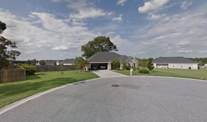
| Description | : | Found in the Lowndes County Cemetery Book as "Slave Cemetery". Located in a clump of trees 300 yards N.E. of the intersection of North Valdosta Road and Interstate 75. The area has changed significantly since the book was written. In the 2000s, the trees were cut down and a housing development built. The plantation had been owned by the family of Remer Young. At the time of the 1860 census he owned 89 enslaved humans. The plantation had been under Young's possession since August 1857. It was previously owned by Francis Rountree. His estate sold the core sections (LL 36, 56,... Read More |
frequently asked questions (FAQ):
-
Where is Old Young Plantation Cemetery?
Old Young Plantation Cemetery is located at Ginger Trail Mineola, Lowndes County ,Georgia ,USA.
-
Old Young Plantation Cemetery cemetery's updated grave count on graveviews.com?
0 memorials
-
Where are the coordinates of the Old Young Plantation Cemetery?
Latitude: 30.8986100
Longitude: -83.3569800
Nearby Cemetories:
1. Nelson Cemetery
Mineola, Lowndes County, USA
Coordinate: 30.9207200, -83.3378600
2. Rocky Hill Cemetery
Valdosta, Lowndes County, USA
Coordinate: 30.9269190, -83.3453390
3. Riverview Memorial Gardens
Valdosta, Lowndes County, USA
Coordinate: 30.8938999, -83.3221970
4. Lowndes County Poor Farm Cemetery
Mineola, Lowndes County, USA
Coordinate: 30.8890800, -83.3176100
5. Barfield-Hodges Cemetery
Hahira, Lowndes County, USA
Coordinate: 30.9347970, -83.3710210
6. Troupville Cemetery
Troupville, Lowndes County, USA
Coordinate: 30.8588000, -83.3410000
7. Riddle Cemetery
Lowndes County, USA
Coordinate: 30.9045450, -83.4057560
8. O'Neal Cemetery
Valdosta, Lowndes County, USA
Coordinate: 30.8835820, -83.3042470
9. Old Orange Grove Church Cemetery
Lowndes County, USA
Coordinate: 30.9162920, -83.4117290
10. River Hill Cemetery
Lowndes County, USA
Coordinate: 30.8525009, -83.3319016
11. Troupville Cemetery
Valdosta, Lowndes County, USA
Coordinate: 30.8474998, -83.3396988
12. Bethany Baptist Church Cemetery
Hahira, Lowndes County, USA
Coordinate: 30.9521610, -83.3429850
13. Hodges Cemetery
Lowndes County, USA
Coordinate: 30.9561005, -83.3533020
14. Shiloh United Methodist Church Cemetery
Hahira, Lowndes County, USA
Coordinate: 30.9386190, -83.4083150
15. Providence United Methodist Church Cemetery
Morven, Brooks County, USA
Coordinate: 30.8761870, -83.4248540
16. Mount Zion AME Church Cemetery
Valdosta, Lowndes County, USA
Coordinate: 30.8897630, -83.2797110
17. Old Jones Cemetery
Hahira, Lowndes County, USA
Coordinate: 30.9690000, -83.3401250
18. Remerton Cemetery
Remerton, Lowndes County, USA
Coordinate: 30.8400002, -83.3067017
19. First Christian Church Memorial Garden
Valdosta, Lowndes County, USA
Coordinate: 30.8539570, -83.2882940
20. Hightower Cemetery
Valdosta, Lowndes County, USA
Coordinate: 30.8351280, -83.3124380
21. Old Lowndes County Poor Farm Cemetery
Lowndes County, USA
Coordinate: 30.8671600, -83.2786000
22. Pallbearers Cemetery #1
Lowndes County, USA
Coordinate: 30.8239002, -83.3388977
23. Friendship Cemetery
Hahira, Lowndes County, USA
Coordinate: 30.9732880, -83.3786710
24. Christ Episcopal Church Urn Garden
Valdosta, Lowndes County, USA
Coordinate: 30.8501300, -83.2873200