| Memorials | : | 8 |
| Location | : | Richmond, Ray County, USA |
| Coordinate | : | 39.3288120, -93.9006293 |
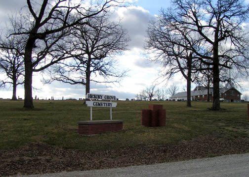
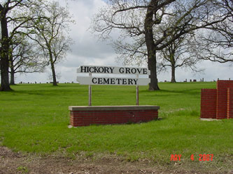
| Description | : | Located 4 miles north of Richmond, MO on Highway 13, 1-1/2 miles east on Route B, 3 miles east on Route F, and 3/4 miles south. Located at the intersection of East 132nd Street and Hickory Grove Road, at south end of Route F by the church. Ray County History 1973, p. 233: Hickory Grove Cemetery was established January 1869 on land donated and sold by Jane Dulaney and Anna J. Smith for graveyard purposes. The first burial there was that of Mary E. Smith who was dragged to her death by a horse. Her grave marks the... Read More |
frequently asked questions (FAQ):
-
Where is Hickory Grove Cemetery?
Hickory Grove Cemetery is located at Richmond, Ray County ,Missouri ,USA.
-
Hickory Grove Cemetery cemetery's updated grave count on graveviews.com?
6 memorials
-
Where are the coordinates of the Hickory Grove Cemetery?
Latitude: 39.3288120
Longitude: -93.9006293
Nearby Cemetories:
1. Pugh Cemetery
Richmond, Ray County, USA
Coordinate: 39.3124800, -93.8968700
2. Ray County Poor Farm Cemetery
Richmond, Ray County, USA
Coordinate: 39.3377110, -93.9391770
3. Bohannon Cemetery
Hardin, Ray County, USA
Coordinate: 39.3291600, -93.8580600
4. Oliphant Cemetery
Richmond, Ray County, USA
Coordinate: 39.3573300, -93.9362200
5. Nutter Cemetery
Richmond, Ray County, USA
Coordinate: 39.2966995, -93.9344025
6. Hill Cemetery
Richmond, Ray County, USA
Coordinate: 39.2933006, -93.9419022
7. Wakenda Cemetery
Hardin, Ray County, USA
Coordinate: 39.3519300, -93.8456900
8. Gunnell Cemetery
Richmond, Ray County, USA
Coordinate: 39.3072014, -93.9569016
9. Johnson Cemetery
Richmond, Ray County, USA
Coordinate: 39.3157997, -93.9630966
10. Lavelock Cemetery
Hardin, Ray County, USA
Coordinate: 39.3078003, -93.8394012
11. Wall Cemetery
Ray County, USA
Coordinate: 39.3671989, -93.9458008
12. Lile Cemetery
Richmond, Ray County, USA
Coordinate: 39.2881700, -93.9477800
13. McGaugh-Dickey Cemetery
Richmond, Ray County, USA
Coordinate: 39.2742800, -93.9229200
14. Richmond Memory Gardens
Richmond, Ray County, USA
Coordinate: 39.2771988, -93.9518967
15. Dale Cemetery
Richmond, Ray County, USA
Coordinate: 39.3339800, -93.9862900
16. Berry Cemetery
Hardin, Ray County, USA
Coordinate: 39.3913800, -93.8710800
17. Bethel Mennonite Church Cemetery
Richmond, Ray County, USA
Coordinate: 39.3936900, -93.9330400
18. Woolard Cemetery
Hardin, Ray County, USA
Coordinate: 39.3769300, -93.8351500
19. Dockery Cemetery
Dockery, Ray County, USA
Coordinate: 39.3612860, -93.9837620
20. Absolem McDonald Cemetery
Lawson, Ray County, USA
Coordinate: 39.3610992, -93.9841995
21. Pioneer Cemetery
Richmond, Ray County, USA
Coordinate: 39.2849800, -93.9762200
22. Forester Cemetery
Hardin, Ray County, USA
Coordinate: 39.3125700, -93.8079100
23. Dunn Family Cemetery
Richmond, Ray County, USA
Coordinate: 39.2898500, -93.9816100
24. Watkins Cemetery
Richmond, Ray County, USA
Coordinate: 39.2633018, -93.9449997


