
| Memorials | : | 0 |
| Location | : | Church Hill, Jefferson County, USA |
| Coordinate | : | 31.7408300, -91.2662000 |
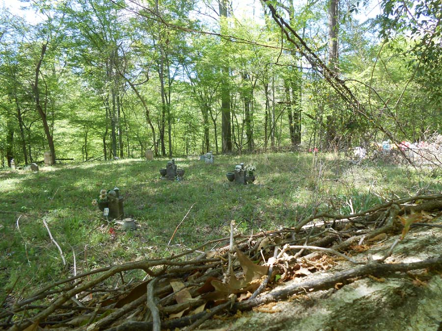
| Description | : | This Cemetery has been replaced by the new Smithland Baptist Chruch and Cemetery in Stanton, Adams County. It is somewhat overgrown and is located on the south side of Guedon Road, approximately 1/2 mile west of the intersection with Hog Farm Road. |
frequently asked questions (FAQ):
-
Where is Original Smithland Baptist Church Cemetery?
Original Smithland Baptist Church Cemetery is located at Church Hill, Jefferson County ,Mississippi ,USA.
-
Original Smithland Baptist Church Cemetery cemetery's updated grave count on graveviews.com?
0 memorials
-
Where are the coordinates of the Original Smithland Baptist Church Cemetery?
Latitude: 31.7408300
Longitude: -91.2662000
Nearby Cemetories:
1. Mercy Seat Baptist Church Cemetery
Church Hill, Jefferson County, USA
Coordinate: 31.7269400, -91.2307100
2. Christ Episcopal Church Cemetery
Church Hill, Jefferson County, USA
Coordinate: 31.7152996, -91.2386169
3. Green Cemetery
Jefferson County, USA
Coordinate: 31.7411200, -91.2248800
4. Church Hill United Methodist Church Cemetery
Church Hill, Jefferson County, USA
Coordinate: 31.7362600, -91.2239200
5. Brooks Cemetery
Jefferson County, USA
Coordinate: 31.7208004, -91.2182999
6. Adams Cemetery
Jefferson County, USA
Coordinate: 31.6907997, -91.2703018
7. Richland Missionary Baptist Church Cemetery
Church Hill, Jefferson County, USA
Coordinate: 31.7579600, -91.2098800
8. Painters Cemetery
Adams County, USA
Coordinate: 31.7099991, -91.3218994
9. Linwood Baptist Church Cemetery
Church Hill, Jefferson County, USA
Coordinate: 31.6834200, -91.2670800
10. New Zion Baptist Church Cemetery
Church Hill, Jefferson County, USA
Coordinate: 31.7582900, -91.2006100
11. Krize Family Cemetery
Church Hill, Jefferson County, USA
Coordinate: 31.6877400, -91.2332100
12. Magruder-Drake Family Cemetery
Church Hill, Jefferson County, USA
Coordinate: 31.6807300, -91.2555200
13. Green Family Cemetery
Jefferson County, USA
Coordinate: 31.7455997, -91.1905975
14. Galtney - Noland Cemetery
Jefferson County, USA
Coordinate: 31.7865500, -91.2099200
15. Gold Mount Baptist Church Cemetery
Jefferson County, USA
Coordinate: 31.7865120, -91.2098070
16. Jefferson Chapel A.M.E. Church Cemetery
Jefferson County, USA
Coordinate: 31.6789900, -91.2348000
17. Shields Cemetery
Jefferson County, USA
Coordinate: 31.6714001, -91.2842026
18. John Jones Cemetery
Church Hill, Jefferson County, USA
Coordinate: 31.6804400, -91.2179800
19. Calviton Cemetery
Rodney, Jefferson County, USA
Coordinate: 31.7728300, -91.1871300
20. Davis Sisters Gravesite
Church Hill, Jefferson County, USA
Coordinate: 31.7240100, -91.1786100
21. Donahue Plantation Cemetery
Church Hill, Jefferson County, USA
Coordinate: 31.7279300, -91.1767100
22. Tenner Family Cemetery
Church Hill, Jefferson County, USA
Coordinate: 31.7007400, -91.1884500
23. Smith Cemetery
Jefferson County, USA
Coordinate: 31.6653004, -91.2378006
24. Mount Locust Slave Cemetery
Cannonsburg, Jefferson County, USA
Coordinate: 31.6871200, -91.1914400