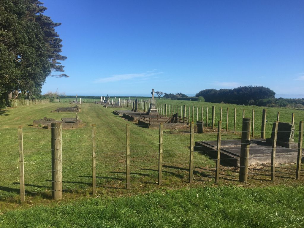
| Memorials | : | 13 |
| Location | : | New Plymouth, New Plymouth District, New Zealand |
| Coordinate | : | -39.5492080, 174.0051880 |
| Description | : | Otakeho is approximately midway between Opunake and Hawera, and has daily coach communication by a good road with each of these places. The village lies to the west of Hawera and to the south-east of Opunake, and is almost due south from Mount Egmont; it is in the Oeo survey district of the Taranaki land district, and the Waimate riding of the county of Hawera (written early 1900s). |
frequently asked questions (FAQ):
-
Where is Otakeho Cemetery?
Otakeho Cemetery is located at State Highway 45 New Plymouth, New Plymouth District ,Taranaki ,New Zealand.
-
Otakeho Cemetery cemetery's updated grave count on graveviews.com?
13 memorials
-
Where are the coordinates of the Otakeho Cemetery?
Latitude: -39.5492080
Longitude: 174.0051880
Nearby Cemetories:
1. Pihama Cemetery
Pihama, South Taranaki District, New Zealand
Coordinate: -39.5075300, 173.9285600
2. Manaia Cemetery
Manaia, South Taranaki District, New Zealand
Coordinate: -39.5575010, 174.1354470
3. Manaia Redoubt
Manaia, South Taranaki District, New Zealand
Coordinate: -39.5461557, 174.1364306
4. Motuawa Urupā Waiokura Marae
Manaia, South Taranaki District, New Zealand
Coordinate: -39.5388010, 174.1438990
5. Te Ngutu o te Manu Battlesite Memorial
Kapuni, South Taranaki District, New Zealand
Coordinate: -39.4876351, 174.1838147
6. Ohawe Military Cemetery
Ohawe Beach, South Taranaki District, New Zealand
Coordinate: -39.5835138, 174.2003758
7. Okaiawa Cemetery
Okaiawa, South Taranaki District, New Zealand
Coordinate: -39.5310220, 174.2042180
8. Opunake Cemetery
Opunake, South Taranaki District, New Zealand
Coordinate: -39.4515370, 173.8458110
9. Kaponga Cemetery
Kaponga, South Taranaki District, New Zealand
Coordinate: -39.4312210, 174.1553160
10. Weri Weri Urupa Aotearoa Marae
Okaiawa, South Taranaki District, New Zealand
Coordinate: -39.5190700, 174.2206700
11. Waihi Cemetery and Redoubt
Normanby, South Taranaki District, New Zealand
Coordinate: -39.5444930, 174.2566820
12. Te Utinga Urupā
Normanby, South Taranaki District, New Zealand
Coordinate: -39.5330847, 174.2761055
13. Hāwera Cemetery
Hāwera, South Taranaki District, New Zealand
Coordinate: -39.5897900, 174.2945500
14. Tiwhaiti Urupa (Taiporohenui Marae)
Hāwera, South Taranaki District, New Zealand
Coordinate: -39.5741843, 174.3216120
15. Rahotu Cemetery
Rahotu, South Taranaki District, New Zealand
Coordinate: -39.3339080, 173.7992810
16. Eltham Cemetery
Eltham, South Taranaki District, New Zealand
Coordinate: -39.4197140, 174.3251260
17. Parihaka Pā Urupa
Parihaka Pa, South Taranaki District, New Zealand
Coordinate: -39.2897366, 173.8370149
18. Pioneer Cemetery
Stratford, Stratford District, New Zealand
Coordinate: -39.3359800, 174.2929000
19. Manutahi Cemetery
Manutahi, South Taranaki District, New Zealand
Coordinate: -39.6594677, 174.3924181
20. Midhirst Cemetery
Midhirst, Stratford District, New Zealand
Coordinate: -39.2913640, 174.2724620
21. Midhirst Old Cemetery
Midhirst, Stratford District, New Zealand
Coordinate: -39.2911920, 174.2731980
22. Kopuatama Cemetery
Stratford, Stratford District, New Zealand
Coordinate: -39.3364400, 174.3364500
23. Okato Cemetery
Okato, New Plymouth District, New Zealand
Coordinate: -39.1904200, 173.8821100
24. Tataraimaka Cemetery
Oakura, New Plymouth District, New Zealand
Coordinate: -39.1503230, 173.9138870

