
| Memorials | : | 0 |
| Location | : | Ovapa, Clay County, USA |
| Coordinate | : | 38.5259680, -81.1470270 |
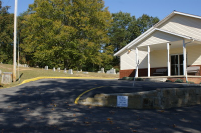
| Description | : | Ovapa Church of God Cemetery From: I-79 South or North you need to get off the Wallback exit, Exit 34. If coming from the north, turn left off the exit and if coming from the south turn right off the exit. You will be on Route 36 for about 4.6 miles. Turn right on County Rd. 36/2 (Laurel Creek Rd.) From here there are two ways to Ovapa. You can take the first road to the right (CR 14/1) to CR 14 and turn right at Ovapa or the second way is to continue on until CR 36/2 dead ends into... Read More |
frequently asked questions (FAQ):
-
Where is Ovapa Church of God Cemetery?
Ovapa Church of God Cemetery is located at Ovapa, Clay County ,West Virginia ,USA.
-
Ovapa Church of God Cemetery cemetery's updated grave count on graveviews.com?
0 memorials
-
Where are the coordinates of the Ovapa Church of God Cemetery?
Latitude: 38.5259680
Longitude: -81.1470270
Nearby Cemetories:
1. Belcher Cemetery
Ovapa, Clay County, USA
Coordinate: 38.5260640, -81.1519610
2. Hall Cemetery
Clay County, USA
Coordinate: 38.5311012, -81.1605988
3. Wyant Cemetery
Ovapa, Clay County, USA
Coordinate: 38.5161770, -81.1569900
4. Hively Cemetery
Clay County, USA
Coordinate: 38.5388985, -81.1343994
5. Joe Butcher Cemetery
Maysel, Clay County, USA
Coordinate: 38.4962070, -81.1261580
6. Hill Cemetery
Amma, Roane County, USA
Coordinate: 38.5359890, -81.1981760
7. Elliot Boggs Cemetery
Maysel, Clay County, USA
Coordinate: 38.4972500, -81.1072300
8. Butcher Cemetery
Maysel, Clay County, USA
Coordinate: 38.4937000, -81.1109600
9. Barnes Cemetery
Clay County, USA
Coordinate: 38.5347090, -81.0895650
10. Moore Cemetery
Clay County, USA
Coordinate: 38.5487630, -81.0953290
11. Blankenship Cemetery
Maysel, Clay County, USA
Coordinate: 38.4917200, -81.1068100
12. Butcher Cemetery
Maysel, Clay County, USA
Coordinate: 38.4855890, -81.1121790
13. Procious Cemetery
Procious, Clay County, USA
Coordinate: 38.4928080, -81.1939270
14. Markle Grose Carper Cemetery
Clay County, USA
Coordinate: 38.4800790, -81.1198820
15. Park Cemetery
Procious, Clay County, USA
Coordinate: 38.4815030, -81.1804250
16. Little Laurel Missionary Baptist Church Cemetery
Clay County, USA
Coordinate: 38.5398750, -81.0827060
17. AJ Samples Cemetery
Procious, Clay County, USA
Coordinate: 38.4791450, -81.1783220
18. Sam Samples Cemetery
Procious, Clay County, USA
Coordinate: 38.4868500, -81.1978430
19. Blue Knob Church Cemetery
Maysel, Clay County, USA
Coordinate: 38.4703320, -81.1332710
20. Samples Harvey Cemetery
Procious, Clay County, USA
Coordinate: 38.4900060, -81.2049670
21. King Family Cemetery
Maysel, Clay County, USA
Coordinate: 38.4700100, -81.1157880
22. King Cemetery
Procious, Clay County, USA
Coordinate: 38.4699940, -81.1155270
23. Davis Cemetery
Clay County, USA
Coordinate: 38.4638590, -81.1472560
24. Pierson Cemetery
Clay, Clay County, USA
Coordinate: 38.4636130, -81.1536220