| Memorials | : | 1 |
| Location | : | Ovapa, Clay County, USA |
| Coordinate | : | 38.5161770, -81.1569900 |
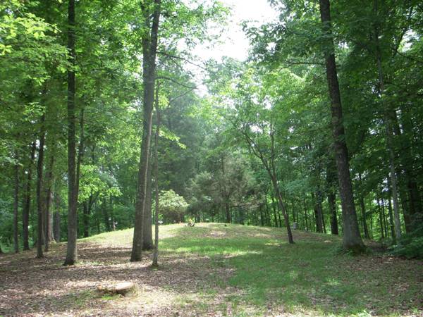
| Description | : | N41 05.223; W081 30.109 Beautiful little cemetery. Locked gate at bottom of long steep hill; keys available in the house next door. Cemetery has no fence, but is well kept and active. There are many illegible markers and stones marking graves. I-79 Wallback exit turn toward Clay on route 36. Go thru Valley Fork and turn right on Laurel Fork about 3.5 miles; go to Ovapa intersection turn left; .05 miles on right locked gate. Go thru gate 1 mile on the very top of hill on left. Deed to cemetery provided by Edward Sloan. |
frequently asked questions (FAQ):
-
Where is Wyant Cemetery?
Wyant Cemetery is located at Ovapa, Clay County ,West Virginia ,USA.
-
Wyant Cemetery cemetery's updated grave count on graveviews.com?
1 memorials
-
Where are the coordinates of the Wyant Cemetery?
Latitude: 38.5161770
Longitude: -81.1569900
Nearby Cemetories:
1. Belcher Cemetery
Ovapa, Clay County, USA
Coordinate: 38.5260640, -81.1519610
2. Ovapa Church of God Cemetery
Ovapa, Clay County, USA
Coordinate: 38.5259680, -81.1470270
3. Hall Cemetery
Clay County, USA
Coordinate: 38.5311012, -81.1605988
4. Hively Cemetery
Clay County, USA
Coordinate: 38.5388985, -81.1343994
5. Joe Butcher Cemetery
Maysel, Clay County, USA
Coordinate: 38.4962070, -81.1261580
6. Procious Cemetery
Procious, Clay County, USA
Coordinate: 38.4928080, -81.1939270
7. Hill Cemetery
Amma, Roane County, USA
Coordinate: 38.5359890, -81.1981760
8. Park Cemetery
Procious, Clay County, USA
Coordinate: 38.4815030, -81.1804250
9. AJ Samples Cemetery
Procious, Clay County, USA
Coordinate: 38.4791450, -81.1783220
10. Butcher Cemetery
Maysel, Clay County, USA
Coordinate: 38.4937000, -81.1109600
11. Elliot Boggs Cemetery
Maysel, Clay County, USA
Coordinate: 38.4972500, -81.1072300
12. Sam Samples Cemetery
Procious, Clay County, USA
Coordinate: 38.4868500, -81.1978430
13. Samples Harvey Cemetery
Procious, Clay County, USA
Coordinate: 38.4900060, -81.2049670
14. Blankenship Cemetery
Maysel, Clay County, USA
Coordinate: 38.4917200, -81.1068100
15. Markle Grose Carper Cemetery
Clay County, USA
Coordinate: 38.4800790, -81.1198820
16. Butcher Cemetery
Maysel, Clay County, USA
Coordinate: 38.4855890, -81.1121790
17. Blue Knob Church Cemetery
Maysel, Clay County, USA
Coordinate: 38.4703320, -81.1332710
18. Pierson Cemetery
Elkhurst, Clay County, USA
Coordinate: 38.4636100, -81.1538900
19. Pierson Cemetery
Clay, Clay County, USA
Coordinate: 38.4636130, -81.1536220
20. Davis Cemetery
Clay County, USA
Coordinate: 38.4638590, -81.1472560
21. Barnes Cemetery
Clay County, USA
Coordinate: 38.5347090, -81.0895650
22. Reed Walker McCune Cemetery
Procious, Clay County, USA
Coordinate: 38.4898510, -81.2200680
23. King Family Cemetery
Maysel, Clay County, USA
Coordinate: 38.4700100, -81.1157880
24. King Cemetery
Procious, Clay County, USA
Coordinate: 38.4699940, -81.1155270

