
| Memorials | : | 45 |
| Location | : | Rector, Clay County, USA |
| Coordinate | : | 36.2619934, -90.3266754 |
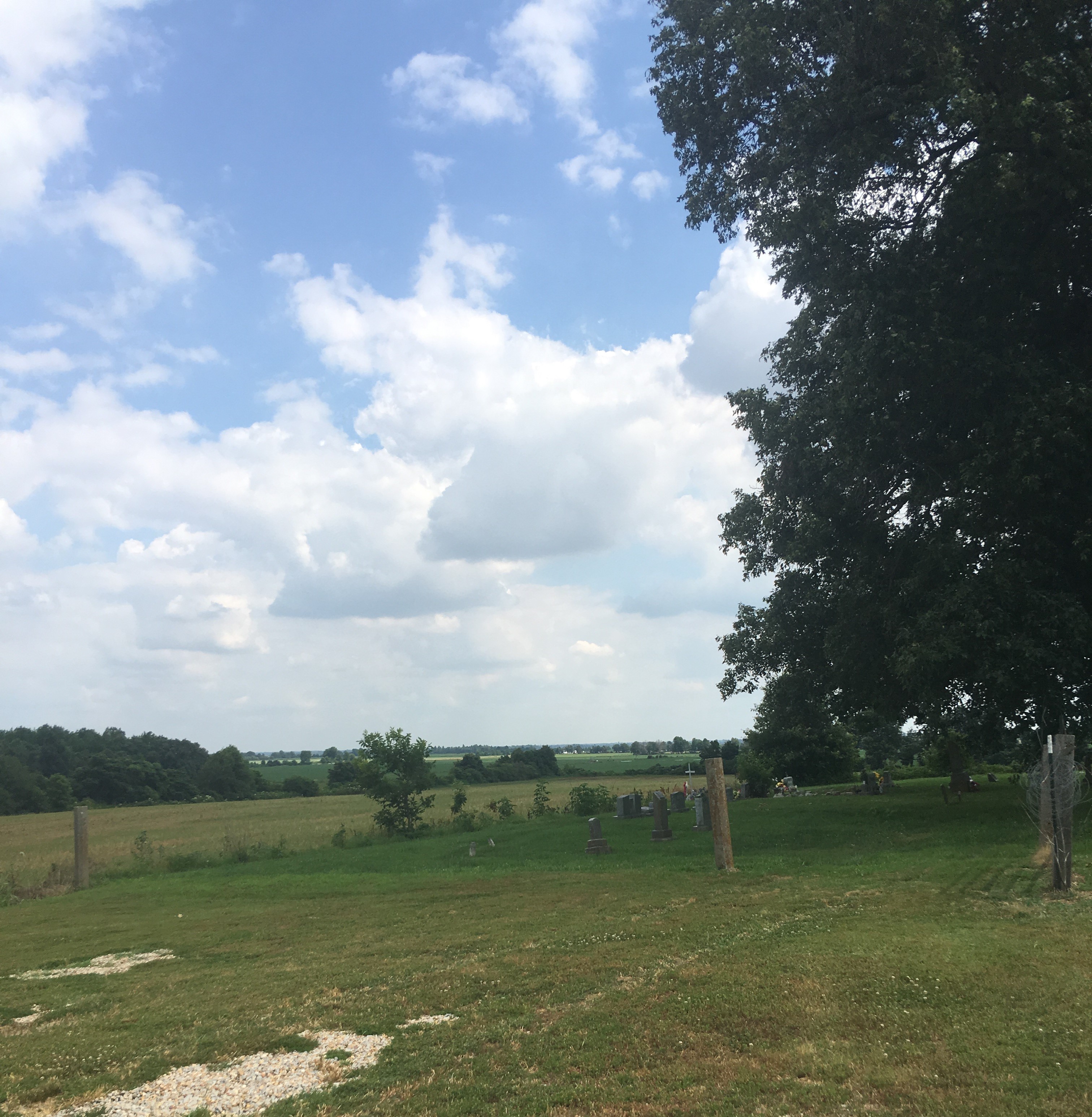
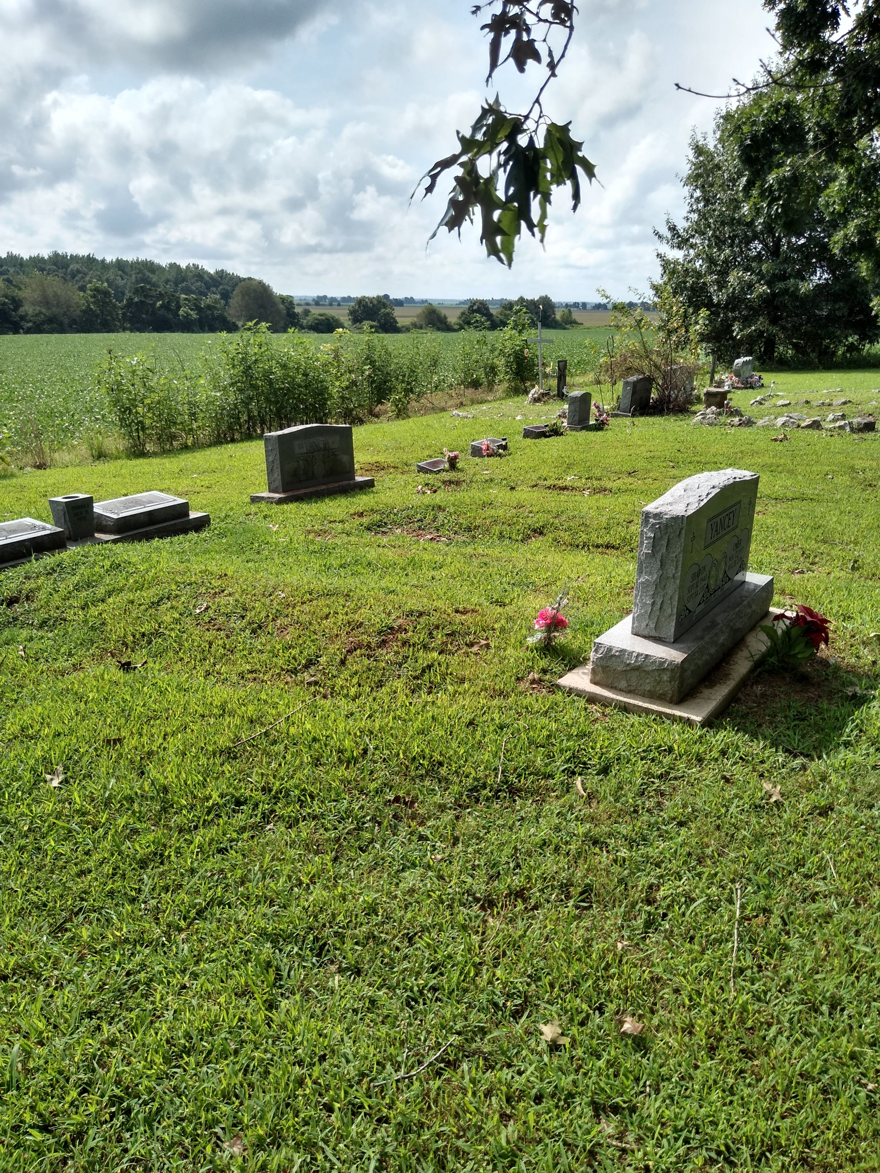
| Description | : | Go West out of Rector, Arkansas on Clay County Road 406. West 5th Street in Rector turns into Clay County Road 406. You will go past Clay County Road 427 on the right (South) side of the road. The next road on the right (South) is Parks Cemetery road. Parks Cemetery road looks like a field road. Because the cemetery is on the edge of a field. When I did this update there was still a few trees there to shade the cemetery. The cemetery is not kept up. By Becky Smith~Schee April 2006 |
frequently asked questions (FAQ):
-
Where is Parks Cemetery?
Parks Cemetery is located at Rector, Clay County ,Arkansas ,USA.
-
Parks Cemetery cemetery's updated grave count on graveviews.com?
45 memorials
-
Where are the coordinates of the Parks Cemetery?
Latitude: 36.2619934
Longitude: -90.3266754
Nearby Cemetories:
1. Mound Cemetery
Clay County, USA
Coordinate: 36.2737312, -90.3426285
2. Woodland Heights Cemetery
Rector, Clay County, USA
Coordinate: 36.2724991, -90.3039017
3. Scatterville Cemetery
Rector, Clay County, USA
Coordinate: 36.2813683, -90.3131104
4. Pleasant Grove Cemetery
Hopewell, Greene County, USA
Coordinate: 36.2543983, -90.3630981
5. Ebenezer Cemetery
Clay County, USA
Coordinate: 36.2887383, -90.3643570
6. Marys Chapel Cemetery
Rector, Clay County, USA
Coordinate: 36.2921982, -90.2830963
7. Shannon Cemetery
Clay County, USA
Coordinate: 36.2982483, -90.3639374
8. Purcell Cemetery
Rector, Clay County, USA
Coordinate: 36.2602997, -90.3910980
9. Blooming Grove Cemetery
Clay County, USA
Coordinate: 36.3147011, -90.2913971
10. Hillsboro Cemetery
Rector, Clay County, USA
Coordinate: 36.2975883, -90.2605820
11. Liberty Hill Cemetery
Boydsville, Clay County, USA
Coordinate: 36.3280983, -90.3182983
12. Cudd Cemetery
Marmaduke, Greene County, USA
Coordinate: 36.2202988, -90.3955994
13. Harveys Chapel Cemetery
Marmaduke, Greene County, USA
Coordinate: 36.2131004, -90.3906021
14. Salem Cemetery
Rector, Clay County, USA
Coordinate: 36.3208008, -90.3818970
15. Lone Grave
Clay County, USA
Coordinate: 36.3358002, -90.3331070
16. Leonard Cemetery
Leonard, Clay County, USA
Coordinate: 36.2164001, -90.2481003
17. Hargrave Parish Church
Hargrave Corner, Clay County, USA
Coordinate: 36.2590598, -90.2290688
18. Johnson Chapel Cemetery
Clay County, USA
Coordinate: 36.3383900, -90.3572400
19. Travillian Cemetery
Clay County, USA
Coordinate: 36.3382988, -90.2842026
20. Bethlehem Cemetery
Clay County, USA
Coordinate: 36.2872009, -90.4393997
21. Rock Springs Cemetery
Knob, Clay County, USA
Coordinate: 36.2785988, -90.4439011
22. Ramers Chapel Cemetery
Marmaduke, Greene County, USA
Coordinate: 36.2344590, -90.4426930
23. Starnes Cemetery
Greene County, USA
Coordinate: 36.2221080, -90.4371790
24. Mars Hill Cemetery
Crockett, Clay County, USA
Coordinate: 36.3624992, -90.3275604