
| Memorials | : | 0 |
| Location | : | Saint Olaf, Clayton County, USA |
| Coordinate | : | 42.9216000, -91.4489000 |
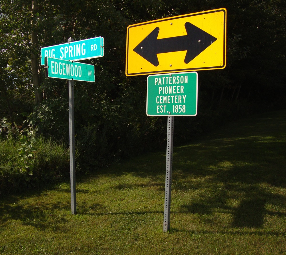
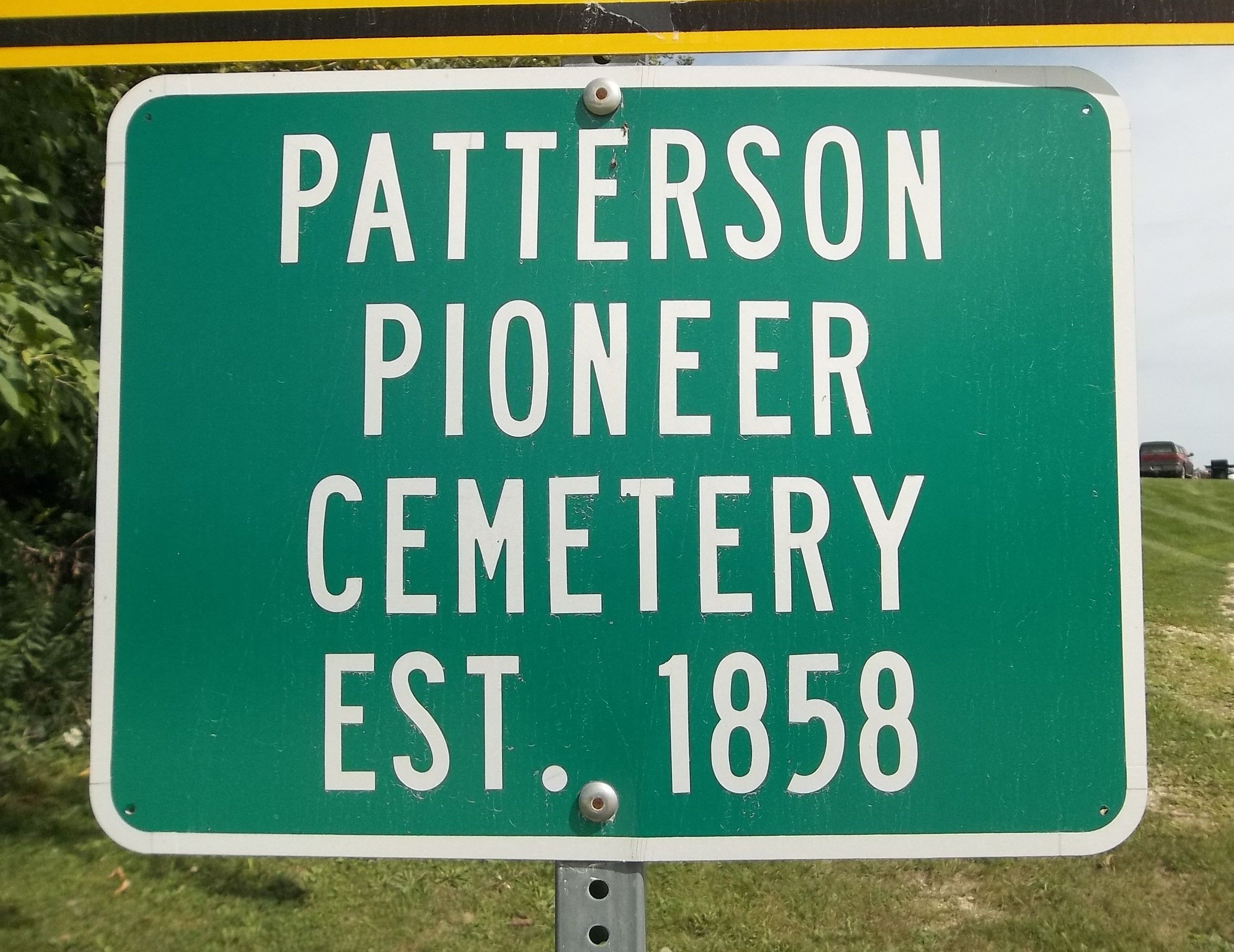
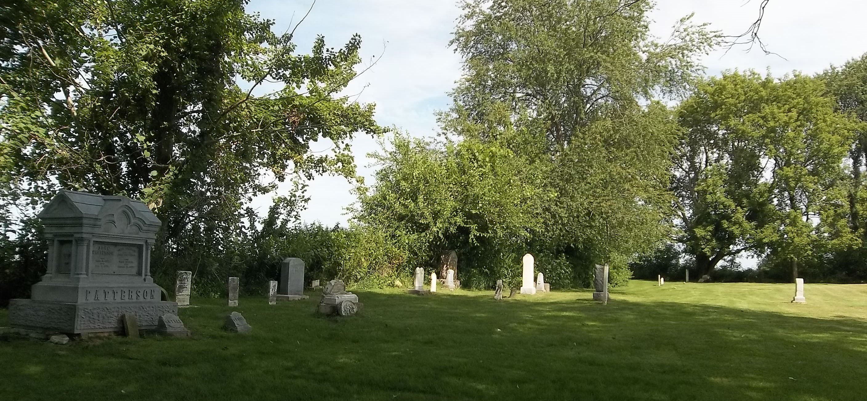
| Description | : | The cemetery is located in Wagner Township on the north side of Big Spring Road at its intersection with Edgewood Avenue. The U.S. Geological Survey (USGS) Geographic Names Information System (GNIS) feature ID for the cemetery is 1949268 (Patterson Cemetery). |
frequently asked questions (FAQ):
-
Where is Patterson Pioneer Cemetery?
Patterson Pioneer Cemetery is located at Big Spring Road Saint Olaf, Clayton County ,Iowa , 52072USA.
-
Patterson Pioneer Cemetery cemetery's updated grave count on graveviews.com?
0 memorials
-
Where are the coordinates of the Patterson Pioneer Cemetery?
Latitude: 42.9216000
Longitude: -91.4489000

Nearby Cemetories:
1. Weymouth Cemetery
Saint Olaf, Clayton County, USA
Coordinate: 42.9278799, -91.4583559
2. Norway Lutheran Church Cemetery
Saint Olaf, Clayton County, USA
Coordinate: 42.9352798, -91.4302826
3. Clark Family Cemetery
Beulah, Clayton County, USA
Coordinate: 42.9166505, -91.4751415
4. Wagner Township Cemetery
Saint Olaf, Clayton County, USA
Coordinate: 42.9519386, -91.4513931
5. Cook Family Cemetery
Elkader, Clayton County, USA
Coordinate: 42.9209880, -91.5091230
6. Farmersburg-Wagner Cemetery
Farmersburg, Clayton County, USA
Coordinate: 42.9481010, -91.3700027
7. Highland Lutheran Cemetery
Highland Township, Clayton County, USA
Coordinate: 42.8987000, -91.5330000
8. Marion Lutheran Cemetery
Gunder, Clayton County, USA
Coordinate: 42.9708290, -91.5127792
9. Gooding Cemetery
Wagner Township, Clayton County, USA
Coordinate: 42.9869490, -91.4191570
10. Eno Cemetery
Wagner Township, Clayton County, USA
Coordinate: 42.9930992, -91.4693985
11. Elkader Cemetery
Elkader, Clayton County, USA
Coordinate: 42.8541718, -91.4000015
12. Colony Catholic Cemetery (Defunct)
Read Township, Clayton County, USA
Coordinate: 42.8830000, -91.3580000
13. County Home Cemetery
Clayton Center, Clayton County, USA
Coordinate: 42.8916702, -91.3499985
14. Saint Josephs Cemetery
Elkader, Clayton County, USA
Coordinate: 42.8488998, -91.4021988
15. Houg Cemetery
Gunder, Clayton County, USA
Coordinate: 42.9444008, -91.5675964
16. Bismark Cemetery
Farmersburg, Clayton County, USA
Coordinate: 42.9790000, -91.3500000
17. Pioneer Cemetery
Monona, Clayton County, USA
Coordinate: 43.0149994, -91.4274979
18. Zion Lutheran Cemetery
Clayton Center, Clayton County, USA
Coordinate: 42.8841705, -91.3249969
19. Apostolic Cemetery
Marion Township, Clayton County, USA
Coordinate: 42.9347000, -91.5821991
20. Clayton Center Cemetery
Clayton Center, Clayton County, USA
Coordinate: 42.8841705, -91.3225021
21. Fry Family Cemetery
Farmersburg, Clayton County, USA
Coordinate: 43.0152530, -91.5182350
22. Dohrer Cemetery
Osborne, Clayton County, USA
Coordinate: 42.8124846, -91.4584734
23. Hartman Cemetery
Cox Creek Township, Clayton County, USA
Coordinate: 42.8155360, -91.3880840
24. National Cemetery
National, Clayton County, USA
Coordinate: 42.9536018, -91.2902985