
| Memorials | : | 0 |
| Location | : | Bemis, Randolph County, USA |
| Coordinate | : | 38.8080040, -79.7386820 |
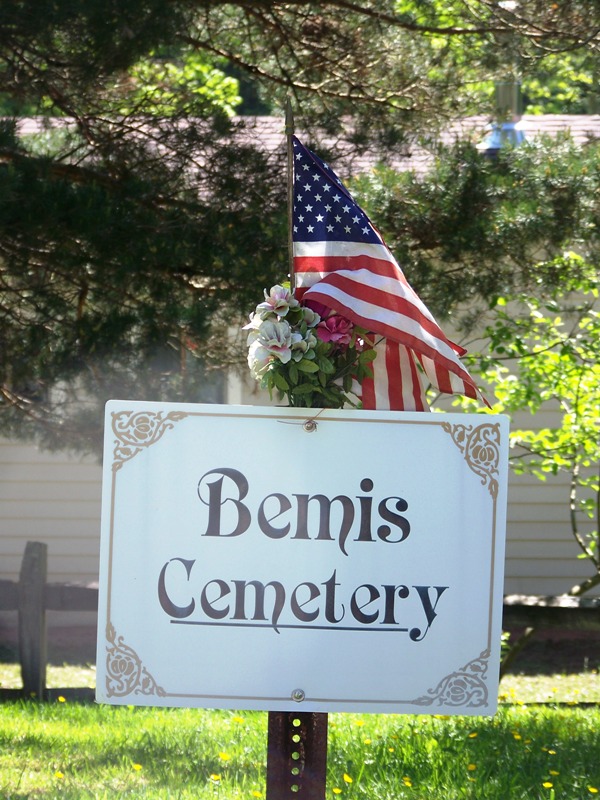
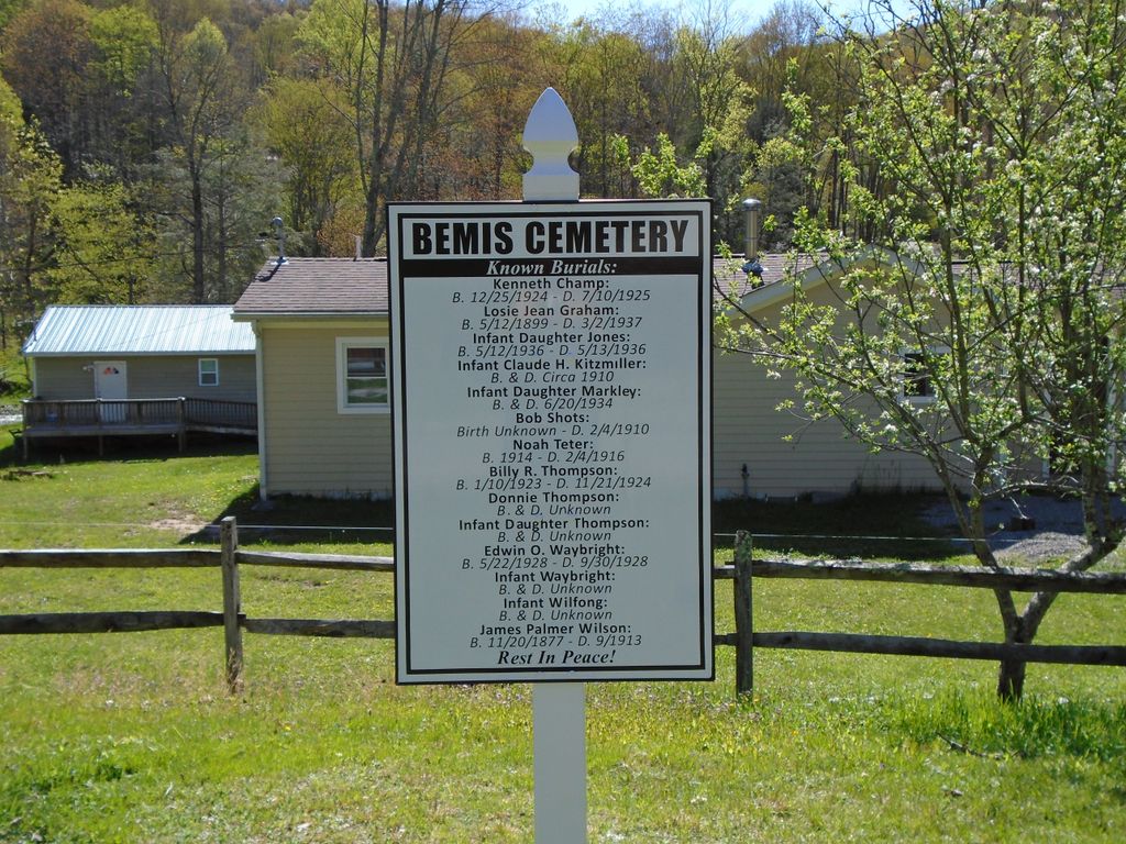
| Description | : | To find the Bemis Cemetery, turn south on CR 27 in Alpena, West Virginia and travel toward Glady. When you reach the community of Glady, turn right on CR 22. About one mile after turning on CR 22 you will cross the Bemis Bridge over the Shaver Fork River. The road will immediately curve to the right. The cemetery is in the curve. There are no tombstones in the cemetery. My information was found in a book named "Bemis & Glady West Virginia: A History of Two Mountain Towns" by Steve Bodkins. There are more burials in the cemetery, but... Read More |
frequently asked questions (FAQ):
-
Where is Bemis Cemetery?
Bemis Cemetery is located at Bemis, Randolph County ,West Virginia ,USA.
-
Bemis Cemetery cemetery's updated grave count on graveviews.com?
0 memorials
-
Where are the coordinates of the Bemis Cemetery?
Latitude: 38.8080040
Longitude: -79.7386820
Nearby Cemetories:
1. Glady Cemetery
Glady, Randolph County, USA
Coordinate: 38.7901600, -79.7241750
2. Shrader Cemetery #1
Franklin, Pendleton County, USA
Coordinate: 38.8235000, -79.7740500
3. Peter Shaver Roadside Gravesite
Glady, Randolph County, USA
Coordinate: 38.8588219, -79.6914673
4. Waybright Cemetery #05
Franklin, Pendleton County, USA
Coordinate: 38.8646300, -79.7964600
5. Harper Cemetery
Pendleton County, USA
Coordinate: 38.8646300, -79.7964600
6. Park Cemetery
Beverly, Randolph County, USA
Coordinate: 38.8407560, -79.8369520
7. Mount Vernon Cemetery
Randolph County, USA
Coordinate: 38.8213300, -79.8482900
8. Bell Family Cemetery
Randolph County, USA
Coordinate: 38.8981480, -79.7708890
9. Kelly Mountain Cemetery
Elkins, Randolph County, USA
Coordinate: 38.9013930, -79.7789460
10. Chenoweth Hill Cemetery
Elkins, Randolph County, USA
Coordinate: 38.8792590, -79.8357770
11. Taylor Cemetery
Bowden, Randolph County, USA
Coordinate: 38.9110500, -79.7130200
12. Butcher Family Cemetery
Beverly, Randolph County, USA
Coordinate: 38.8419500, -79.8672600
13. John M Stalnaker Cemetery
Beverly, Randolph County, USA
Coordinate: 38.8245470, -79.8731770
14. Mount Iser Confederate Cemetery
Beverly, Randolph County, USA
Coordinate: 38.8444500, -79.8666600
15. Hazelwood Cemetery
Elkins, Randolph County, USA
Coordinate: 38.8597641, -79.8577118
16. Old Stalnaker Family Cemetery
Randolph County, USA
Coordinate: 38.8143083, -79.8767627
17. Beverly Cemetery
Beverly, Randolph County, USA
Coordinate: 38.8455200, -79.8726807
18. Elkins Memorial Gardens
Elkins, Randolph County, USA
Coordinate: 38.8838997, -79.8469009
19. Armstrong Cemetery
Randolph County, USA
Coordinate: 38.7916500, -79.8841070
20. Hammer Cemetery #6
Pendleton County, USA
Coordinate: 38.9277500, -79.7253300
21. Thomas Phillips Farm Cemetery
Beverly, Randolph County, USA
Coordinate: 38.8543472, -79.8824921
22. Trinity Cemetery
Beverly, Randolph County, USA
Coordinate: 38.8329440, -79.8920230
23. Alpena Cemetery
Alpena, Randolph County, USA
Coordinate: 38.9109280, -79.6512930
24. Saint Brendan Catholic Cemetery
Elkins, Randolph County, USA
Coordinate: 38.9002991, -79.8442001