
| Memorials | : | 4 |
| Location | : | Pewee Valley, Oldham County, USA |
| Coordinate | : | 38.3044014, -85.4749985 |
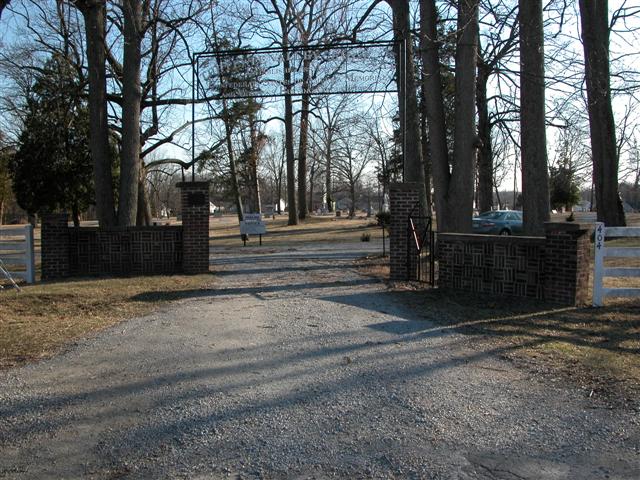
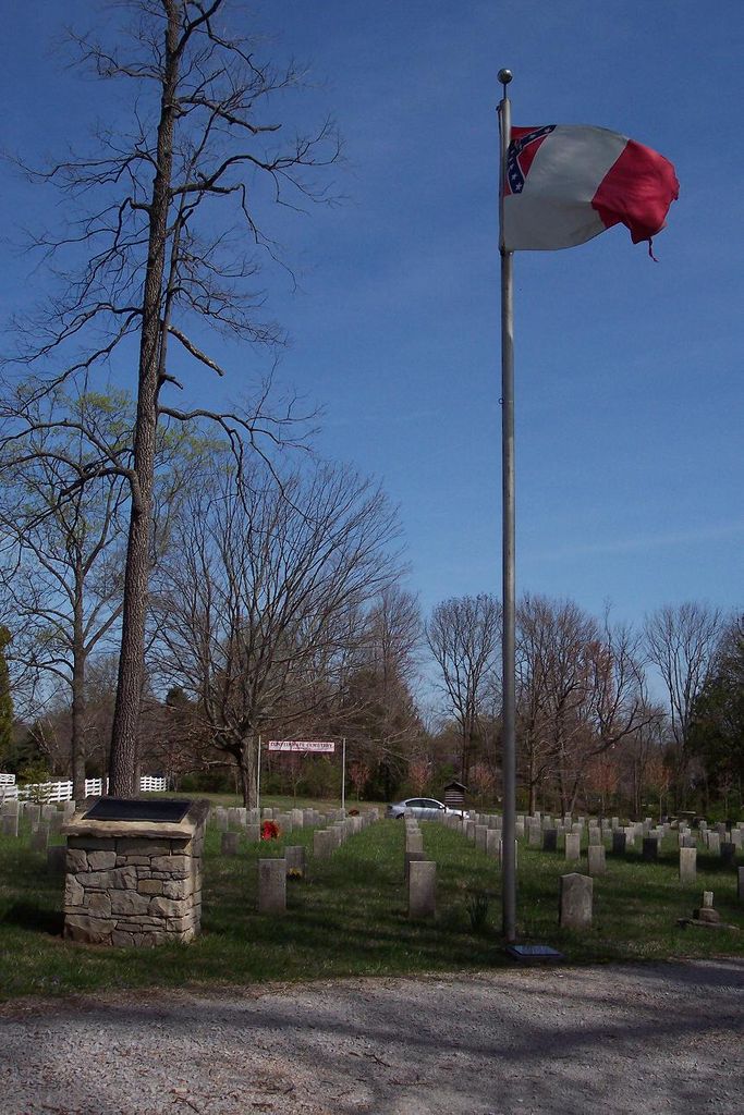
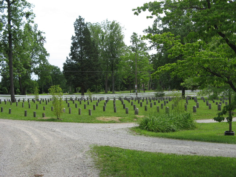
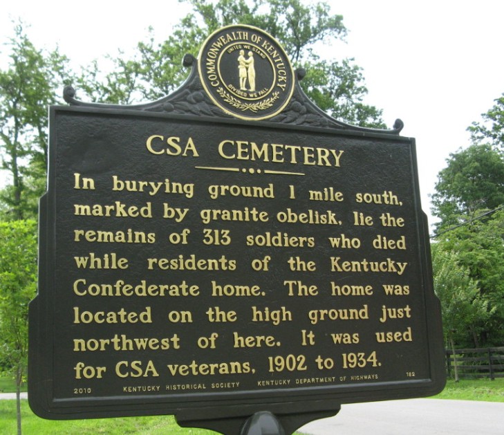
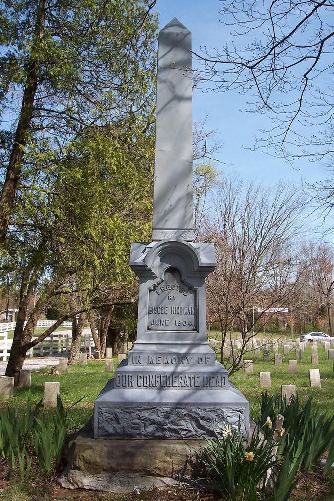
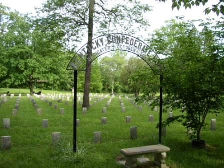
| Description | : | The cemetery is located on both sides of Maple Avenue about 0.1 miles west of its intersection with Cross Brook Drive. The cemetery was established in May 1871. With the extension of Maple Avenue through the cemetery in 1889, the white and African American sections were separated by the road. The African American section is referred to as Pewee Valley Cemetery East and is on the north side of Maple Avenue. In 1904, a section of the cemetery on the south side of Maple Avenue was assigned to the State of Kentucky for use by the Kentucky Confederate... Read More |
frequently asked questions (FAQ):
-
Where is Pewee Valley Cemetery?
Pewee Valley Cemetery is located at Maple Avenue Pewee Valley, Oldham County ,Kentucky , 40056USA.
-
Pewee Valley Cemetery cemetery's updated grave count on graveviews.com?
4 memorials
-
Where are the coordinates of the Pewee Valley Cemetery?
Latitude: 38.3044014
Longitude: -85.4749985
Nearby Cemetories:
1. Pewee Valley East Cemetery
Pewee Valley, Oldham County, USA
Coordinate: 38.3044444, -85.4752778
2. Confederate Cemetery
Pewee Valley, Oldham County, USA
Coordinate: 38.3032990, -85.4760971
3. Saint James Episcopal Church Cemetery
Pewee Valley, Oldham County, USA
Coordinate: 38.3131530, -85.4847110
4. Yager Cemetery #1
Floydsburg, Oldham County, USA
Coordinate: 38.3006859, -85.4574203
5. Floydsburg Cemetery
Crestwood, Oldham County, USA
Coordinate: 38.3108444, -85.4581146
6. Allen Cemetery
Louisville, Jefferson County, USA
Coordinate: 38.2893030, -85.4784340
7. Speer Cemetery
Crestwood, Oldham County, USA
Coordinate: 38.3130830, -85.4571940
8. Souther Cemetery
Pewee Valley, Oldham County, USA
Coordinate: 38.3115830, -85.4988890
9. Saint Aloysius Cemetery
Pewee Valley, Oldham County, USA
Coordinate: 38.3185800, -85.4967200
10. James Ward Cemetery
Louisville, Jefferson County, USA
Coordinate: 38.2796580, -85.4840650
11. Bradshaw Cemetery
Crestwood, Oldham County, USA
Coordinate: 38.3015000, -85.4342780
12. Williams Cemetery
Crestwood, Oldham County, USA
Coordinate: 38.3333720, -85.4571370
13. Wooden Cemetery
Glenarm, Oldham County, USA
Coordinate: 38.3351600, -85.4617880
14. Boulware Cemetery
Pewee Valley, Oldham County, USA
Coordinate: 38.3159720, -85.4351670
15. Goldstein Cemetery
Louisville, Jefferson County, USA
Coordinate: 38.3086410, -85.5211130
16. Jackson Family Cemetery
Louisville, Jefferson County, USA
Coordinate: 38.2782823, -85.4420730
17. Williams-Phillips Cemetery
Fincastle, Jefferson County, USA
Coordinate: 38.3044720, -85.5340540
18. Curl Cemetery
Crestwood, Oldham County, USA
Coordinate: 38.3366640, -85.4325660
19. Louisville Memorial Gardens East
Louisville, Jefferson County, USA
Coordinate: 38.3196983, -85.5307999
20. Flat Rock Christian Church Cemetery
Louisville, Jefferson County, USA
Coordinate: 38.2866600, -85.4168200
21. Pleasant Grove Cemetery
Anchorage, Jefferson County, USA
Coordinate: 38.2585280, -85.4970430
22. Clore Cemetery
Brownsboro, Oldham County, USA
Coordinate: 38.3526670, -85.4862500
23. Berrytown Cemetery
Louisville, Jefferson County, USA
Coordinate: 38.2689200, -85.5204960
24. Walden Cemetery
Long Run, Jefferson County, USA
Coordinate: 38.2657200, -85.4317400