
| Memorials | : | 0 |
| Location | : | Mindelstetten, Landkreis Eichstätt, Germany |
| Coordinate | : | 48.8501480, 11.6439630 |
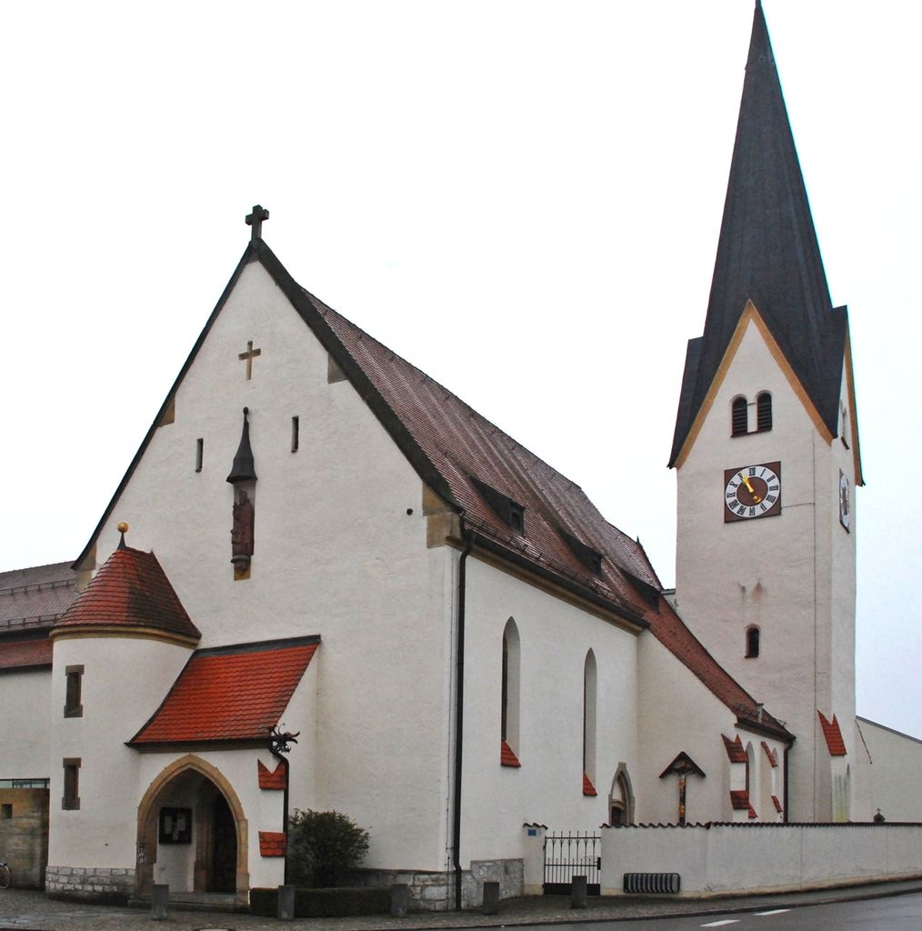
| Description | : | Located in Mindelstetten, Eichstätt County. The church is dedicated to Saint Nikolaus. Its origins date back to the 12th century. Rebuilt and enlarged multiple times during the last 700 years, with the latest renovations done in 1904/05. It is the final resting place for Saint Anna Schäffer. The cemetery of Mindelstetten can be found here. |
frequently asked questions (FAQ):
-
Where is Pfarrkirche Mindelstetten?
Pfarrkirche Mindelstetten is located at Kirchplatz 2 Mindelstetten, Landkreis Eichstätt ,Bavaria (Bayern) , 93349Germany.
-
Pfarrkirche Mindelstetten cemetery's updated grave count on graveviews.com?
0 memorials
-
Where are the coordinates of the Pfarrkirche Mindelstetten?
Latitude: 48.8501480
Longitude: 11.6439630
Nearby Cemetories:
1. Friedhof Mindelstetten
Mindelstetten, Landkreis Eichstätt, Germany
Coordinate: 48.8493990, 11.6512910
2. Friedhof Hüttenhausen
Hüttenhausen, Landkreis Eichstätt, Germany
Coordinate: 48.8484900, 11.6207100
3. Friedhof Theißing
Theissing, Landkreis Eichstätt, Germany
Coordinate: 48.8124631, 11.5816013
4. Friedhof Vohburg an der Donau
Vohburg an der Donau, Landkreis Pfaffenhofen an der Ilm, Germany
Coordinate: 48.7703900, 11.6164220
5. St. Sebastian Kirche
Sandharlanden, Landkreis Kelheim, Germany
Coordinate: 48.8389500, 11.8208200
6. Friedhof Sandharlanden
Sandharlanden, Landkreis Kelheim, Germany
Coordinate: 48.8367800, 11.8244900
7. Kloster Weltenburg
Weltenburg, Landkreis Kelheim, Germany
Coordinate: 48.8989360, 11.8203130
8. Friedhof Holzharlanden
Holzharlanden, Landkreis Kelheim, Germany
Coordinate: 48.8651500, 11.8368400
9. Friedhof Westenhausen
Westenhausen, Landkreis Pfaffenhofen an der Ilm, Germany
Coordinate: 48.7342700, 11.5557500
10. Friedhof Abendsberg
Schwaighausen, Landkreis Regensburg, Germany
Coordinate: 48.8180238, 11.8380722
11. Friedhof Abensberg
Abensberg, Landkreis Kelheim, Germany
Coordinate: 48.8177900, 11.8382200
12. Denkendorf St. Laurentius
Denkendorf, Landkreis Eichstätt, Germany
Coordinate: 48.9282500, 11.4560100
13. Denkendorf
Denkendorf, Landkreis Eichstätt, Germany
Coordinate: 48.9301700, 11.4540200
14. Kloster Biburg
Biburg, Landkreis Kelheim, Germany
Coordinate: 48.7921690, 11.8566110
15. Waldfriedhof Kelheim
Kelheim, Landkreis Kelheim, Germany
Coordinate: 48.9106500, 11.8587500
16. Friedhof Geisenfeld
Geisenfeld, Landkreis Pfaffenhofen an der Ilm, Germany
Coordinate: 48.6901600, 11.6138600
17. Alter Friedhof Kelheim
Kelheim, Landkreis Kelheim, Germany
Coordinate: 48.9200000, 11.8801800
18. Münster Zur Schönen Unserer Lieben Frau
Ingolstadt, Stadtkreis Ingolstadt, Germany
Coordinate: 48.7642510, 11.4205030
19. Ingolstadt Westfriedhof
Ingolstadt, Stadtkreis Ingolstadt, Germany
Coordinate: 48.7650400, 11.4093980
20. Friedhof Unterpindhart
Unterpindhart, Landkreis Pfaffenhofen an der Ilm, Germany
Coordinate: 48.6733265, 11.6797093
21. Friedhof Unsernherrn
Ingolstadt, Stadtkreis Ingolstadt, Germany
Coordinate: 48.7267183, 11.4435747
22. Friedhof Offenstetten
Abensberg, Landkreis Kelheim, Germany
Coordinate: 48.8033630, 11.9098060
23. Friedhof Oberstimm
Oberstimm, Landkreis Pfaffenhofen an der Ilm, Germany
Coordinate: 48.7112155, 11.4607631
24. Friedhof Oberpindhart
Oberpindhart, Landkreis Kelheim, Germany
Coordinate: 48.6696563, 11.7029125