
| Memorials | : | 0 |
| Location | : | Sandharlanden, Landkreis Kelheim, Germany |
| Coordinate | : | 48.8389500, 11.8208200 |
| Description | : | other cemeteries in the county of Kelheim (Landkreis Kelheim CScnty=4863): ► Cemeteries in Kelheim county |
frequently asked questions (FAQ):
-
Where is St. Sebastian Kirche?
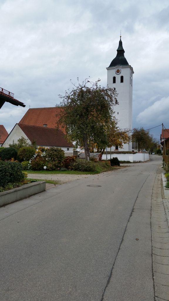
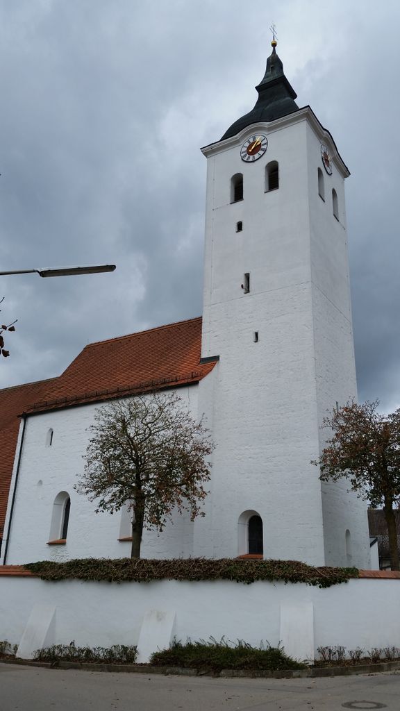
St. Sebastian Kirche is located at Kirchplatz 3 Sandharlanden, Landkreis Kelheim ,Bavaria (Bayern) , 93326Germany.
-
St. Sebastian Kirche cemetery's updated grave count on graveviews.com?
0 memorials
-
Where are the coordinates of the St. Sebastian Kirche?
Latitude: 48.8389500
Longitude: 11.8208200
Nearby Cemetories:
1. Friedhof Sandharlanden
Sandharlanden, Landkreis Kelheim, Germany
Coordinate: 48.8367800, 11.8244900
2. Friedhof Abendsberg
Schwaighausen, Landkreis Regensburg, Germany
Coordinate: 48.8180238, 11.8380722
3. Friedhof Abensberg
Abensberg, Landkreis Kelheim, Germany
Coordinate: 48.8177900, 11.8382200
4. Friedhof Holzharlanden
Holzharlanden, Landkreis Kelheim, Germany
Coordinate: 48.8651500, 11.8368400
5. Kloster Biburg
Biburg, Landkreis Kelheim, Germany
Coordinate: 48.7921690, 11.8566110
6. Kloster Weltenburg
Weltenburg, Landkreis Kelheim, Germany
Coordinate: 48.8989360, 11.8203130
7. Friedhof Offenstetten
Abensberg, Landkreis Kelheim, Germany
Coordinate: 48.8033630, 11.9098060
8. Waldfriedhof Kelheim
Kelheim, Landkreis Kelheim, Germany
Coordinate: 48.9106500, 11.8587500
9. Alter Friedhof Kelheim
Kelheim, Landkreis Kelheim, Germany
Coordinate: 48.9200000, 11.8801800
10. Friedhof Kelheimwinzer
Kelheimwinzer, Landkreis Kelheim, Germany
Coordinate: 48.9138000, 11.9085700
11. Friedhof Saal Donau
Saal an der Donau, Landkreis Kelheim, Germany
Coordinate: 48.9008500, 11.9396400
12. Friedhof Mindelstetten
Mindelstetten, Landkreis Eichstätt, Germany
Coordinate: 48.8493990, 11.6512910
13. Pfarrkirche Mindelstetten
Mindelstetten, Landkreis Eichstätt, Germany
Coordinate: 48.8501480, 11.6439630
14. Friedhof Hüttenhausen
Hüttenhausen, Landkreis Eichstätt, Germany
Coordinate: 48.8484900, 11.6207100
15. Friedhof Kapfelberg
Kapfelberg, Landkreis Kelheim, Germany
Coordinate: 48.9313645, 11.9841941
16. Friedhof Vohburg an der Donau
Vohburg an der Donau, Landkreis Pfaffenhofen an der Ilm, Germany
Coordinate: 48.7703900, 11.6164220
17. Friedhof Theißing
Theissing, Landkreis Eichstätt, Germany
Coordinate: 48.8124631, 11.5816013
18. Friedhof Bergmatting
Bergmatting, Landkreis Regensburg, Germany
Coordinate: 48.9692808, 11.9813400
19. Friedhof Viehhausen
Viehhausen, Landkreis Regensburg, Germany
Coordinate: 48.9799884, 11.9625860
20. Friedhof Abbach
Bad Abbach, Landkreis Kelheim, Germany
Coordinate: 48.9350284, 12.0521349
21. Friedhof Oberpindhart
Oberpindhart, Landkreis Kelheim, Germany
Coordinate: 48.6696563, 11.7029125
22. Friedhof Unterpindhart
Unterpindhart, Landkreis Pfaffenhofen an der Ilm, Germany
Coordinate: 48.6733265, 11.6797093
23. Kirchlicher Friedhof Eilsbrunn
Eilsbrunn, Landkreis Regensburg, Germany
Coordinate: 49.0044463, 11.9752872
24. Friedhof Geisenfeld
Geisenfeld, Landkreis Pfaffenhofen an der Ilm, Germany
Coordinate: 48.6901600, 11.6138600