
| Memorials | : | 1 |
| Location | : | Grant County, USA |
| Coordinate | : | 32.6226050, -108.3039090 |
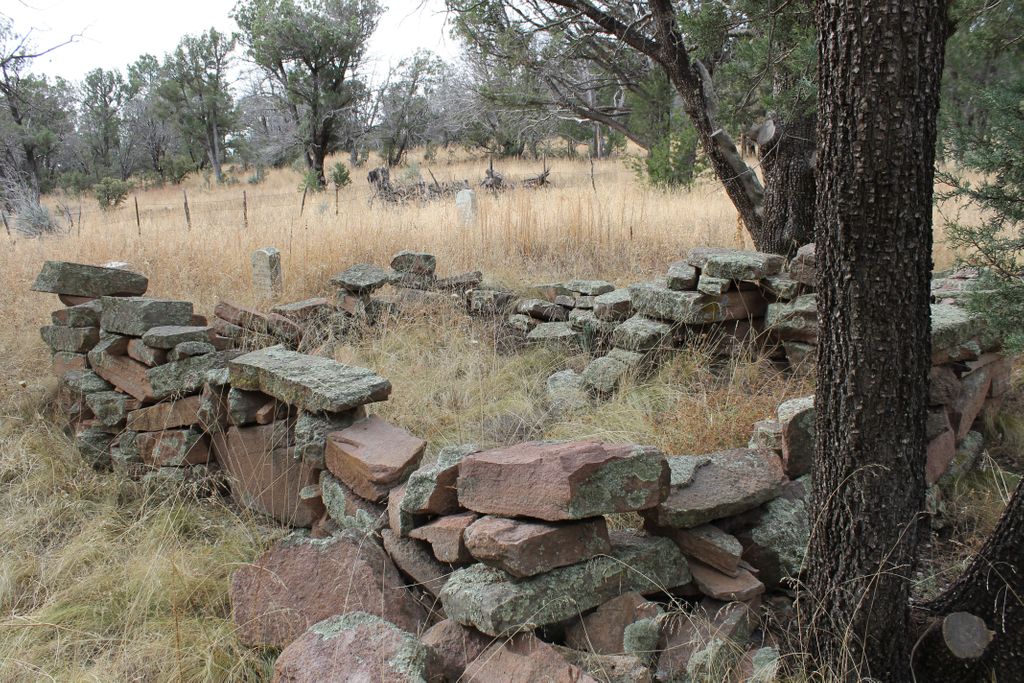
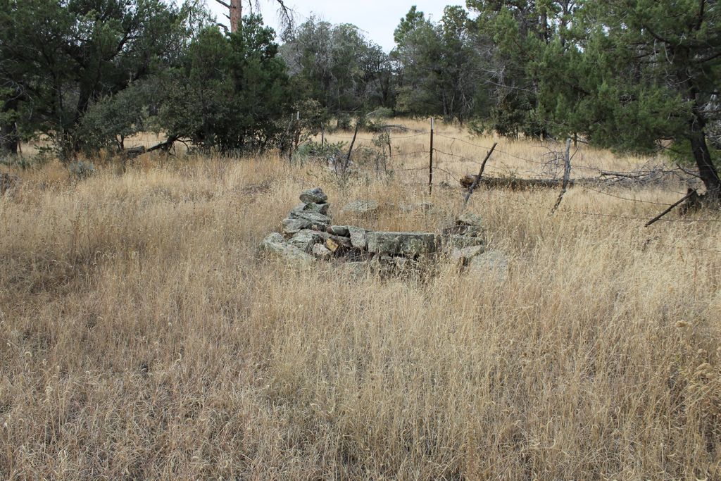
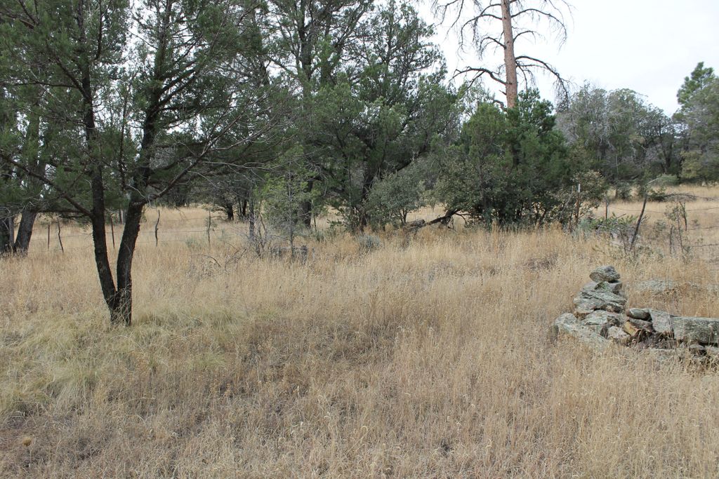
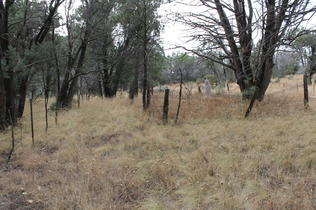
| Description | : | This cemetery is located 10.3 miles south of the Mule Creek Post Office, off Forest Road 112. To reach the cemetery, turn south from New Mexico State Highway 78 at the Mule Creek Post Office on to Forest Road 112. Approximately 10 miles south of Mule Creek Post Office there is a metal gateway with the words "Pine Cienega" over the roadway. Another .3 mile, after crossing a cement low water crossing across Pine Cienega Creek, an unmarked road turns to the left. 7/10ths of a mile in a northerly direction the road will enter a meadow along Pine Cienega... Read More |
frequently asked questions (FAQ):
-
Where is Pine Cienega Cemetery?
Pine Cienega Cemetery is located at Grant County ,New Mexico ,USA.
-
Pine Cienega Cemetery cemetery's updated grave count on graveviews.com?
1 memorials
-
Where are the coordinates of the Pine Cienega Cemetery?
Latitude: 32.6226050
Longitude: -108.3039090
Nearby Cemetories:
1. Savannah Cemetery
Tyrone, Grant County, USA
Coordinate: 32.6443000, -108.3568000
2. Gustava Glaze Gravesite
Grant County, USA
Coordinate: 32.5309240, -108.3568690
3. Saint Vincent de Paul Catholic Cemetery
Silver City, Grant County, USA
Coordinate: 32.7572861, -108.2812361
4. Masonic Cemetery
Silver City, Grant County, USA
Coordinate: 32.7572972, -108.2812361
5. Hurley Cemetery
Hurley, Grant County, USA
Coordinate: 32.6885986, -108.1363983
6. Memory Lane Cemetery
Silver City, Grant County, USA
Coordinate: 32.7830000, -108.2570000
7. Bayard Cemetery
Bayard, Grant County, USA
Coordinate: 32.7403620, -108.1326270
8. Santa Clara Cemetery
Central, Grant County, USA
Coordinate: 32.7701920, -108.1530590
9. Fort Bayard Memorial Cemetery
Fort Bayard, Grant County, USA
Coordinate: 32.7907000, -108.1565000
10. Fort Bayard National Cemetery
Fort Bayard, Grant County, USA
Coordinate: 32.7989006, -108.1541977
11. Vanadium Cemetery
Vanadium, Grant County, USA
Coordinate: 32.7820000, -108.1100000
12. Peace of the Wilderness Cemetery
Silver City, Grant County, USA
Coordinate: 32.8682050, -108.2875500
13. Pinos Altos Community Cemetery
Pinos Altos, Grant County, USA
Coordinate: 32.8672791, -108.2173004
14. Hanover Cemetery
Hanover, Grant County, USA
Coordinate: 32.8063000, -108.0893000
15. Gold Hill Cemetery
Grant County, USA
Coordinate: 32.4338989, -108.5269012
16. Santa Rita Cemetery #4
Santa Rita, Grant County, USA
Coordinate: 32.8137200, -108.0576200
17. Santa Rita #4
Santa Rita (Noriega y Anexo), Santa Bárbara Municipality, Mexico
Coordinate: 32.8136425, -108.0571579
18. Fierro Cemetery
Fierro, Grant County, USA
Coordinate: 32.8436012, -108.0755997
19. Coleson's Crossing Cemetery
Dwyer, Grant County, USA
Coordinate: 32.5682540, -107.9522090
20. Billings Cemetery
Gila, Grant County, USA
Coordinate: 32.8129900, -108.5989700
21. Georgetown Cemetery
Silver City, Grant County, USA
Coordinate: 32.8405991, -108.0147018
22. Foster Cemetery
Luna County, USA
Coordinate: 32.5862410, -107.9062660
23. Redrock Cemetery
Redrock, Grant County, USA
Coordinate: 32.7083015, -108.7024994
24. Dwyer Cemetery
Dwyer, Grant County, USA
Coordinate: 32.6231600, -107.8792400