
| Memorials | : | 0 |
| Location | : | Pine Ridge, Surry County, USA |
| Coordinate | : | 36.4995842, -80.7190552 |
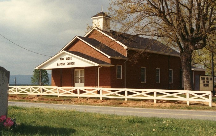
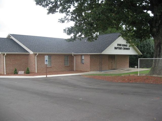
| Description | : | From the intersection of Pine Ridge Road and West Pine Street (NC Highway 89), travel approximately 0.13 miles north on Pine Ridge Road; the cemetery will be on the left. The cemetery is located across the road from Pine Ridge Baptist Church. |
frequently asked questions (FAQ):
-
Where is Pine Ridge Baptist Church Cemetery?
Pine Ridge Baptist Church Cemetery is located at Pine Ridge Road Pine Ridge, Surry County ,North Carolina , 27030USA.
-
Pine Ridge Baptist Church Cemetery cemetery's updated grave count on graveviews.com?
0 memorials
-
Where are the coordinates of the Pine Ridge Baptist Church Cemetery?
Latitude: 36.4995842
Longitude: -80.7190552
Nearby Cemetories:
1. Semper Fi Cemetery
Pine Ridge, Surry County, USA
Coordinate: 36.5010540, -80.7216920
2. Tucker Cemetery
Mount Airy, Surry County, USA
Coordinate: 36.4908905, -80.7153091
3. Tucker Cemetery
Pine Ridge, Surry County, USA
Coordinate: 36.4908889, -80.7153056
4. Laurel Springs Primitive Baptist Church Cemetery
Pine Ridge, Surry County, USA
Coordinate: 36.4821930, -80.7263031
5. Maple Grove United Methodist Church Cemetery
Pine Ridge, Surry County, USA
Coordinate: 36.5237770, -80.7171402
6. Community Baptist Church Cemetery
Red Brush, Surry County, USA
Coordinate: 36.4713593, -80.7171097
7. Antioch Baptist Church Cemetery
Toast, Surry County, USA
Coordinate: 36.5038872, -80.6841660
8. Surry County Veterans Cemetery
Toast, Surry County, USA
Coordinate: 36.5052800, -80.6835300
9. Union Hill Friends Church Cemetery
Red Brush, Surry County, USA
Coordinate: 36.4714410, -80.6956890
10. Johnson Puckett Cemetery
Mount Airy, Surry County, USA
Coordinate: 36.5306740, -80.7362830
11. Oak Grove Baptist Church Cemetery
Oak Grove (Bottom), Surry County, USA
Coordinate: 36.4788770, -80.7540890
12. Beamer Cemetery
Mount Airy, Surry County, USA
Coordinate: 36.5343060, -80.7012220
13. Furbee Cemetery
Wetzel County, USA
Coordinate: 36.5363984, -80.7316687
14. Johnson Family Cemetery
Mount Airy, Surry County, USA
Coordinate: 36.5037500, -80.6698330
15. Genesis Full Gospel Church Cemetery
Toast, Surry County, USA
Coordinate: 36.5120010, -80.6711960
16. Golding Family Cemetery
Mount Airy, Surry County, USA
Coordinate: 36.5326670, -80.7528330
17. Snow Cemetery
Mount Airy, Surry County, USA
Coordinate: 36.5422500, -80.7299170
18. Zion Hill Primitive Baptist Church Cemetery
Crooked Oak, Surry County, USA
Coordinate: 36.5313339, -80.7572250
19. Moore Family Cemetery
Mount Airy, Surry County, USA
Coordinate: 36.4919910, -80.7741450
20. Holy Cross Missionary Baptist Church Cemetery
Beulah, Surry County, USA
Coordinate: 36.4702640, -80.7655040
21. McCraw Cemetery
Beulah, Surry County, USA
Coordinate: 36.4671370, -80.7626220
22. Zion United Methodist Cemetery
Mount Airy, Surry County, USA
Coordinate: 36.5326958, -80.6725845
23. Beulah United Methodist Church Cemetery
Beulah, Surry County, USA
Coordinate: 36.4865160, -80.7795830
24. Westside Baptist Church Cemetery
Toast, Surry County, USA
Coordinate: 36.4859720, -80.6574720