
| Memorials | : | 10 |
| Location | : | Crooked Oak, Surry County, USA |
| Coordinate | : | 36.5313339, -80.7572250 |
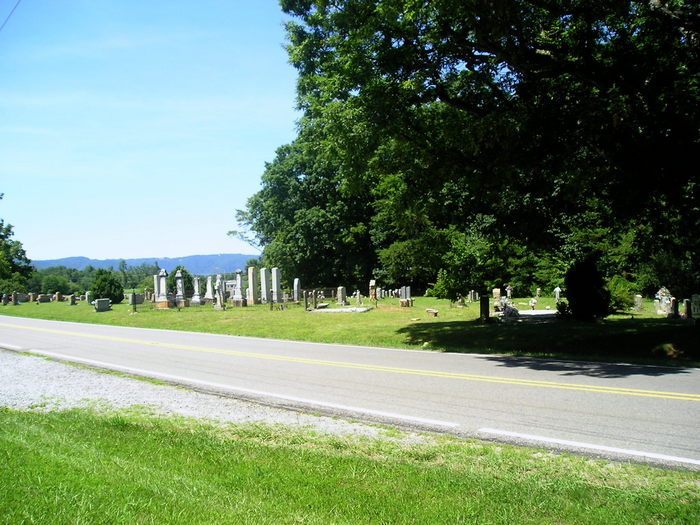
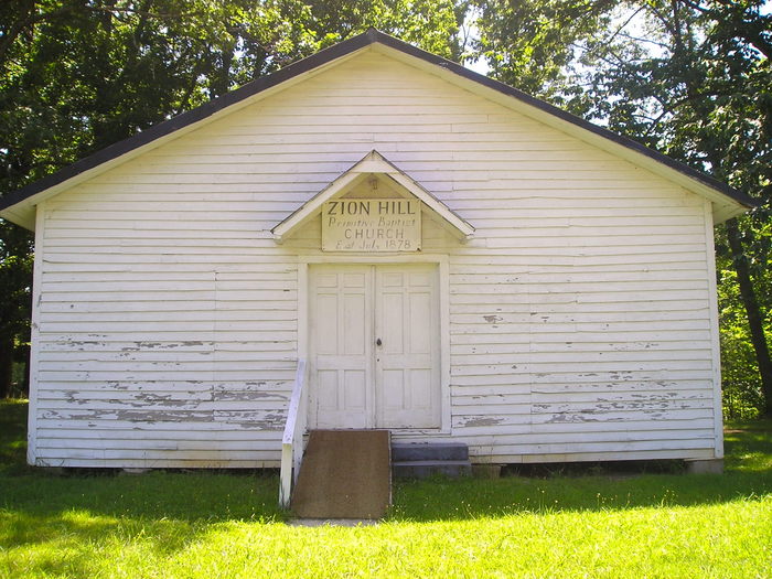
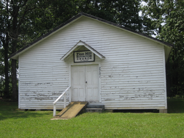
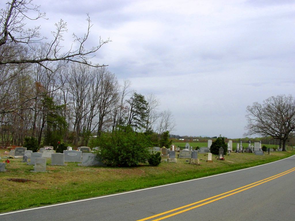
| Description | : | From the intersection of Pine Ridge Road and West Pine Street (NC Highway 89), travel approximately 3.36 miles north on Pine Ridge Road; the cemetery will be on the right across the road from the church. |
frequently asked questions (FAQ):
-
Where is Zion Hill Primitive Baptist Church Cemetery?
Zion Hill Primitive Baptist Church Cemetery is located at 2751 Pine Ridge Road Crooked Oak, Surry County ,North Carolina , 27030USA.
-
Zion Hill Primitive Baptist Church Cemetery cemetery's updated grave count on graveviews.com?
10 memorials
-
Where are the coordinates of the Zion Hill Primitive Baptist Church Cemetery?
Latitude: 36.5313339
Longitude: -80.7572250
Nearby Cemetories:
1. Golding Family Cemetery
Mount Airy, Surry County, USA
Coordinate: 36.5326670, -80.7528330
2. Johnson Puckett Cemetery
Mount Airy, Surry County, USA
Coordinate: 36.5306740, -80.7362830
3. Ivy Green Baptist Church Cemetery
Crooked Oak, Surry County, USA
Coordinate: 36.5381927, -80.7771683
4. Jarrell Family Graveyard
Lowgap, Surry County, USA
Coordinate: 36.5362520, -80.7798310
5. Furbee Cemetery
Wetzel County, USA
Coordinate: 36.5363984, -80.7316687
6. Blue Ridge Baptist Church Cemetery
Crooked Oak, Surry County, USA
Coordinate: 36.5490440, -80.7727400
7. Snow Cemetery
Mount Airy, Surry County, USA
Coordinate: 36.5422500, -80.7299170
8. Holder Cemetery
Lowgap, Surry County, USA
Coordinate: 36.5364670, -80.7875720
9. Round Peak Primitive Baptist Church Cemetery
Round Peak, Surry County, USA
Coordinate: 36.5145264, -80.7861633
10. Phillip Haywood McBride Family Cemetery
Lowgap, Surry County, USA
Coordinate: 36.5602950, -80.7678630
11. Maple Grove United Methodist Church Cemetery
Pine Ridge, Surry County, USA
Coordinate: 36.5237770, -80.7171402
12. Imogene Baptist Church Cemetery
Pine Ridge, Surry County, USA
Coordinate: 36.5521393, -80.7203598
13. Low Family Cemetery
Lowgap, Surry County, USA
Coordinate: 36.5461430, -80.7985910
14. Dillard Family Cemetery
Lowgap, Surry County, USA
Coordinate: 36.5500298, -80.8002243
15. Semper Fi Cemetery
Pine Ridge, Surry County, USA
Coordinate: 36.5010540, -80.7216920
16. Moore Family Cemetery
Mount Airy, Surry County, USA
Coordinate: 36.4919910, -80.7741450
17. Stewart Cemetery
Lambsburg, Carroll County, USA
Coordinate: 36.5681860, -80.7855490
18. Pine Ridge Baptist Church Cemetery
Pine Ridge, Surry County, USA
Coordinate: 36.4995842, -80.7190552
19. Jarrell Family Cemetery
Lowgap, Surry County, USA
Coordinate: 36.5427860, -80.8103660
20. Holly Grove Baptist Church Cemetery
Lambsburg, Carroll County, USA
Coordinate: 36.5712840, -80.7810790
21. Beamer Cemetery
Mount Airy, Surry County, USA
Coordinate: 36.5343060, -80.7012220
22. Payne Cemetery
Lowgap, Surry County, USA
Coordinate: 36.4947220, -80.7928060
23. Edwards-Upchurch Cemetery
Lambsburg, Carroll County, USA
Coordinate: 36.5750140, -80.7788060
24. Fellowship Tabernacle Cemetery
Lambsburg, Carroll County, USA
Coordinate: 36.5769680, -80.7723510