
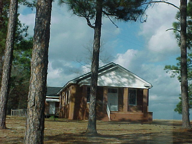
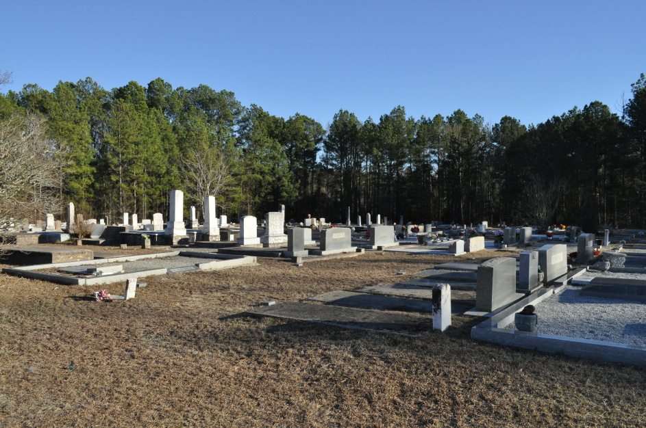
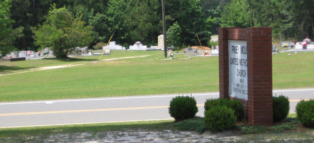
| Memorials | : | 1 |
| Location | : | Wrightsville, Johnson County, USA |
| Coordinate | : | 32.6459300, -82.7100340 |
| Description | : | Cemetery location for maps: Latitude: 32.646007 Longitude: - 82.710139 |
frequently asked questions (FAQ):
-
Where is Piney Mount Cemetery?
Piney Mount Cemetery is located at Wrightsville, Johnson County ,Georgia ,USA.
-
Piney Mount Cemetery cemetery's updated grave count on graveviews.com?
1 memorials
-
Where are the coordinates of the Piney Mount Cemetery?
Latitude: 32.6459300
Longitude: -82.7100340

Nearby Cemetories:
1. Carter Cemetery
Spann, Johnson County, USA
Coordinate: 32.6385710, -82.7262030
2. Union Grove Church Cemetery
Spann, Johnson County, USA
Coordinate: 32.6429405, -82.7387466
3. Harriett Carter Cemetery
Wrightsville, Johnson County, USA
Coordinate: 32.6549750, -82.6830800
4. Pinehill Holiness Church Cemetery
Wrightsville, Johnson County, USA
Coordinate: 32.6665800, -82.7313620
5. Thomas Chapel Methodist Church Cemetery
Dublin, Laurens County, USA
Coordinate: 32.6071360, -82.7139700
6. Brantley Chapel Church Cemetery
Wrightsville, Johnson County, USA
Coordinate: 32.6779300, -82.7384700
7. Lovett Grove Community Baptist Church Cemetery
Wrightsville, Johnson County, USA
Coordinate: 32.6800750, -82.7399620
8. Lovett Cemetery
Laurens County, USA
Coordinate: 32.6481200, -82.7715970
9. Liberty Grove Cemetery
Johnson County, USA
Coordinate: 32.6588510, -82.6493950
10. Community Missionary Baptist Church Cemetery
Wrightsville, Johnson County, USA
Coordinate: 32.7030550, -82.7140480
11. Sumner-Anthony Cemetery
Wrightsville, Johnson County, USA
Coordinate: 32.7034264, -82.7170105
12. Brown's Chapel Missionary Cemetery
East Dublin, Laurens County, USA
Coordinate: 32.6418970, -82.7788520
13. Red Hill Cemetery
Johnson County, USA
Coordinate: 32.6049995, -82.6557999
14. Galilee Church Cemetery
Wrightsville, Johnson County, USA
Coordinate: 32.7059010, -82.7299100
15. Snell Cemetery
Meeks, Johnson County, USA
Coordinate: 32.6547012, -82.6355972
16. Bay Springs Baptist Church Cemetery
Scott, Johnson County, USA
Coordinate: 32.5930610, -82.6671900
17. Mount Olive Church of the Nazarene Cemetery
Wrightsville, Johnson County, USA
Coordinate: 32.6010600, -82.6518520
18. Mount Green Baptist Church Cemetery
East Dublin, Laurens County, USA
Coordinate: 32.6141800, -82.7810400
19. Brazeal Church Cemetery
Laurens County, USA
Coordinate: 32.6140340, -82.7813390
20. Smith Cemetery
Scott, Johnson County, USA
Coordinate: 32.6044006, -82.6386032
21. Pleasant Grove Baptist Church Cemetery
Wrightsville, Johnson County, USA
Coordinate: 32.6900690, -82.7841220
22. Mitchell Grove Baptist Church Cemetery
Wrightsville, Johnson County, USA
Coordinate: 32.6987990, -82.7770830
23. Cypress Grove Church Cemetery
Wrightsville, Johnson County, USA
Coordinate: 32.7188900, -82.6741700
24. Mount Pullen A.M.E. Cemetery
Laurens County, USA
Coordinate: 32.6383250, -82.8035430