
| Memorials | : | 1 |
| Location | : | Pistol River, Curry County, USA |
| Coordinate | : | 42.2902985, -124.3985977 |
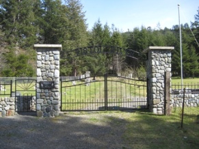
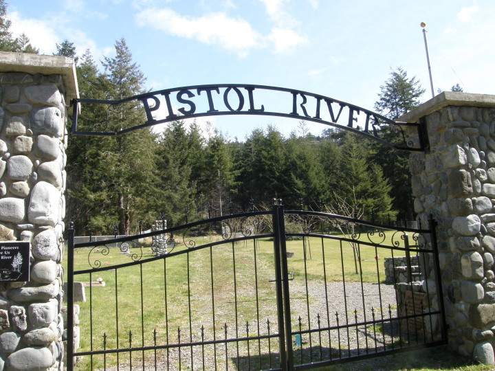
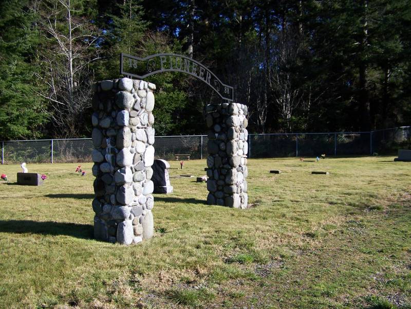
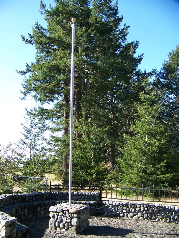
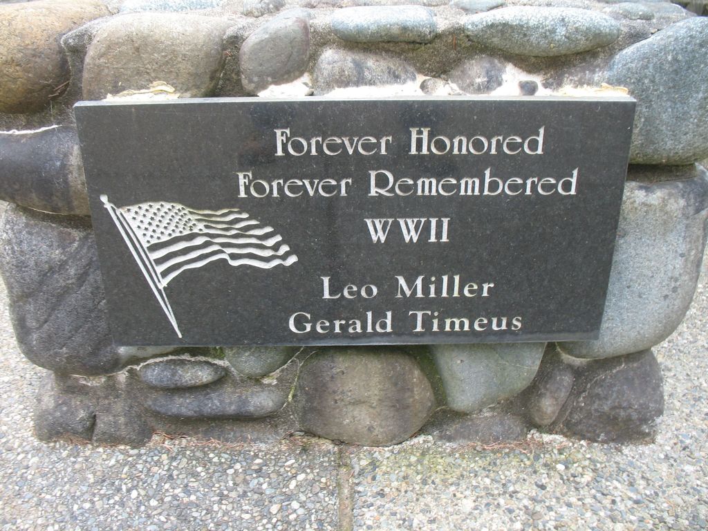
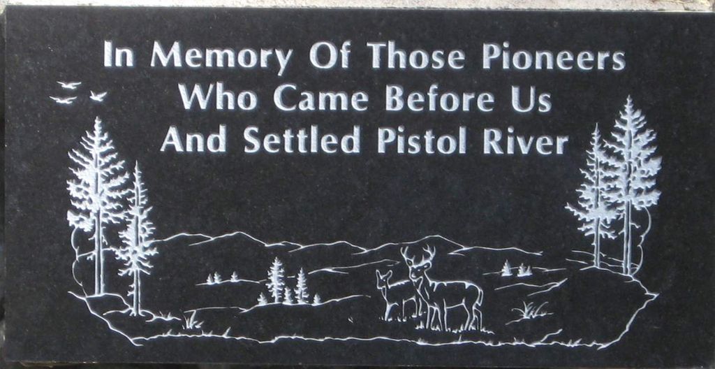
| Description | : | Pistol River Cemetery, Curry County, actually has an internal section, complete with wrought iron arch and name, designating presumably that section as "Pistol River Pioneer" Cemetery, AND to make matters more confusing, "Pistol River" is actually a part of the municipality of "Gold Beach" Curry County! But it has retained a strong independent "neighborhood" identity and so is thought of as "separate". |
frequently asked questions (FAQ):
-
Where is Pistol River Cemetery?
Pistol River Cemetery is located at Pistol River, Curry County ,Oregon , 97444USA.
-
Pistol River Cemetery cemetery's updated grave count on graveviews.com?
1 memorials
-
Where are the coordinates of the Pistol River Cemetery?
Latitude: 42.2902985
Longitude: -124.3985977
Nearby Cemetories:
1. Smith Family Cemetery
Curry County, USA
Coordinate: 42.3833008, -124.4141998
2. Rogue River Cemetery
Gold Beach, Curry County, USA
Coordinate: 42.3930000, -124.4205000
3. Gold Beach Pioneer Cemetery
Gold Beach, Curry County, USA
Coordinate: 42.4128250, -124.4216920
4. Keys Memorial
Gold Beach, Curry County, USA
Coordinate: 42.4633790, -124.4262180
5. Cooper Grave
Carpenterville, Curry County, USA
Coordinate: 42.1214670, -124.3382530
6. Edson Cemetery
Gold Beach, Curry County, USA
Coordinate: 42.4848360, -124.4026150
7. Harriett Edson Plot
Nesika Beach, Curry County, USA
Coordinate: 42.4856500, -124.4029700
8. Geisel Family Cemetery
Gold Beach, Curry County, USA
Coordinate: 42.4905840, -124.4158480
9. Rumley Hill Cemetery
Curry County, USA
Coordinate: 42.4883003, -124.3480988
10. Merriam Cemetery
Gold Beach, Curry County, USA
Coordinate: 42.4893990, -124.3319016
11. Pierson Memorial
Nesika Beach, Curry County, USA
Coordinate: 42.5095920, -124.4107030
12. Lyman Albert Woodruff Gravesite
Curry County, USA
Coordinate: 42.5183290, -124.4071140
13. Ward Memorial Cemetery
Brookings, Curry County, USA
Coordinate: 42.0681000, -124.2818985
14. Old Brookings Cemetery
Brookings, Curry County, USA
Coordinate: 42.0619130, -124.2775670
15. Saint Timothys Episcopal Church Memorial Garden
Brookings, Curry County, USA
Coordinate: 42.0570560, -124.2757830
16. Van Pelt Cemetery
Harbor, Curry County, USA
Coordinate: 42.0480995, -124.2489014
17. Oceanview Cemetery
Harbor, Curry County, USA
Coordinate: 42.0424200, -124.2463400
18. Fox Hill Cemetery
Curry County, USA
Coordinate: 42.5647011, -124.3861008
19. Navy PBY-5A Aircraft Crash Site Memorial
Brookings, Curry County, USA
Coordinate: 42.1331446, -124.0036297
20. Costelloe Cemetery
Curry County, USA
Coordinate: 42.0148780, -124.1127480
21. Oak Flats Cemetery
Agness, Curry County, USA
Coordinate: 42.5292015, -124.0389023
22. Edgerton Family Gravesite
Agness, Curry County, USA
Coordinate: 42.5632960, -124.0787550
23. How-On-Quet Cemetery
Del Norte County, USA
Coordinate: 41.9553170, -124.2067690
24. Lucas Grave
Agness, Curry County, USA
Coordinate: 42.5749530, -124.0516740