| Memorials | : | 28 |
| Location | : | Spink, Union County, USA |
| Coordinate | : | 42.8741000, -96.6876000 |
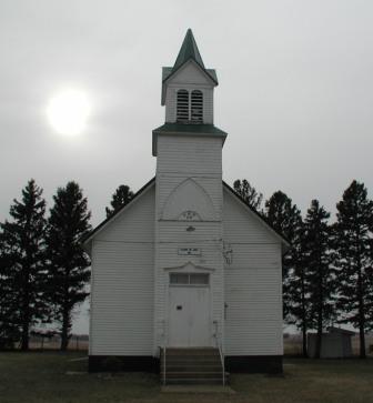
| Description | : | The land for this cemetery and chapel was donated in 1904 by Mr. and Mrs. John Welch. In 1925, most of the graves from the Old Pleasant Hill Cemetery were moved to this cemetery. A few graves still remain at the old cemetery. |
frequently asked questions (FAQ):
-
Where is Pleasant Hill Cemetery?
Pleasant Hill Cemetery is located at 476th Avenue Spink, Union County ,South Dakota ,USA.
-
Pleasant Hill Cemetery cemetery's updated grave count on graveviews.com?
28 memorials
-
Where are the coordinates of the Pleasant Hill Cemetery?
Latitude: 42.8741000
Longitude: -96.6876000
Nearby Cemetories:
1. Pleasant Hill Cemetery Old
Spink, Union County, USA
Coordinate: 42.8588462, -96.7215592
2. Brule Creek Cemetery
Spink Township, Union County, USA
Coordinate: 42.8346510, -96.7324350
3. Nora Cemetery
Union County, USA
Coordinate: 42.9314003, -96.7061005
4. Olbue Lerseth Cemetery
Beresford, Union County, USA
Coordinate: 42.9281100, -96.7516100
5. Ahlsborg Lutheran Cemetery
Union County, USA
Coordinate: 42.8228000, -96.7612000
6. Union Creek Cemetery
Union County, USA
Coordinate: 42.8911018, -96.5863037
7. Saint Mary Cemetery
Union County, USA
Coordinate: 42.8520584, -96.7877502
8. First Brule Creek Cemetery
Elk Point, Union County, USA
Coordinate: 42.7943993, -96.7069016
9. Gores Bluff Cemetery
Union County, USA
Coordinate: 42.8035069, -96.6260468
10. Roseni Lutheran Church Cemetery
Beresford, Union County, USA
Coordinate: 42.9388000, -96.7639000
11. Big Springs Cemetery
Big Springs, Union County, USA
Coordinate: 42.9379000, -96.6090000
12. Mount Hope Cemetery
Union County, USA
Coordinate: 42.8885994, -96.5667038
13. Old Big Springs Cemetery
Big Springs, Union County, USA
Coordinate: 42.9455986, -96.5868988
14. Richland Cemetery
Richland, Union County, USA
Coordinate: 42.7682991, -96.6624985
15. Union County Poor Farm Cemetery
Union County, USA
Coordinate: 42.7649210, -96.7077580
16. Peace Lutheran Cemetery
Union County, USA
Coordinate: 42.9805984, -96.6481018
17. Saint Paul Cemetery
Elk Point, Union County, USA
Coordinate: 42.7641983, -96.7061005
18. Riverside Cemetery
Akron, Plymouth County, USA
Coordinate: 42.8367004, -96.5453033
19. Saint Joseph Catholic Church Cemetery
Emmet, Union County, USA
Coordinate: 42.9836950, -96.7466350
20. Saint Patricks Cemetery
Akron, Plymouth County, USA
Coordinate: 42.8232300, -96.5374800
21. Rockfield Cemetery
Clay County, USA
Coordinate: 42.9397011, -96.8302994
22. Saint Peter Greenfield Cemetery
Vermillion, Clay County, USA
Coordinate: 42.8608017, -96.8644028
23. Dowlin Cemetery
Burbank, Clay County, USA
Coordinate: 42.7789001, -96.8107986
24. Westfield Township Cemetery
Westfield, Plymouth County, USA
Coordinate: 42.7510986, -96.5914001


