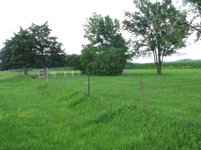
| Memorials | : | 12 |
| Location | : | Burbank, Clay County, USA |
| Coordinate | : | 42.7789001, -96.8107986 |
| Description | : | The cemetery is located on the south side of 318th Street about 0.25 miles west of its intersection with 470th Avenue. The U.S. Geological Survey (USGS) Geographic Names Information System (GNIS) feature ID for the cemetery is 1265187 (Dowlin Cemetery / Burbank Community Cemetery). |
frequently asked questions (FAQ):
-
Where is Dowlin Cemetery?
Dowlin Cemetery is located at 318th Street Burbank, Clay County ,South Dakota , 57010USA.
-
Dowlin Cemetery cemetery's updated grave count on graveviews.com?
12 memorials
-
Where are the coordinates of the Dowlin Cemetery?
Latitude: 42.7789001
Longitude: -96.8107986
Nearby Cemetories:
1. Saint Agnes Cemetery
Vermillion, Clay County, USA
Coordinate: 42.7872009, -96.8499985
2. Ahlsborg Lutheran Cemetery
Union County, USA
Coordinate: 42.8228000, -96.7612000
3. Bluff View Cemetery
Vermillion, Clay County, USA
Coordinate: 42.7714000, -96.9056000
4. Saint Agnes Calvary Cemetery
Vermillion, Clay County, USA
Coordinate: 42.7715900, -96.9072100
5. Saint Mary Cemetery
Union County, USA
Coordinate: 42.8520584, -96.7877502
6. Union County Poor Farm Cemetery
Union County, USA
Coordinate: 42.7649210, -96.7077580
7. First Brule Creek Cemetery
Elk Point, Union County, USA
Coordinate: 42.7943993, -96.7069016
8. Saint Paul Cemetery
Elk Point, Union County, USA
Coordinate: 42.7641983, -96.7061005
9. Brule Creek Cemetery
Spink Township, Union County, USA
Coordinate: 42.8346510, -96.7324350
10. Gibb's Cemetery
Newcastle, Dixon County, USA
Coordinate: 42.6985100, -96.8518400
11. Ionia Cemetery
Newcastle, Dixon County, USA
Coordinate: 42.6893997, -96.8300018
12. Saint Peter Greenfield Cemetery
Vermillion, Clay County, USA
Coordinate: 42.8608017, -96.8644028
13. Pleasant Hill Cemetery Old
Spink, Union County, USA
Coordinate: 42.8588462, -96.7215592
14. Richland Cemetery
Richland, Union County, USA
Coordinate: 42.7682991, -96.6624985
15. Pleasant Hill Cemetery
Spink, Union County, USA
Coordinate: 42.8741000, -96.6876000
16. Newcastle Cemetery
Newcastle, Dixon County, USA
Coordinate: 42.6550500, -96.8708700
17. Saint Peters Calvary Cemetery
Newcastle, Dixon County, USA
Coordinate: 42.6533800, -96.8744700
18. Gores Bluff Cemetery
Union County, USA
Coordinate: 42.8035069, -96.6260468
19. Saint Joseph Cemetery
Elk Point, Union County, USA
Coordinate: 42.6794014, -96.6797028
20. Elk Point Cemetery
Elk Point, Union County, USA
Coordinate: 42.6794586, -96.6794586
21. Clay Point Cemetery
Prairie Center Township, Clay County, USA
Coordinate: 42.8987700, -96.9065600
22. Clay Creek Cemetery
Clay County, USA
Coordinate: 42.8516998, -96.9788971
23. Spirit Mound Cemetery
Clay County, USA
Coordinate: 42.8885994, -96.9424973
24. Olbue Lerseth Cemetery
Beresford, Union County, USA
Coordinate: 42.9281100, -96.7516100

