
| Memorials | : | 10 |
| Location | : | Irving Township, Brown County, USA |
| Coordinate | : | 39.9435997, -95.4328232 |
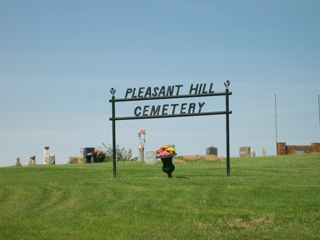
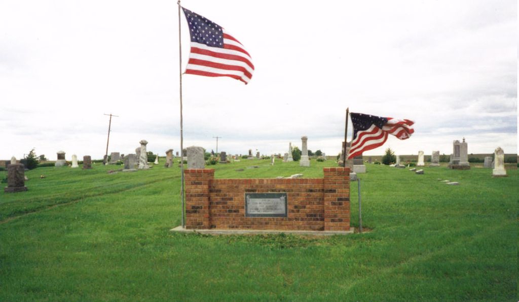
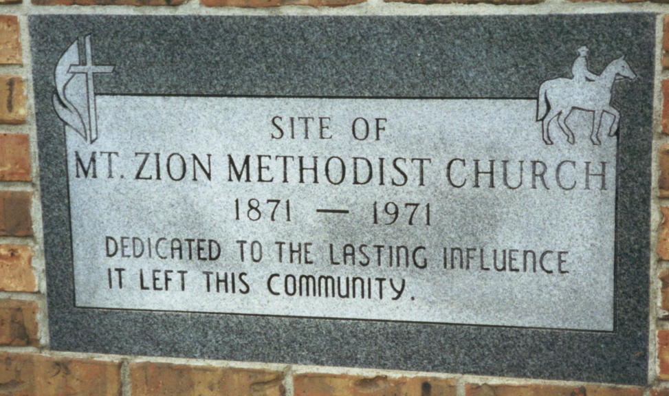
| Description | : | This cemetery is located in Irving Township in Brown county, about halfway between White Cloud and Hiawatha. To get to this cemetery from Hiawatha, Ks. you go 5 miles east on old 36 highway and then 6 miles north on blacktop. The cemetery is on the right/east side of the road, setting up above an embankment up on a little hill. It's easy to miss so count the miles & then watch for it. Joseph A. Wolfley came to Brown County, Kans. in 1866, settling on a homestead about halfway between White Cloud and Hiawatha. Some years later he gave 4... Read More |
frequently asked questions (FAQ):
-
Where is Pleasant Hill Cemetery?
Pleasant Hill Cemetery is located at Irving Township, Brown County ,Kansas ,USA.
-
Pleasant Hill Cemetery cemetery's updated grave count on graveviews.com?
10 memorials
-
Where are the coordinates of the Pleasant Hill Cemetery?
Latitude: 39.9435997
Longitude: -95.4328232
Nearby Cemetories:
1. Kenyon Cemetery
Robinson, Brown County, USA
Coordinate: 39.9122000, -95.3964600
2. Laus Creek Cemetery
Reserve, Brown County, USA
Coordinate: 39.9754105, -95.4699936
3. Campbell Cemetery
Reserve, Brown County, USA
Coordinate: 39.9905980, -95.3961750
4. Franklin Cemetery
Rulo, Richardson County, USA
Coordinate: 40.0035000, -95.3884700
5. Roy and Franklin Cemetery
Richardson County, USA
Coordinate: 40.0036011, -95.3878021
6. Tesson Cemetery
Brown County, USA
Coordinate: 39.9763985, -95.3407974
7. Partlow Cemetery
Hiawatha, Brown County, USA
Coordinate: 39.9994011, -95.3602982
8. Hart Cemetery
Reserve, Brown County, USA
Coordinate: 39.9519005, -95.5366974
9. Ununda Cemetery
Robinson, Brown County, USA
Coordinate: 39.8582993, -95.4143982
10. Cornelison Cemetery
Reserve, Brown County, USA
Coordinate: 39.9754105, -95.5485687
11. Olive Branch Cemetery
White Cloud, Doniphan County, USA
Coordinate: 39.9729400, -95.3129400
12. Oakland Cemetery
Padonia, Brown County, USA
Coordinate: 39.9273900, -95.5610900
13. Immaculate Conception Cemetery
Rulo, Richardson County, USA
Coordinate: 40.0480200, -95.4431800
14. Kelley Cemetery
White Cloud, Doniphan County, USA
Coordinate: 39.9797100, -95.3042800
15. Collins Family Cemetery
White Cloud, Doniphan County, USA
Coordinate: 39.9221992, -95.2969284
16. Hiawatha Cemetery
Hiawatha, Brown County, USA
Coordinate: 39.8601799, -95.5265198
17. Rulo City Cemetery
Rulo, Richardson County, USA
Coordinate: 40.0561218, -95.4420471
18. Mount Hope Cemetery
Hiawatha, Brown County, USA
Coordinate: 39.8497009, -95.5156021
19. Rose Hill Cemetery
Robinson, Brown County, USA
Coordinate: 39.8097000, -95.4139023
20. Zion Bethel Cemetery
Jefferson Township, Richardson County, USA
Coordinate: 40.0727997, -95.5017014
21. Catron Cemetery
Fortescue, Holt County, USA
Coordinate: 40.0736300, -95.3629800
22. Pearson Point Cemetery
Falls City, Richardson County, USA
Coordinate: 40.0400800, -95.5688500
23. Heater Cemetery
Rulo, Richardson County, USA
Coordinate: 40.0868300, -95.4638200
24. Falls City Cemetery
Falls City, Richardson County, USA
Coordinate: 40.0593987, -95.5569000