| Memorials | : | 0 |
| Location | : | Valley County, USA |
| Coordinate | : | 41.4230800, -98.8377700 |
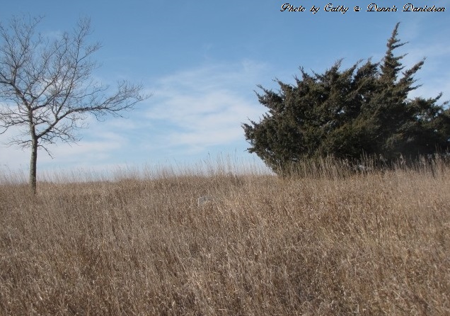
| Description | : | There are no markers or signs for this cemetery. Tree limbs and brush is scattered all along the bottom as seen in the corner photo and the close-up shot of the corner photo. The location is on 800th Road on the Southside of the road between 481st Avenue and 482nd Avenue. Located across the road from Pleasant Hill Cemetery is an old abandoned school house. A stroke of luck for us was that a farmer was coming to check his mail and was very generous in sharing his knowledge of the cemetery, showing where the stone of Virgil Edward Worrell was... Read More |
frequently asked questions (FAQ):
-
Where is Pleasant Hill Friends Cemetery?
Pleasant Hill Friends Cemetery is located at 800th Road, Southside between 481 Ave & 482nd Ave Valley County ,Nebraska , 68859USA.
-
Pleasant Hill Friends Cemetery cemetery's updated grave count on graveviews.com?
0 memorials
-
Where are the coordinates of the Pleasant Hill Friends Cemetery?
Latitude: 41.4230800
Longitude: -98.8377700
Nearby Cemetories:
1. Davis Creek Cemetery
Valley County, USA
Coordinate: 41.4219017, -98.9052963
2. Hillside Cemetery
North Loup, Valley County, USA
Coordinate: 41.4892006, -98.7960968
3. Salem Evangelical Church Cemetery
Ord, Valley County, USA
Coordinate: 41.4902992, -98.9244003
4. Mount Hope Cemetery
Scotia, Greeley County, USA
Coordinate: 41.4752998, -98.7117004
5. Dannevirke Cemetery
Dannevirke, Howard County, USA
Coordinate: 41.3227997, -98.6986008
6. Mount Carmel Cemetery
Howard County, USA
Coordinate: 41.2797012, -98.7328033
7. Saint Josaphats Cemetery
Loup City, Sherman County, USA
Coordinate: 41.3022003, -98.9847031
8. Evergreen Cemetery
Loup City, Sherman County, USA
Coordinate: 41.2997017, -98.9852982
9. Vinton Cemetery
Ord, Valley County, USA
Coordinate: 41.5467000, -98.9970000
10. Fish Creek Cemetery
Scotia, Greeley County, USA
Coordinate: 41.4663000, -98.6154000
11. Saint Francis Cemetery
Ashton, Sherman County, USA
Coordinate: 41.2438000, -98.7994000
12. Dunkard Cemetery
Arcadia, Valley County, USA
Coordinate: 41.4522000, -99.0769000
13. Cotesfield Cemetery
Cotesfield, Howard County, USA
Coordinate: 41.3358002, -98.6219025
14. Springdale Hillside Cemetery
Valley County, USA
Coordinate: 41.6114010, -98.8282950
15. Sunny Slope Cemetery
Loup City, Sherman County, USA
Coordinate: 41.2906000, -99.0267000
16. Balsora Cemetery
Sherman County, USA
Coordinate: 41.3782997, -99.0975037
17. Union Cemetery
Ashton, Sherman County, USA
Coordinate: 41.2214012, -98.7855988
18. Ord Cemetery
Ord, Valley County, USA
Coordinate: 41.6142006, -98.9403000
19. Arcadia Cemetery
Arcadia, Valley County, USA
Coordinate: 41.4237000, -99.1167000
20. Immanuel Lutheran Cemetery
Ashton, Sherman County, USA
Coordinate: 41.2140000, -98.8142000
21. Manderson Cemetery
Valley County, USA
Coordinate: 41.5598870, -99.0949250
22. Saint Josephs Cemetery
Elba, Howard County, USA
Coordinate: 41.2930984, -98.5746994
23. Cleoria Cemetery
Loup City, Sherman County, USA
Coordinate: 41.2779000, -99.0893500
24. Austin Cemetery
Rockville, Sherman County, USA
Coordinate: 41.1880989, -98.8981018


